 [private]NOTE: The Database is located under INDEX and also as a stand alone page DATABASE[/private]British Columbia Lighthouse Keeper Database
– a work in progress – any help is greatly appreciated!
First of all, welcome to the database. I hope you find the information you require here, be it genealogical or historical.
So far I have collected 1129 (up from 1119) British Columbia (BC) lighthouse keeper names on 96 different lighthouses, for a total of 1922 (up from 1908) changes / moves / appointments.
My thanks for supporting help goes in no particular order to Ron Ammundsen, Chris Mills, Jim Derham-Reid, Pen Brown, Tony Holland, Fran Aitkens, Frank Statham, Leone Taylor, and the late Don Graham and Hubert Cadieux, plus all the others that emailed me.
If you have something to contribute, wish to correct something, or just comment, please contact me.
Lately I have also been adding birth and death dates for deceased lightkeepers on my list of names, and also creating an “In Memorium” page as a memorial to those that worked the lights. If you wished to add dates, and/or a short piece of information about a friend or family member who was a lighthouse keeper, please contact me.
Also, if you have any stories or photos about British Columbia lighthouses, lighthouse keepers, wives, adventures, etc., I would like to add them to my site. Please contact me.
If you want to jump straight to the DATABASE
(for the ZIP file of above, right-click on your mouse and select “Save link as . . .” )
or the LIST of LIGHTHOUSE KEEPERS
(for the ZIP file of above right-click on your mouse and select “Save link as . . .” )
or the LIST of LIGHTHOUSES please click the links.
The Database is searchable by using Ctrl-F (bottom left key) on your keyboard . This opens up a search box on the upper right of the page.
If you find any errors or omissions, or wish to add a name, please contact me. Thanks!
**********************
A Wee Bit of History . . .
British Columbia lighthouses were not only used as lightstations, but during the Second World War (WW2), some of the lights had military personnel on them manning radar installations.
Later, wireless operators, telegraph operators and radio operators were stationed on some stations, and then weather observers, and the station became almost a small village. Add to this the truck drivers, linesmen, park wardens, labourers, ranchers, trappers, power house attendant, etc. and we have quite an assorted list of personnel.
I have started to include all of these people in this list, but because of the diverse nature of some of these jobs we have had to put them under the title “Others”.
A lot of these names were found in BC Directories from 1909 – 1939. This also includes the 1909 – 1912 directories referred to below. Please note that a directory listing does not mean they were on station that year as the directory data was collected and then published later e.g. a listing in the 1935 directory may have been collected in 1934.
*****************************
I Need Your Help . . .
There is one problem that I would like your help with. I have located numerous BC locations associated with “lights” but no one seems to have mentioned them or the keepers that tended them. Most of these “unknowns” were just lights (aids to navigation) looked after by local contractors who lived nearby – lit them at night and put them out in the morning.
Some of these, especially in the Fraser River, were looked after by the Department of Public Works (DPW) from Steveston, BC. Some of these unknown keepers moved onto manned lighthouses later on.
If you have any information on the following “lights” and/or their keepers please let me know.
Information in the table below is what I have collected so far on these unknowns, most of it from the Vancouver City Directories of 1909 – 1912. If I have located a keeper’s name associated/working with these lights I have recorded them as well in the full lightkeeper database and marked the light with a star (*) after the name – same as in the next table.
Also, if I managed to confirm a name or light location I have marked it as such with a Google Earth placemark . Most of these locations (marked “LL plus number”) are taken from the Canadian Government publication “List of Lights” and may not be the actual location of the tended lights for which I am searching.
The dates shown are for the periods when I have found data showing these lights were tended, not the length of time they were in service.
- Balfour*……………- Unknown position, west arm of Kootenay Lake; no longer listed as such in current “List of Lights”(1910)
- Ball Island*……………- Unknown location (1912)
- Birnie Point*
 ……………- Birnie Island, LL728, On rock, S. of Knox Point, chart 3963; perhaps someone from Port Simpson looked after this one? (1905 – 1917)
- Brotchie Ledge*……………- Brotchie Ledge (aka Brotchy), LL205, off Victoria harbour, chart 3415; someone rowed out twice each day to tend this. (1905 – 1934) Automated November 30, 1934. See this excellent story of Brotchie Ledge here.
- Calamity Point*……………- Calamity Point, LL395, north side of Burrard Inlet between Brockton and Prospect points, chart 3493; John Walsh rowed out twice each day to tend this light during the years 1931 – 1936. The light is still in operation but automated.
- Carr Point*……………- Unknown location; could be near Metlakatla/Venn Passage OR near Cassiar, BC (1915 – 1918)
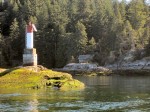 Channel Rock*……………- This was a light in Uganda Pass now known as Uganda Pass (LL 483) between Cortes Island and Shark Spit on Marina Island. One of the keepers was John Poole, followed by Alex McKee – I don’t know the exact dates. A writer, Gilean Douglas, moved to Cortes Island in 1948, to the property homesteaded by John Poole. That property is known as Channel Rock. – thanks J. Milton for the information and photo .

- Crofton Light*……………- Crofton, LL 277, On SE. Shoal Island, chart 3475
- Denman Island*……………- Denman Island, LL499, On reef on W. side of island, southward of Denman Point, chart 3527 (1910 – 1921) Automated April 02, 1921
- Duke Point……………- Unknown location; was there a light at Duke Point off Nanaimo?; not listed in current List of Lights
- Fossy Island*……………- Unknown location? (1900 – 1905)
- Fraser River Lights……………- besides Garry Point & North Arm (below), we have many lights on the Fraser River which were looked after by individuals working for the Department of Public Works (DPW) from Steveston or under separate contract; reportedly looked after by P. A. Parker – same for Garry Point?
- Garry Point*……………- Garry Point West, LL333, W. of point, near Steveston (Fraser River), chart 3490 (1953)- Square skeleton tower on 9-pile dolphin, green and white rectangular daymarks.
- Helen Point*……………- Helen Point, LL272, on point, W. entrance to Active Pass, chart 3473; used to have a fog bell (1940 – 1941) (1921 – 1940)
- Kaslo Spit*……………- Kaslo, LL17 on Kootenay Lake, Chart 3050, Kootenay Electric Co. employee looked after this one in 1911
- Kootenay Landing*……………- Kootenay Landing Outer, LL13.3, on Kootenay Lake, Chart 3050; CPR employee looked after this one in 1911?
- Kyuquot ……………- Kyuquot Channel light and whistle buoy M38, LL84, Chart 3682?
- Lardo Spit ……………- Lardeau, LL20, Kootenay Lake, Chart 3050; CPR employee looked after this one in 1911?
- Lookout Island ……………- east side of Island, LL78, Kyuquot, Chart 3677;
- MacLaughlin Pt.*……………- Unknown; 2 NM from Fisgard Light and is right below Work Point Barracks; does this light still exist; not in current List of Lights
- Meares Spit*……………- Meares Spit lightbuoy, LL126, West end of Hyphen Channel, near Tofino, Chart 3685? (1918 – 1921)
- Nanaimo Harbour……………- Unknown location; This is definitely not Entrance Island; nor Gallows Point; reportedly looked after by H. B. Shaw?
- North Arm Lights……………- would it be North Arm Breakwater, LL385? North Arm Third, LL384? Fraser River, Chart 3491; reportedly maintained by James Quinn? (1913 – 1919) Automated November 01, 1919
- Ogden Point*……………- LL 204 probably serviced by the same man that serviced Brotchie Ledge; On outer end of breakwater – Chart 3412
- Patey Rock*……………- Patey Rock, LL249, On rock, entrance to Saanich Inlet, chart 3441? (1911 – 1921)
- Pilot Bay*……………- Pilot Bay – old LL11; no longer listed as such in current List of Lights see this page for more information (1905 – 1934) Automated 1934
- Potty Point*……………- Unknown location; is this Polly Point, LL165, on Polly Point, Alberni harbour, chart 3668? OR Pelly Point at the entrance to Victoria Harbour; LL208; Chart 3415? OR Pelly Point near the mouth of the Fraser River; not listed in List of Lights? (1945)
- Proctor*……………- Proctor, LL10, entrance to W. Arm Kootenay Lake, chart 3050?
- Sechart Light*……………- Seshart (sp?); in Alberni Inlet; no longer listed as such in current List of Lights; reportedly maintained by G. Strickland? It could even be a mispelled “Sechelt”
- Shark Spit*……………- Unknown location; not in current List of Lights?
- Sooke Light*……………- this could be Whiffin Spit
 , LL188, E. end of spit, Sooke, chart 3411? (1906 – 1938) (automated in January 31, 1938)
- Somass Light*……………- Somass River, LL168.1, W. coast Vancouver Island, chart 3668; reportedly maintained by G. A. Paterson?
- Swaile Rock*……………- could this be Swale Rock, LL 150, on Prideau Island, near Amphitrite Point, Barkley Sound; Chart 3670?
- Victoria Harbour……………- Unknown location; is this the same as “McLaughlin” listed above; reportedly maintained by T. Sparks & J. W. Davies?
- Yellow Island*……………- Chrome Island range light, LL495,496, chart 3527
- Walker Rock……………- Walker Rock, LL291, Trincomali Channel,near Saltspring Island, chart 3442; reportedly maintained by John Georgeson?
******************************
[private]Download the complete database file here in zipped format (108 Kb) . . . ")
. . . this will be the most up-to-date information I have available.
Please be patient This database is 3.2 MBs in size and takes a wee bit of time to load or download . . . [/private]
To see some of the lighthouses these people were working visit the BC Lighthouse Website
For those of you that have the free Google Earth program download the BC Lighthouses.KML
which shows the location of all the lighthouses.
To see some sea-level photos of BC lighthouses, check out Ray Morgan’s BC Marina website.