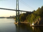
In Memorium – Prospect Point Lighthouse – Automated!
Prospect Point Lighthouse
Latitude 49 18 50.4N, Longitude 123 08 29.1W List of Lights #392
Established: October 01, 1888 Automated: January 1926
Three nautical miles east of Point Atkinson, situated at the base of a cliff, stands the lonely and short-lived lighthouse called Prospect Point.
The light was first manned in October 1888 and was overshadowed by the importance of the Signal Station on the cliff above. This signal station operated in conjunction with Brockton Point to signal when ships were coming into or out of Vancouver Harbour.
In January 1926 the poor lightkeeper was informed by the Department of Marine and Fisheries that the lighthouse would be electrified and would then be operated by the Prospect Point Signal Station. He was out of a job after years keeping both systems working.
Prospect Point Lighthouse keeper’s house 1920 – 1930
Photo by Cyril R. Littlebury from Dudley Booth Collection
Prospect Point Lighthouse (bottom) Signal Station (top)
Photo by Cyril R. Littlebury from Dudley Booth Collection
Princess Victoria passing Prospect inbound 1920 – 1930
Photo by Cyril R. Littlebury from Dudley Booth Collection
Princess Patricia Passing Prospect 1920 – 1930
Photo by Cyril R. Littlebury from Dudley Booth Collection
SS Prince Rupert Passing Prospect 1920 – 1930
Photo by Cyril R. Littlebury from Dudley Booth Collection
Prospect Point Signal Station 1920 – 1930
Photo by Cyril R. Littlebury from Dudley Booth Collection
The photo below shows what replaced the lighthouse – a concrete block structure with a light on top and several small electric foghorns.
Prospect Point 2006
Photo from Imran Flickr pages
Prospect Point 2006
Modern light, modern ship
Photo from pwhsu48 Webshots page.
As mentioned above, the Prospect Point and Brockton Point signal stations monitored ship traffic in and out of Vancouver harbour.
Just across the harbour from Prospect Point, at the mouth of the Capilano river, was the tiny little-known Capilano lighthouse (aka First Narrows). (see Capilano webpage here.)
Below is a photo taken from the mouth of the Capilano River showing Prospect Point today and the the probable view from the Capilano lighthouse. Beside it is a Google Earth map showing the exact location of the three lighthouses.
Prospect Point 2006 From mouth of Capilano river
Notice – no signal station
Photo from Glamorous_Life Flickr page.
Google Earth map Showing Vancouver harbour lights
Photo from Google Earth printout.
In this 360° view you can see Prospect Point off the right-hand side of the bridge. As the scene sweeps across the harbour, The sandbanks of the Capilano River come into view with the dolphin visible in deeper water. (Zoom in using Shift, and out with Ctrl key; Pause by clicking on photo).
| Keepers | ||
| John Grove | PLK (1888-1926) | |


