Haida Gwaii

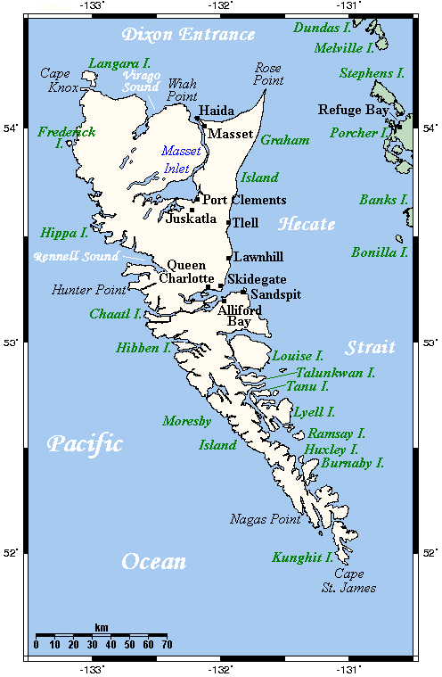
Haida Gwaii (High-Da Gwi my pronunciation) literally means “Islands of the Haida People”, informally but formerly known as the Queen Charlotte Islands (QCI) and the Charlottes, is an archipelago on the North Coast of British Columbia, Canada, populated mostly by first nations Haida people.
Langara Point Lighthouse courtesy of Langara Fishing Adventures on Flickr
Haida Gwaii consists of two main islands: Graham Island in the north and Moresby Island in the south, along with approximately 150 smaller islands with a total landmass of 10,180 km2 (3,931 sq mi). Other major islands include Anthony, Langara (with Langara Point Lighthouse – see above), Louise, Lyell, Burnaby, and Kunghit Islands (with the now automated Cape St. James Lighthouse – below).

The islands are separated from mainland British Columbia to the east by Hecate Strait. Vancouver Island lies to the south, across Queen Charlotte Sound, while the U.S. state of Alaska is to the north, across the disputed Dixon Entrance.
Some of the islands are protected under federal legislation as Gwaii Haanas National Park Reserve and Haida Heritage Site, which is mostly Moresby Island (Gwaii Haanas in Haida) and adjoining islands and islets.
On June 3, 2010, the Haida Gwaii Reconciliation Act officially renamed the islands Haida Gwaii as part of a reconciliation protocol between British Columbia and the Haida people. – part quoted from Wikipedia
*************************************
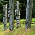
The island was well-known for its totem poles buried in the rain forests, but most have rotted over the years. The photo below shows part of the old history.
Just recently, the Haida people erected a large totem pole, the first in many years on Haida Gwaii. It received national and worldwide news coverage from many countries.
The Gwaii Haanas legacy totem pole was raised in Windy Bay, B.C., on Lyell Island in Haida Gwaii on Thursday, August 15, 2013. The 13-metre totem is the first monumental pole to be raised in the area in 130 years. It was carved to celebrate the 20th anniversary of the Gwaii Haanas Agreement, a document that allows the government of Canada and the Haida Nation to co-manage and protect the region. – see photo and article in The Vancouver Sun
The Story of the Gwaii Haanas Legacy Pole is portrayed on this Parks Canada website.
***************************
The photo below shows the west coast of the Haida Gwaii which opens to the Pacific Ocean. It is a glorious area and provides lots of adventure for hikers, boaters and photographers, and an especially great place for finding glass fishing floats.

And guess what? The Haida village of Nan Sdins on the island of Sgang Gwaay in the territory of Haida Gwaii was selected May 08, 2013 by Reader’s Digest as number 6 out of 10 Attractions That Make Canada Great!
Located on the small island of SGang Gwaay off the west coast of the Queen Charlotte Island archipelago (Gwaii Hanaas), the village of Nan Sdins was once a thriving community of the indigenous Haida people. But by the 1880’s, disease had completely destroyed the population. Today, the site is home to the remains of 10 original 19th-century Haida houses and 32 carved mortuary totem poles. Declared a UNESCO World Heritage Site in 1981, the village is a testament to the art, culture and history of the Haida First Nation. . . . more


