Category Archives: Maps

Shine Bright Like A Lighthouse. A Love Affair With Maritime History.

Shine Bright Like A Lighthouse. A Love Affair With Maritime History.

John Sylvester, Country Magazine May 15, 2014
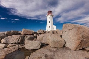
Peggy's Cove
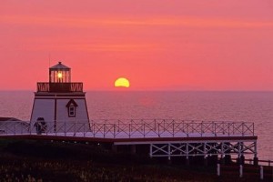
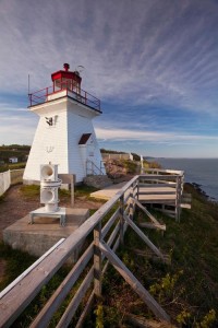
Peggy’s Point Lighthouse (Photo: John Sylvester)

Having grown up in Nova Scotia, I have fond memories of scrambling over the curved granite whaleback rocks below my aunt’s cottage near the community of Peggy’s Cove.

Even though that’s the home of Nova Scotia’s most famous landmark, Peggy’s Point Lighthouse, I didn’t pay much attention to the lighthouse in those days. The tide pools and shallow caves of the whalebacks were more enticing. As an adult, however, I’ve grown to appreciate and cherish these beautiful beacons and the maritime tradition they represent. . . . more

See more photos and information under his story in Country Magazine called Lighthouse Preservation in Atlantic Coast Canada

Editor’s Note: Find additional information on Quebec, Newfoundland and Prince Edward Island lighthouses, along with ideas for exploring the surrounding towns, right here on our blog!

And be sure to read John Sylvester’s new eBook: A Photographer’s Guide to Prince Edward Island, a downloadable PDF for mobile devices, available at: www.photographersguidetopei.com.

[private]

As long as humans have sailed the oceans, we’ve needed navigational aids to warn of hidden shoals and dangerous headlands. The earliest warning lights were coastal bonfires. The first known lighthouse was built at Alexandria, Egypt, around 280 B.C. The British built North America’s first one at the entrance to Boston Harbor in 1716. The French ­followed 15 years later with Canada’s first lighthouse near their fortress at ­Louisbourg on what is now Nova Scotia’s Cape Breton Island.
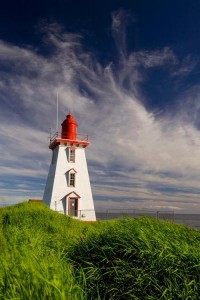
John Sylvester_01
Peggy’s Point Lighthouse (Photo: John Sylvester)

In sailing’s golden age, from the 1700s to the mid-19th century, lighthouses proliferated along the Atlantic coast. In Atlantic Canada alone, nearly 500 still stand along 33,000 miles of mainland and island coastline. A few miles up the coast from Peggy’s Cove, North America’s oldest continuously operating light, Sambro Island Lighthouse, stands on a tiny granite outcrop at the entrance to Halifax Harbor. Built in 1758, its eye-catching 80-foot red-and-white tower has been the first sign of land seen by countless sailors, immigrants and ocean liner passengers—including the Titanic survivors—as they approached the safety of landfall.

During the heyday of maritime activity, lighthouse keepers and their families lived in homes either attached to or close by the lighthouse. They often had to fend for themselves in isolated circumstances, growing a garden and raising livestock in addition to their full-time duties tending the light. Every evening, in fair weather or foul, the light keeper climbed a narrow, winding staircase to the top of the tower to light the lamp, located behind a powerful Fresnel lens that magnified and ­transmitted the beam far out to sea.

Light keepers eventually lost their jobs to automation, and in recent years sophisticated GPS navigation systems have rendered lighthouses redundant. Some have fallen into disrepair, but many have been rescued by local preservation or historical societies and converted into museums or tourist attractions.

Thanks to broad grassroots support, the federal government passed an act encouraging lighthouse preservation. But Natalie Bull, executive director of Heritage Canada The National Trust, notes that the legislation ultimately says it’s up to communities to protect their lighthouses.
John Sylvester_02
Bay of Fundy Lighthouse (Photo: John Sylvester)

“It’s very challenging, but residents of the Maritime Provinces are resourceful,” she adds. “Community groups have long been willing to take on these preservation projects, even before the act passed. New Brunswick’s Cape Enrage Lighthouse is a great example.”

The Cape Enrage keepers house was slated to be torn down when, in 1993, a group of local high school kids and their physics teacher started renovating it. Two years later the Coast Guard transfered ownership to the province, and the site is now the hub of a thriving adventure tourism destination that includes kayaking, rock climbing and horseback riding.

The wonderful thing about lighthouses, of course, is that they’re invariably built on beautiful coastal stretches. Some have been converted into inns where you can rent a room overlooking the ocean, listen to the waves lapping the shore and imagine life in a bygone era. You can now find lighthouse inns in all five of the provinces on Canada’s Atlantic Coast.
John Sylvester_03
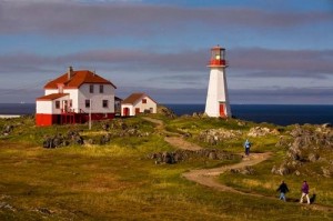
Quirpon Island Lighthouse (Photo: John Sylvester)

A few years ago I clambered into a small fishing boat that transported me to remote Quirpon Island off the north coast of Newfoundland, where I stayed in a cozy inn that was a former light keeper’s cottage. I spent two glorious days exploring the island, watching whales and sculpted icebergs drift by, and being pampered with Newfoundland’s renowned hospitality.

But even when I can’t spend the night, I rarely pass up a chance to visit one of these inviting beacons. On a recent trip to Nova Scotia, my wife and I drove out to Peggy’s Point Lighthouse on a beautiful autumn day. We joined tourists from all over the world wandering among the same whaleback rocks that fascinated me as a child.

We lingered through the afternoon, enjoying the timeless wonder of waves breaking on the rocks and sunlight sparkling off the ocean while one of Canada’s most beloved symbols of a proud seafaring tradition stood watch. And this time, I knew enough to appreciate it.

John Sylvester is an author and photographer based in Prince Edward Island, Canada. He specializes in photographing the people and places of Canada, and has published extensively on the Atlantic region, including the great lighthouses.
John Sylvester_04
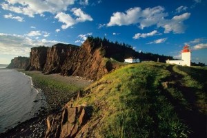
Cape d’Or Lighthouse (Photo: John Sylvester)


John Sylvester_05
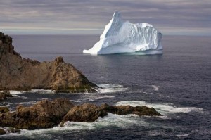
An ice flow off Newfoundland (Photo: John Sylvester)


John Sylvester_06
Sunset at Fortune Head Lighthouse (Photo: John Sylvester)

[nggallery id=96]

[/private]
Ship Movements – It Keeps Getting Better!

On August 08, 2013 I wrote Canadian Firm Tracks Earth’s Ships From Space which also refers to another 2012 article What Ship Is That? Now we have an even better program, free, and online, called Marine Traffic.

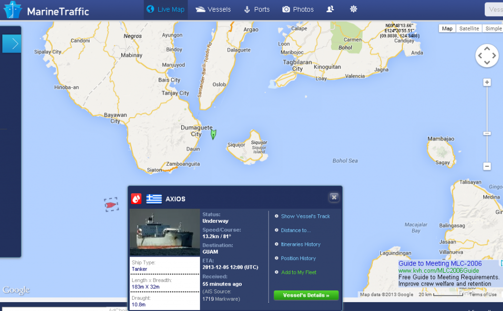
Live Ships Map   AIS   Vessel Traffic and Positions   AIS Marine Traffic(1)

The screen shot above of Marine Traffic for 05:30 UTC (Z) for November 30, 2013 shows the freighter Axios (bottom left) off my area, Negros Oriental Island, Philippines, heading for Guam.

With this  free program you can locate ships in your area, determine their destination, speed, nationality, etc., and even see a photo of the ship.

The program shows Vessels, Ports, Lights, and Aerial Photos of the ports. The “Lights” portion lists and shows photos of navigation lights and lighthouses in the areas.

If one is interested in the sea, vessel traffic, ships, lights, or just navigation, this program is for you. Please take a look here at MarineTraffic.com.


Wildlife and Spirit Bear Adventures

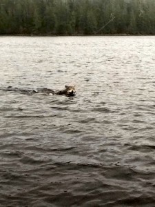
When I wrote the story A Wolf At McInnes I never really explained how the wolf got on to McInnes Island, so today I am going to combine two stories into one. Firstly, the wolf swam from nearby Price Island over two (2) kilometers away, probably island hopping to catch its breath. Pictured below and in the album are photos of wolves swimming taken by photographer Leanne Reandy, a staff member of Spirit Bear Adventures, on a trip back to Klemtu from Bella Bella, BC. 

wolf swimming - by Leanne Reandy

[nggallery id=78] Continue reading Wildlife and Spirit Bear Adventures

Tar Sands SOS: Save Our Shore

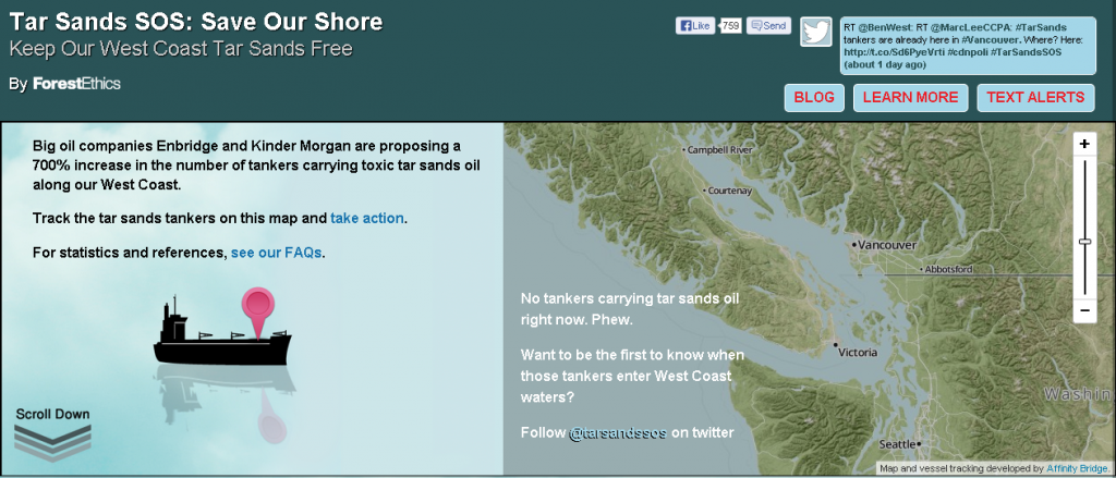
Tar Sands SOS  Keep Our West Coast Tar Sands Free

The photo above is a screen capture of part of the Tar Sands SOS webpage. Click the photo above to go to the webpage and you can track the tar sands tankers on the interactive map, scroll down the webpage and learn more why the tar sands tankers are a bad idea. One thing I learned is that tar sands oil sinks to the ocean bed rather than floating up on the beaches. This lengthens the time the oil can pollute British Columbia waters!

I have seen an oil spill personally – it is not a pretty sight!

Inside Passage Ferry Trip to Visit Some of the Lighthouses

The idea for this story came from an article in the Vancouver Sun newspaper. I asked for permission to reprint it here for all to see, and they said I would have to pay them. This was an article about the Inside Passage ferry trip with mention of a couple of lighthouses – very few actually. I am not even going to mention the title of the story – how can they turn down free advertising.  😉

manned lighthouses
manned lighthouses

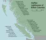
 When you visit Canada do you plan on seeing some lighthouses? We have twenty-seven (27) manned lighthouses on the west coast of British Columbia (BC); Canada. There are other unmanned lighthouses that are available for viewing also. You can see some of them if you wish with the BC Ferries, plus enjoy wonderful trips through BC waters.


The Inside Passage

Let us start with the longest trip first. How about fifteen (15) hours on a luxurious ferry in daylight so that you can make many photos. Fifteen hours may seem like a long time, but there is so much to see that time flies by, especially if the weather is fine.

Northern Expedition
Northern Expedition – BC Ferries photo


Northern Adventure
Northern Adventure – BC Ferries photo

There are two ferries on the route (2013) – the Northern Expedition and the Northern Adventure. You can actually follow them live on this website.

Continue reading Inside Passage Ferry Trip to Visit Some of the Lighthouses

Message In A Bottle

My title here Message in a Bottle is also the title of a 1999 American romantic drama film directed by Luis Mandoki and based on a novel with the same name by Nicholas Sparks, but in this case it refers to something completely different!

Most people think of a message in a bottle as a beachcomber’s mystery find. In this case there was no mystery, but lots of adventure! The story was posted on the MR BONE HEAD Facebook page. You never know what you will find on the beach!

From Glunz Ocean Beach Hotel & Resort

Judi and the message bottle
Judi and the message bottle – photo – Glunz Ocean Beach Hotel & Resort

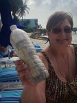
So one of our owners Judi was walking on the beach this morning cleaning up the junk that washed into shore and finds a bottle with a message in it. There is also some sand and 2 one dollar bills.

Once we get it open and read the notes we find out that it is in fact NOT sand. It is the ashes of this woman’s husband of 70 years named Gordon. She writes that He loved to travel so she sent him traveling in a bottle with a note and money for someone to call home and tell her where he landed.

He started at Big Pine Key [Florida] (point A on the map below) in March of 2012 and then went to Islamerada [Florida] (point B) where someone found him. They added a note and sent him traveling again and he landed on our beach in Key Colony (point C).

Judi called the wife in Tennessee who was excited to know of Gordon’s travels! Judi added her note, we put him in a rum bottle (you know added a little fun to his trip) with the three notes. We added another dollar in case Gordon travels far and a long distance call is needed.

We will be having a memorial service or celebration of his life on our beach later today before sending him on his way again. Only our sister Judi could find a dead guy on our beach!

This is an amazing true story Continue reading Message In A Bottle

Doug Clement Photography

All photos copyright by Doug Clement Photography, and used with permission.

Doug is a professional artist, videographer and photographer. He is a lifetime resident of Victoria and has been capturing its beauty on film for over 30 years. – from the Facebook page

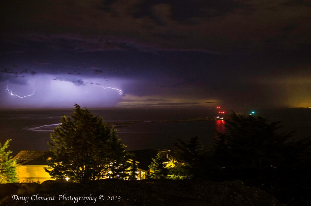
Lightning at Trial Island
Lightning at Trial Island © Doug Clement Photography

In my teenage years while attending High School and University, and before I moved onto the lighthouses, I lived in Victoria, British Columbia (BC), Canada (on southern Vancouver Island off the West Coast of BC). It was a delightful town to grow up in and had access to numerous beaches, parks and believe it or not, a few lighthouses, of which I was not interested at that time.

Just recently on Facebook I have seen some wonderful photography of the lighthouses in and around Victoria, BC by Doug Clement. He has given me permission to publish them here, I hope that in your first or next trip to Victoria, you get a chance to see these places. If not, please admire them in the photos by Doug Clement. 

The first photo above shows Trial Island Lighthouse at night with a blast of lightning. The actual light of the lighthouse is the greenish glow on the right side while the red lights are  warning  lights for aircraft mounted on the radio towers on the island (see the last photo in this story).

Here is a link to a Google Map showing the Trial Island Lighthouse, above photo (yellow point on map) and Ogden Point Breakwater light, photo below (red point on the map). Continue reading Doug Clement Photography

Haida Gwaii

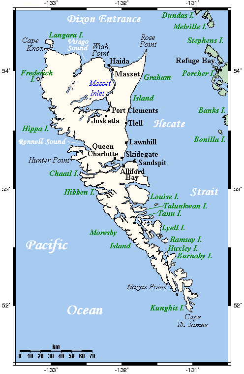
Queen_Charlotte_Islands_Map
Haida Gwaii Map

Haida Gwaii (High-Da Gwi my pronunciation) literally means “Islands of the Haida People”, informally but formerly known as the Queen Charlotte Islands (QCI) and the Charlottes, is an archipelago on the North Coast of British Columbia, Canada, populated mostly by first nations Haida people.

Langara Point Lighthouse

Langara Point Lighthouse courtesy of Langara Fishing Adventures on Flickr Continue reading Haida Gwaii

The West Coast Trail

 90527barr18

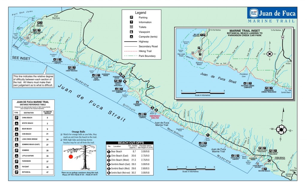
The West Coast Trail is a 75 km (47 mi) long backpacking trail following the southwestern edge of Vancouver Island in British Columbia, Canada. It was built in 1907 to facilitate the rescue of survivors of shipwrecks along the coast, part of the treacherous Graveyard of the Pacific. It is now part of Pacific Rim National Park (Parks Canada and Wikipedia) and is often rated by hiking guides as one of the world’s top hiking trails.

The West Coast Trail is open from May 1 until September 30. It is accessible to hikers outside of this period but Parks Canada does not guarantee the accessibility of services (such as search and rescue) in the off season. It was originally known as the Dominion Lifesaving Trail (sometimes misidentified as the West Coast Lifesaving Trail).-Wikipedia

*************************

Video courtesy of Parks Canada website

*************************

1044857_10151761979494553_1816265077_n

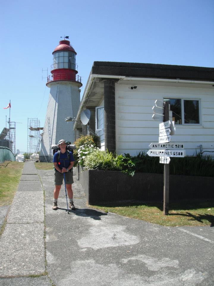
My daughter and her friend just finished hiking the West Coast Trail this Summer 2013 and thoroughly enjoyed it. (photos on Facebook) It is rough, it is challenging, but it is an adventure, and it is fun! The trail passes by two manned lighthouses (Pachena -photo above, and Carmanah – photo below) which date back to the time when the trail was Continue reading The West Coast Trail

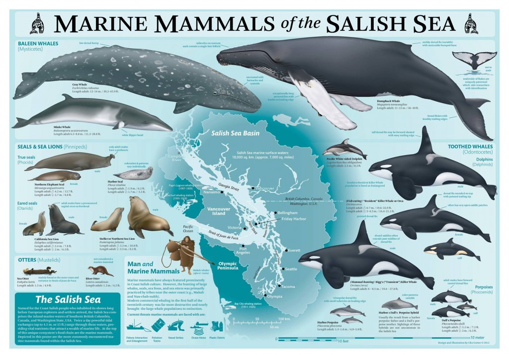
Marine Mammals of the Salish Sea – Poster

Marine Mammals of the Salish Sea

MARINE MAMMALS OF THE SALISH SEA1

Poster designed and illustrated by Uko Gorter (moi)
19″ x 27″ rolled in plastic sleeve.

The poster is now available. We are working on setting up the online sales via my website (www.ukogorter.com) hopefully within this week [August 20, 2013]. In the meantime, you can contact me at: uko(at)ukogorter.com for information and/or requests. If you’re in the Seattle/Eastside area, you may swing by and pick one up.

****************************

MARINE MAMMALS of the SALISH SEA
19″ x 27″ poster (rolled in plastic sleeve). $16 plus S&H.

Contact Uko for wholesale orders of 25 or more posters.

NOW (August 23, 2013) available via Uko’s website! 
http://www.ukogorter.com/merchandise/index.html

************************************

Advertised on Salish Sea Association of Marine Naturalists (SSAMN) on Facebook.

FOOTNOTE:

1 Salish Sea – The Salish Sea is the intricate network of coastal waterways located between the south-western tip of the Canadian province of British Columbia, and the north-western tip of the U.S. state of Washington. – Wikipedia