Tag Archives: earthquake

Preparing for an Earthquake and/or a Tsunami

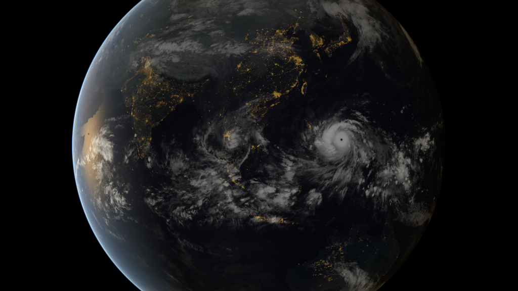
Typhoon Haiyan (Yolanda in the Philippines)Super Typhoon Haiyan (Yolanda in the Philippines) made morning landfall November 07, 2013 at Guiuan, a small city in Samar province in the eastern Philippines. The U.S. Navy’s Joint Typhoon Warning Center said maximum sustained winds were 195 mph, with gusts to 235 mph.

As many of you readers now know, I am living in the Philippines where a tsunami is NOT rare, but the biggest worry here are typhoons and earthquakes, the latter being what sparked this article.

On October 15 this year, 2013, we experienced the biggest earthquake1 I have ever felt in my life. The following data is taken from the Philippine Volcano website:

Date – Time                 Latitude     Longitude     Depth   Magnitude   Location 

(Philippine Time)             (ºN)           (ºE)          (km)

15 Oct 2013 – 08:12 AM   09.86       124.07        012        7.2     006 km S 24° W                                                                                                                 of Sagbayan (Borja) (Bohol)

This was approximately one hundred and twenty (120) kilometers (about 75 miles) northeast (NE) from us and they say we felt it like a magnitude 6.0 earthquake. I would hate to feel anything stronger! The house shook and rattled, and the ground rolled just like in the movies. For hours afterwards our sensory organs for balance were out of kilter – you felt like a drunk might feel heading home from an all night party!

Now this brings me back to the subject – How do you prepare for an earthquake or tsunami? As you never know where you will be at the time of the event, all you can do is prepare for BEFORE and AFTER the event. Continue reading Preparing for an Earthquake and/or a Tsunami
Reprint – New Tsunami Warning Protocol Rolled Out in B.C.

New tsunami warning protocol rolled out in B.C.

New system tested by magnitude 6.4 quake off Alaska coast on Monday

CBC News 

Posted: Nov 12, 2012 2:43 PM PT 

Last Updated: Nov 12, 2012 7:05 PM PT 

[media url=”https://ccanadaht3.com/wp-content/uploads/2012/11/bc-tsunami-warning-williams-11_32291146.flv” width=”400″ height=”350″]

The B.C. government is upgrading its tsunami warning plans following delays broadcasting emergency information after a magnitude 7.7 earthquake last month.

After the quake struck off the west coast of Haida Gwaii on Oct. 27 at 8:04 p.m. PT, emergency officials in B.C. did not issue any sort of tsunami alert or advisory for 51 minutes, leaving many civic leaders in B.C. wondering what they were supposed to do. . . . more

[private]

But many communities did start evacuations based on notifications issued by U.S. officials just minutes after the quake was detected.


B.C. has rolled out a new system to issue tsunami alerts and advisories faster to the public using twitter, email and SMS. (Emergency Info B.C./Twitter)

After questions about B.C.’s response, Justice Minister Shirley Bond ordered a review of the notification protocol, and on Monday she rolled out the changes.

Under the new protocol, when emergency officials in B.C. receive an alert or advisory from the West Coast and Alaska Tsunami Warning Centre, they will immediately email it to a list of prioritized local authorities, emergency responders and media outlets.

The alert will also be immediately broadcast on Twitter thru the @EmergencyInfoBC account and posted on the Emergency Info B.C. website.

Provincial emergency officials will then follow up with direct phone calls to local authorities starting with those in areas of highest risk.

Alaska earthquake tests new protocol

The system appeared to be in operation when a magnitude 6.4 earthquake struck about 248 km off the coast of Alaska on Monday afternoon at 12:42 p.m. PT.

At 12:46 p.m., the @NWS_WCATWC twitter account broadcast a message saying there was no tsunami danger for the West Coast from Alaska to California.

A modified version of the tweet was retweeted on the Emergency Info B.C. account at 12:50 p.m.

Other improvements to the Emergency Info B.C. website will include:

  • A mobile version for use on smartphones.
  • An RSS feed for updates
  • Development of an interactive map for tsunami warning zones.
  • Digital audio recordings of tsunami warnings posted online.

Justice Minister Shirley Bond said the changes are the direct result of a review that was conducted following the Oct. 27 earthquake.

“We made a commitment to review our earthquake and tsunami response and we are now taking action to implement some of the early recommendations identified,” said Bond.

“We have also been in direct contact with those mayors who expressed concern about B.C.’s emergency response reaction time and have communicated with regional district board chairs, local authorities and first responders, gathering their feedback.”

How to sign up for tsunami warnings:


[/private]

Japanese Debris On The BC Coast – Is it from the Japanese Tsunami?


The next time you go to the beach and pick up a piece up something from the sand, think of the story of how it arrived there. Is it something lost from the local town, or something that has drifted for years to arrive here just for you?

Kuroshio Current (upper left)

 Early in the 1900’s – commercial Japanese crab fishermen began replacing wooden and cork floats on their fishing nets with free blown glass floats. When the nets broke loose or were lost, the net rotted and the glass balls floated free from their nets and drifted across the Pacific, along with much other debris, on the Kuroshio Current (also known as the Black Stream or Japanese Current). This is a north-flowing ocean current on the west side of the North Pacific Ocean and it is part of the North Pacific ocean gyre1.

1910 – PRESENT – Every year the Kuroshio Current brings material from Asia to North American shores – floats, shoes, boats, wood, bottles, cans, etc. – garbage! Continue reading Japanese Debris On The BC Coast – Is it from the Japanese Tsunami?

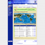
The Pacific Tsunami Warning Center (PTWC)

PTWC webpage warnings for July 29, 2011

On the Pacific Coast of British Columbia tsunami warnings are posted to all coastal communities and marine traffic by radio broadcasts. On the British Columbia lighthouses there is one monitoring station located at Langara Point lighthouse. In the event of a significant earthquake readings are taken from this site to observe forecasted tsunami waves. Up to date tsunami warnings may be found on this page. of the PTWC.

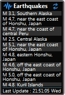
For those interested in monitoring earthquakes, there is a sidebar gadget for Vista and Windows 7 that lists earthquakes as they occur. You can see it here.

A bit of history from the Pacific Tsunami Warning Center (PTWC) webpage:

The era of tsunami warnings began in the United States with Thomas Jaggar’s (founder of the Hawaiian Volcano Observatory (HVO)) attempt to warn the Hilo harbormaster of the possibility of a tsunami generated by the 1923 Kamchatka earthquake. His warning was not taken seriously, and at least one fisherman was killed.


Official tsunami warning capability in the U.S. began in 1949 as a response to the 1946 tsunami generated in the Aleutian Islands that devastated Hilo. The U.S. federal government already had a sizable piece of property in ʻEwa Beach to house the Honolulu Geomagnetic Observatory. The Tsunami Warning Center was co-located with this facility, which is maintained by PTWC staff today. Continue reading The Pacific Tsunami Warning Center (PTWC)