Tag Archives: USA

Reprint – Machias Island Subject of Dispute Between Canada and US


As I stated in my post The Lighthouse as a Sovereignty Symbol, put a lighthouse on your disputed territory and it is yours, or something to that effect. Now here is another ongoing dispute coming to light again – Canada vs USA. According to my theory above, Canada wins! – retlkpr

***************************

Machias Seal Island a seabird sanctuary

The Canadian Press

Posted: Dec 23, 2012 7:37 PM AT Last Updated: Dec 24, 2012 12:38 PM AT
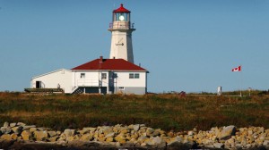
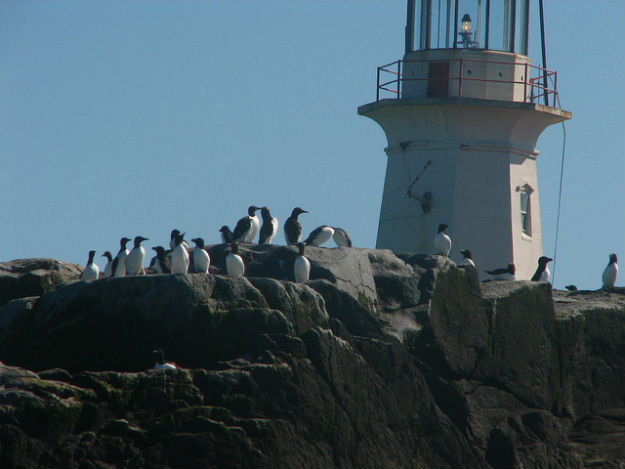
The Canadian flag flutters in the breeze by the lighthouse at Machias Seal Island. (Photograph by: Fred J. Field-The Canadian Press)

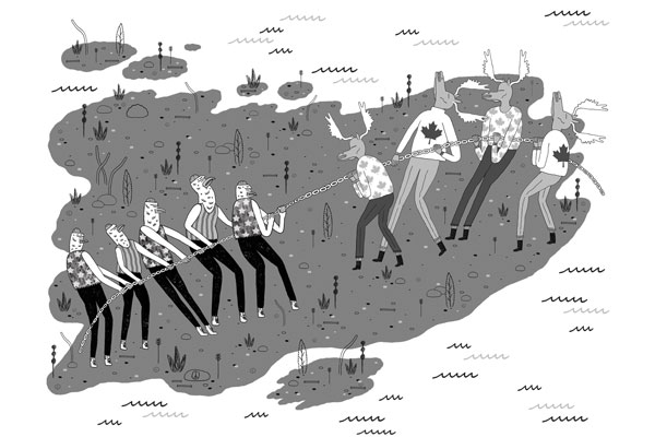
A tiny island between New Brunswick and Maine is the subject of renewed calls from both sides of the border to settle a territorial dispute once and for all.

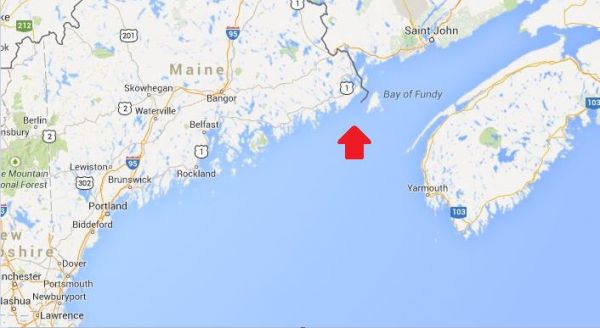
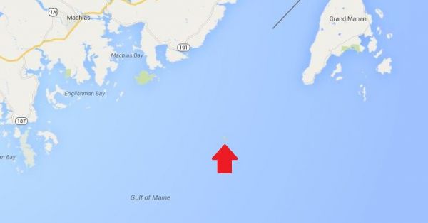
Machias Seal Island is a flat, treeless piece of rock located about 19 kilometres southwest of Grand Manan Island and east of Maine at the mouth of the Bay of Fundy.

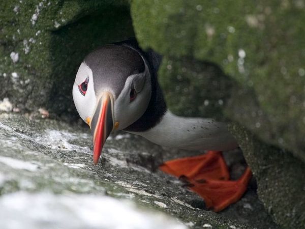
The island is a sanctuary for many kinds of seabirds including the Atlantic Puffin and draws visitors from around the world to observe them in the summer. more . . .

[private]

There are no permanent human residents on the island, just pairs of lightkeepers who spend 28 days at a time maintaining a lighthouse operated by the Canadian Coast Guard.

The original lighthouse was built by the British in 1832, and a lighthouse has been maintained there ever since.

So why would anyone even care which country gets title to Machias Seal Island?

‘Wouldn’t we feel silly?’
The answer lies in the 720 square kilometres of water around the island in what’s called a grey zone. Lobster fishermen from both Canada and the U.S. fish these waters.

“The fishing community on Grand Manan is permitted to fish there on an open-end basis and it’s our way of laying our claim to this water that is part of the Machias Seal Island dispute,” said MP John Williamson, who represents the riding of New Brunswick-Southwest.

Williamson said the island is considered to be in his riding.

‘I think our claim is sound and is legitimate.’ —MPJohn Williamson
“I think our claim is sound and is legitimate, but at the end of the day it’s going to come down to the minister in this country and the administration in Washington to settle it,” he said. “I think it is in the interests of both of our countries to do that.”

That feeling is echoed by Stephen Kelly, a professor at the Center for Canadian Studies at Duke University and a retired American diplomat who has served in Canada.

“It just strikes me if we have this opportunity to remove a potential irritant going forward, why don’t we take it?” Kelly said in an interview from his office in Durham, N.C.

Kelly put his thoughts in a commentary for The New York Times last month, which he said he was prompted to write after seeing territorial disputes that have erupted between Japan and China over uninhabited islands in the East China Sea.

He said while the situation between Canada and the United States is much different, land disputes are better settled.

Machias Seal Island

“What if some valuable resource is discovered in the grey zone around Machias Seal Island? What if some other contingency that we can’t imagine now of strategic importance comes along?” he asked.

“Wouldn’t we feel silly that we didn’t take the opportunity to resolve this when the stakes were relatively low.”

 
Irrelevant for lightkeeper

For Ralph Eldridge, a Canadian who has been a lightkeeper on the island for the last 16 years, the question of who owns Machias Seal Island is a “non-issue,” something that is never a question from the visitors who travel to the island each summer.

And Eldridge said he doesn’t have to produce his passport to go there.

“But neither does someone from the United States or China or Japan or Spain have to when they come to the island,” he said.

A spokeswoman for the Department of Foreign Affairs and International Trade said ownership of the island and surrounding waters is clear as far as Canada is concerned: they are Canadian.

“Canada’s sovereignty over Machias Seal Island and sovereign jurisdiction over the 210 square nautical mile surrounding waters is strongly founded in international law,” Barbara Harvey said in a statement.

 [/private]

***********************************

[private]

In the Media
Op-Ed: Canada and US dispute ownership of small rocky island
Digital Journal By Ken Hanly Dec 25, 2012 in World
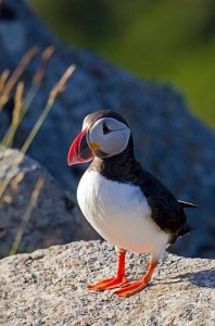
Tourist comes to Machias Seal Island during the summer to see birds such as the Atlantic Puffin.

Machias Seal Island is a tiny rock island 16 kilometres from the coast of the US state of Maine and 19 kilometers south of Grand Manan Island just off the coast of the Canadian province of New Brunswick. The island is claimed by both Canada and the US.

Machias Seal Island has an area of just 8 hectares or about 20 acres. The island is a sanctuary for many seabirds including the Atlantic Puffin seen in the appended video. Visitors from around the world come to view the birds during the summer.
There are no permanent residents of the island although there are lighthouse keepers who come in pairs and stay four weeks at a time. The lighthouse is operated by the Canadian Coast Guard. The original lighthouse was built by the British in 1832. There has been a lighthouse maintained ever since. Many think that the presence of the lighthouse will give Canada a legitimate claim to the island. The United States has never had a presence on the island except in 1918 during the First World War when a small detachment of marines was posted to the island with Canadian agreement.

However in the past private citizens in Maine have claimed ownership of the island. There is a tour boat operator from Cutler Maine, who brings tourists to the island in the summer to view the birds. While there has been no oil or mineral resources discovered in the area, there is a large 720 square kilometres around the island called a grey zone. Lobster fishermen from both Canada and the US fish this area.

MP for New Brunswick Southwest , John Williamson said:
“The fishing community on Grand Manan is permitted to fish there on an open-end basis and it’s our way of laying our claim to this water that is part of the Machias Seal Island dispute.I think our claim is sound and is legitimate, but at the end of the day it’s going to come down to the minister in this country and the administration in Washington to settle it. I think it is in the interests of both of our countries to do that.”

Unfortunately an earlier decision of a joint commission in 1817 did not decide the ownership of Machias Sea Island even though it did decide that of other islands in the area including Moose, Dudley, and Fredericks Islands that are now owned by the US and also Grand Manan island that now belongs to Canada.

Stephen Kelly of Duke University and a retired US diplomat thinks that it would be a good idea to resolve the issue.

“It just strikes me if we have this opportunity to remove a potential irritant going forward, why don’t we take it. What if some valuable resource is discovered in the grey zone around Machias Seal Island? What if some other contingency that we can’t imagine now of strategic importance comes along?Wouldn’t we feel silly that we didn’t take the opportunity to resolve this when the stakes were relatively low.”

Ralph Edlridge, who has been a light-keeper on the island for 16 years, thought ownership was a non-issue. Neither he nor anyone else who comes to visit the island has to worry about showing a passport whether they come from Maine, Canada, China, or Spain he said. Barbara Harvey a spokesperson for Foreign Affairs and International Trade said that as far as Canada is concerned the island is Canadian: “Canada’s sovereignty over Machias Seal Island and sovereign jurisdiction over the 210 square nautical mile surrounding waters is strongly founded in international law.” Some residents of Maine may not agree.

This opinion article was written by an independent writer. The opinions and views expressed herein are those of the author and are not necessarily intended to reflect those of DigitalJournal.com

[/private]

***************************

[private]

December 28, 2012

Private Island News (P.I.N.) ISLAND ISSUES
Canada: The Little-Known Island Dispute Over Machias Seal Island
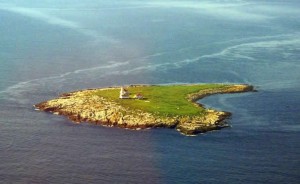
Image of Machias Seal Island from www.unb.ca

Along the border of the Canadian province of New Brunswick and the American state of Maine sits a small rocky island caught between the two countries.

An almost endless number of headlines have been made in recent months over the (at times heated) conflict between Japan and China over the ownership of a small group of islands in the East China Sea.

Due to the nature of islands, often found along inexact maritime boundaries, ownership disputes are not uncommon – but few of them tend to make headlines. A recent article has shone a spotlight on one of these lesser-known tales, involving a lighthouse isle along the Canada/USA border.

Found at the mouth of the Bay of Fundy, Machias Seal Island is an unassuming rocky outcropping of less than 20 acres, with only a lighthouse tower and outbuildings raised above its flat, barren surface. This modest appearance may be why the island was overlooked during the latter part of the 18th century, when Britain and the newly-formed United States were defining their territorial boundaries. Surprisingly, the intervening centuries have done little to resolve the question of just who owns the island.

While the dispute over Machias Seal Island has remained a friendly one, it has heated up in recent decades. Unlike in the case of Japan and China’s battle over the Diaoyu/Senkaku archipelago, there are no rich offshore oil and gas reserves at stake, however, there is a vibrant lobster fishing industry in the indeterminate “grey zone” of the surrounding waters.
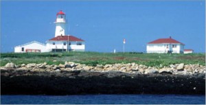
Image of island’s lighthouse from www.ccg.gc.ca

“It’s very congested,” said the head of local fisherman’s association. “It’s a very hard area to fish. The Americans think it’s theirs; the Canadians think it’s theirs, and nobody gets along all that well.”

Canada has, thus far, maintained the upper hand in the conflict – despite an elimination of full-time staff from lighthouses on the East Coast to cut costs, the building on Machias Seal Island bears the distinction of being the sole remaining non-automatic lighthouse in the region, a contiguous occupation that stretches back two centuries.

The Department of Foreign Affairs has been willing to foot the Coast Guard’s bill for the live-in staff, giving only the explanation that it is for “sovereignty purposes”.

Read more about this story: Link [/private]

[private]

Island fever – December 21, 2012

The Chinese are at it. The Japanese are at it. The Brits and the Argentines are at it – all squabbling over small islands. There is even speculation that the US and Canada will revive their long-running dispute over little Machias Seal Island.

When large states are feeling small, it seems, small islands loom large. This is true not just of tiny, uninhabited outcrops. Independent and semi-independent islands are in the limelight too.

One reason for this is clear. Entitled to many of the same rights as large states, but without the same responsibilities, these islands pose an outrageous challenge to the international order and need to be brought back under control.

It is not just their tax practices, although this is the issue that currently defines the EU’s agenda. By selling passports to anyone passing, islands help criminals change identities and travel the globe undetected. And by conferring diplomatic recognition upon renegade countries, islands endanger global security.

There is a second reason too: entitled to many of the same rights as larger states, but without the same responsibilities, small islands are an outrageous challenge to the international order, and are therefore extremely useful allies to big countries.

Thanks to the competition caused by their tax regimes, small islands can be helpful to large countries wishing to impose fiscal discipline upon their partners or just hoping to excuse their own tax practices. And by handing out passports to all-comers, islands can ‘liberate’ the business elites and political opposition of repressive regimes – saving big states the need to intervene.

Small islands are even credited with a diplomatic daring which larger countries cannot afford to practice. Fearful of encouraging secessionist tendencies at home or of antagonising their international partners, large states are often too nervous to recognise breakaway countries. Small islands go where large states fear to tread.

This ambiguous status in an international system made for big players gives islands a significance quite disproportionate to their size. Take for instance Nauru (population: 9,000; size: 21 square kilometres; distinguishing features: looks from above suspiciously like a treasure island).

For years, China and Taiwan were locked in competition for Nauru’s diplomatic loyalty, with Nauru reportedly allowing itself to be bought first by one side then the other. Indeed, in 2002, when the Taiwanese president rocked the world by supporting a referendum on independence, his move was viewed as a reaction to Nauru’s sudden switch of loyalties to the People’s Republic.

The case of Nauru also shows how quickly islands can go from international pariahs to valued partners, depending on large states’ whims. In 2003, the US appears to have decided that the Nauruans’ passport-for-sale scheme was not a danger to international security after all. Just the opposite in fact: it offered a means to smuggle nuclear scientists out of North Korea. If reports are true, Nauru, the one-time bandit, suddenly found itself made deputy sheriff.

This special attitude towards islands – an attitude which does not seem to pertain to other small states – reflects the strong hold they exercise over the popular imagination. Blame that Christmas favourite, Treasure Island. For people living a routine mainland life, islands signify pirates or palm trees: they are either dangerous or alluring.

At one extreme are the harmless bores who view islands as a serious threat to international security and stability, can recite by heart the guidelines on good governance produced with a cheerful lack of irony by the EU, OECD or G20, and show an unhealthy interest in all forms of small-island deviance.

At the other are the escapists who see islands as an alluring alternative to mainland life and who secretly dream of seizing a rocky outcrop and establishing a libertarian utopia of their own.

Islands are thus either ‘unviable’ – incapable of sustaining themselves without cheating on big states, and ripe for depopulation – or an escape – ripe for repopulation by mainlanders. Acknowledging instead that islands are in fact entities in their own right, capable of responsible self-regulation – within the same context of global interdependence that affects all countries – might help avoid unfortunate situations like Nauru’s.

After all, if the reports about 2003’s ‘Operation Weasel’ are accurate, Nauru’s citizens had just succeeded in stopping their government from selling passports on grounds of good governance, only to see the US reintroduce the practice for them.

[/private]

[private]

Machias Seal Island–An Ongoing Border Dispute Between the United States and Canada


(Maps: Google Maps)

This is Machias Seal Island, a 20-acre island in the Bay of Fundy.

You can’t see it? Let’s zoom in.


Hmm. That doesn’t help much. Let’s zoom in some more.


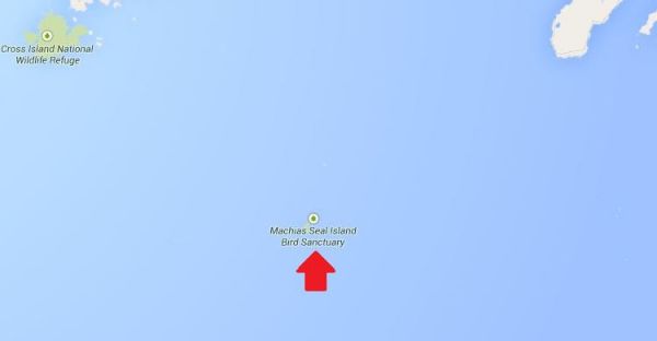
There it is! It’s a speck of land that barely appears on the map.


(Photo: Albnd)

You can see the lighthouse in the photo above. The island is inhabited by 2 human lighthouse keepers, a few seals…


(Photo: Thomas O’Neil)

…and lots and lots of puffins.

The ownership of Machias Seal Island is disputed by the United States and Canada. Canada is in physical possession of it, but the United States has not formally dropped its claim to the island.

I’ve previously written several posts about the development of the US-Canadian border, whichincludes weird exclaves. Ambiguity about the border even led to the creation of 2 short-lived nations.


(Painting by Benjamin West of the American delegation at the Treaty of Paris)

Although the United States and Canada now maintain a long, peaceful border, the placement of that border has been in doubt since the Treaty of Paris (1783) in which Britain recognized the United States as an independent nation. That treaty attempted to draw borders over unexplored lands. The authors did the best that they could with their knowledge of geography. But, alas, one of the descriptions for the border between Maine and maritime Canada was problematic. The treaty says that US territory includes:

all Islands within twenty Leagues of any Part of the Shores of the United States, and lying between Lines to be drawn due East from the Points where the aforesaid Boundaries between Nova Scotia on the one Part and East Florida on the other shall, respectively, touch the Bay of Fundy and the Atlantic Ocean, excepting such Islands as now are or heretofore have been within the limits of the said Province of Nova Scotia.

I’ve bolded the parts of the text that are the source for the Machias Seal Island dispute.

As I’ve mentioned in a previous post, the eastern border of Maine was of great concern to the British. Some British officials coveted what Americans saw as their territory, and vice versa. Control of the Bay of Fundy was of great importance to British commissioners at the Treaty of Ghent (1814), which ended the War of 1812.


(Photo: Thomas O’Neil)

Now back to Machias Seal Island. The American argument is that it lies within 20 leagues (approximately 69 miles) of the coast of the United States.

The Canadian argument is that a land grant that pre-exists the Treaty of Paris defines the island as part of Nova Scotia. It built and has operated a lighthouse on the island since 1832.

Occasionally fishermen from the 2 nations have gotten into scraps about its ownership. Some Canadian citizens have staked mining claims to the island as a means of asserting Canadian sovereignty. The State of Maine has included the island on its maps of electoral districts.

But if possession is indeed 9/10ths of the law, then Machias Seal Island is Canadian. The United States has chosen not to press the issue.

Sources:
Clark, Edie. “Barna Norton Invades Canada.” Yankee 62.6 (1998): 48. Biography Reference Bank (H.W. Wilson). Web. 22 Apr. 2014.

Guo, Rongxing. Territorial Disputes and Resource Management: A Sourcebook. New York: Nova Science Publishers, 2007. Web. Google Books. 22 Apr. 2014.

Kelly, Stephen R. “Good Neighbors, Bad Border.” New York Times, Late Edition (East Coast) ed. Nov 27 2012. ProQuest. Web. 22 Apr. 2014 .

[/private]


An Island Dispute of our Own

An island dispute of our own
Posted By Joshua Keating  Wednesday, November 28, 2012 – 11:36 AM

It’s not quite the Senkakus, but Stephen Kelly highlights a long-festering territorial dispute between the United States and Canada:

Machias Seal Island is a 20-acre, treeless lump that sits nearly equidistant from Maine and New Brunswick. It, and the even smaller North Rock, lie in what local lobstermen call the gray zone, a 277-square-mile area of overlapping American and Canadian maritime claims.

The disagreement dates back to the 1783 Treaty of Paris that ended the Revolutionary War. The treaty assigned to the newly independent 13 colonies all islands within 20 leagues — about 70 miles — of the American shore. Since Machias Seal Island sits less than 10 miles from Maine, the American position has been that it is clearly United States soil.

But the treaty also excluded any island that had ever been part of Nova Scotia, and Canadians have pointed to a 17th-century British land grant they say proves the island was indeed part of that province, whose western portion became New Brunswick in the late 18th century.

Perhaps more important to the Canadian case, the British built a lighthouse on Machias Seal Island in 1832, which has been staffed ever since. Even today, two lighthouse keepers are regularly flown to the island by helicopter for 28-day shifts to operate a light — even though, like every other lighthouse in Canada, it is automated. – Opinion Pages – NY Times

[private]

The New York Times Opinion pages Good Neighbors, Bad Border Cartoon: John Malta

By STEPHEN R. KELLY   Published: November 26, 2012

AT a time when territorial disputes over uninhabited outcrops in the East China Sea have led to smashed cars and skulls in China, a similar, if less dramatic, dispute over two remote rocks in the Gulf of Maine smolders between the United States and Canada.

Machias Seal Island and nearby North Rock are the only pieces of land that the two countries both claim after more than 230 years of vigorous and sometimes violent border-making between them.

Except for the occasional jousting of lobster boats, this boundary dispute floats far below the surface of public or official attention, no doubt reflecting the apparent lack of valuable natural resources and a reluctance to cede territory, no matter how small.

But if we are unlikely to resort to arms anytime soon, the clashes in Asia have shown how seemingly minor border disputes can suddenly stoke regional and nationalistic tensions. Our relaxed attitude toward these remote rocks may well be a mistake.

While the United States and Canada have other maritime boundary disputes along their 5,525-mile border, the world’s longest, this is the only one left that involves actual chunks of land.

Machias Seal Island is a 20-acre, treeless lump that sits nearly equidistant from Maine and New Brunswick. It, and the even smaller North Rock, lie in what local lobstermen call the gray zone, a 277-square-mile area of overlapping American and Canadian maritime claims.

The disagreement dates back to the 1783 Treaty of Paris that ended the Revolutionary War. The treaty assigned to the newly independent 13 colonies all islands within 20 leagues — about 70 miles — of the American shore. Since Machias Seal Island sits less than 10 miles from Maine, the American position has been that it is clearly United States soil.

But the treaty also excluded any island that had ever been part of Nova Scotia, and Canadians have pointed to a 17th-century British land grant they say proves the island was indeed part of that province, whose western portion became New Brunswick in the late 18th century.

Perhaps more important to the Canadian case, the British built a lighthouse on Machias Seal Island in 1832, which has been staffed ever since. Even today, two lighthouse keepers are regularly flown to the island by helicopter for 28-day shifts to operate a light — even though, like every other lighthouse in Canada, it is automated.

While abundant legal arguments surround Machias Seal Island, natural resources are far less evident. No oil or natural gas has been discovered in the area, nor has it had any strategic significance since it served as a lookout for German U-boats during World War I.

Tour boats from Maine and New Brunswick carry strictly limited numbers of bird watchers to the island to see nesting Atlantic puffins. And the surrounding waters contain lobsters that, thanks to different regulatory schemes and overlapping claims, have occasionally sparked clashes between Maine and New Brunswick lobstermen, although a bumper lobster crop this summer has slackened demand for gray zone crustaceans.

But the lack of hydrocarbons and the current lobster glut make this an ideal time to color in the gray zone.

The United States and Canada settled all their other maritime differences in the Gulf of Maine in 1984 by submitting their claims to the International Court of Justice for arbitration. They could have included the gray zone in that case, but did not. The Canadians had refused an earlier American arbitration proposal by saying their case was so strong that agreeing to arbitration would bring their title into question.

This attitude calls for re-examination. The fact that so little in the way of resources appears to be at stake, far from justifying the status quo, should be the main reason for resolving the issue. And for those concerned about blowback from “giving away” territory, letting the international court decide the case provides the most political cover.

As China and Japan can attest, border disputes do not go away; they fester. And when other factors push them back to the surface — the discovery of valuable resources, an assertion of national pride, a mishap at sea — the stakes can suddenly rise to a point where easy solutions become impossible.

Before that happens, we should put this last land dispute behind us, and earn our reputation for running the longest peaceful border in the world.

Stephen R. Kelly is the associate director of the Center for Canadian Studies at Duke University and a retired American diplomat who served twice in Canada.

A version of this op-ed appeared in print on November 27, 2012, on page A31 of the New York edition with the headline: Good Neighbors, Bad Border.

[/private]

[private] An island dispute of our ownPosted By Joshua Keating  Wednesday, November 28, 2012 – 11:36 AM  

It’s not quite the Senkakus, but Stephen Kelly highlights a long-festering territorial dispute between the United States and Canada:

Machias Seal Island is a 20-acre, treeless lump that sits nearly equidistant from Maine and New Brunswick. It, and the even smaller North Rock, lie in what local lobstermen call the gray zone, a 277-square-mile area of overlapping American and Canadian maritime claims.

The disagreement dates back to the 1783 Treaty of Paris that ended the Revolutionary War. The treaty assigned to the newly independent 13 colonies all islands within 20 leagues — about 70 miles — of the American shore. Since Machias Seal Island sits less than 10 miles from Maine, the American position has been that it is clearly United States soil.

But the treaty also excluded any island that had ever been part of Nova Scotia, and Canadians have pointed to a 17th-century British land grant they say proves the island was indeed part of that province, whose western portion became New Brunswick in the late 18th century.

Perhaps more important to the Canadian case, the British built a lighthouse on Machias Seal Island in 1832, which has been staffed ever since. Even today, two lighthouse keepers are regularly flown to the island by helicopter for 28-day shifts to operate a light — even though, like every other lighthouse in Canada, it is automated.

Kelly reasonably suspects that the lack of natural resources in the region have made both sides reluctant to rock the boat by submitting their claims to the International Court of Justice for arbitration, as they have with other disputes. There’s simply nothing there worth the risk of losing the case and having to explain to voters why you “gave away” U.S. or Canadian territory. In any case, from the photos on Flickr it looks like the Canadian government has staked a pretty permanent claim to the island, so this one may be de facto settled.

Machias is the only U.S.-Canadian border conflict that involves land, but the sea border is disputed in a few places. Here’s Wikipedia’s list:

  • Strait of Juan de Fuca 48°17?58?N 124°02?58?W (Washington /British Columbia) The middle-water line is the boundary, but the governments of both Canada and British Columbia disagree and support two differing boundary definitions that would extend the line into the Pacific Ocean to provide a more definite Exclusive Economic Zone (EEZ) boundary.
  • Dixon Entrance 54°22?N 132°20?W (Alaska / British Columbia) is wholly administered by Canada as part of its territorial waters, but the US supports a middle-water line boundary, thereby providing the US more maritime waters. Canada claims that a 1903 treaty demarcation is the international maritime boundary, while the United States holds that the maritime boundary is an equidistant line between the islands that form the Dixon Entrance, extending as far east as the middle-water line with Hecate Strait to the south and Clarence Strait to the north.[2]
  • Yukon–Alaska disputeBeaufort Sea 72°01?40?N 137°02?30?W(Alaska / Yukon) Canada supports an extension into the sea of the land boundary between Yukon and Alaska. The US does not, but instead supports an extended sea boundary into the Canadian portion of the Beaufort Sea. Such a demarcation means that a minor portion of Northwest Territories EEZ in the polar region is claimed by Alaska, because the EEZ boundary between Northwest Territories and Yukon follows a straight north-south line into the sea. US claims would create a triangular shaped EEZ for Yukon. This is mainly an Alaska-Yukon dispute.
  • Northwest Passage; Canada claims the passage as part of its “internal waters” belonging to Canada, while the United States regards it as an “international strait” (a strait accommodating open international traffic).

The last two might get a bit more controversial as resource competition in the rapidly melting Arctic heats up.

[/private]

Reprint – Restoring Canaveral Light – Brick by Brick!


Restoring Canaveral Light – Brick by Brick!


The mission statement of the Cape Canaveral Lighthouse Foundation is  “To Assist the 45th Space Wing in preserving, protecting, and interpreting the Cape Canaveral Lighthouse and its historical significance to the Florida Space Coast, State of Florida, and our Nation.” The US Air Force owns and maintains Cape Canaveral Light, but the Foundation exists to be of assistance in its restoration and to share its remarkable history.

In many ways Cape Canaveral and the Lighthouse is a bridge between the age of exploration and exploration yet to come; a bridge between the sea and the stars!

On October 13th, 2012 I attended a gathering at the Canaveral Lighthouse with my father to celebrate the progress having been made on the restoration of this special and significant beacon. Although, we had visited the light by special permission a couple of years ago in order to photograph, I did not then have the opportunity to see the interior of the tower. Saturday, October 13th, could not have been a more perfect day to gather, discuss goals, walk the newly built Keeper’s Brick Paver Walkway, and climb!! I have to say right here that I was amazed that my 88 year old father was able to navigate the stairs better than I did!  The metal lighthouse is lined with brick and the winding stairs curl upwards around a center pole with no hand railing along the brick walls. Of course, it was probably because I was lugging my heavy camera!! Probably!! Continue reading Reprint – Restoring Canaveral Light – Brick by Brick!

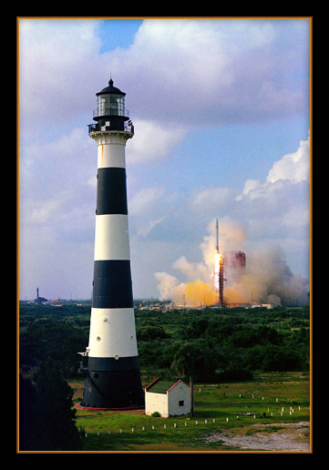
Reprint – Cape Canaveral Light – Warden of the Sea, Launchpad to the Stars!


The following story is the first of two parts on the Cape Canaveral lighthouse by Judy Lovell, a photographer extraordinaire, who runs a WordPress blog called Janthina Images.

Besides this article, and the one following, please view her image gallery on her website as well. In the gallery she has some lovely photos of Florida lighthouses with prints available for sale. Enjoy, and drop by her website occasionally for different articles. If you wish to view the image gallery as a slideshow, please click here.

***********************************

Cape Canaveral Light – Warden of the Sea, Launchpad to the Stars!

They fill that night with Knowledge. A thousand ships go by,
A thousand captains bless them, so bright and proud and high:
The world’s dark capes they glamour; or low on sand banks dread,
They, crouching, mark a pathway between the Quick and Dead —
Like star points in the ether
They bring the seamen ease,
These Lords of Wind and Weather
These Wardens of the Seas!

…Edwin James Brady…

Lighthouses have long stood at the edges of the world, lonely outposts maintained by devoted souls to ensure the safety of ships at sea. But, only one remarkable beacon was destined to illuminate the path for ships of space! But how did this happen? How did a lighthouse built on a hook of sand jutting out into the Atlantic to protect mariners from dangerous currents become a front row witness to the advent of the Space Age?

Rocket Launch with Canaveral Lighthouse is courtesy NASA Continue reading Reprint – Cape Canaveral Light – Warden of the Sea, Launchpad to the Stars!

Mise Tales Fifteen


For an update on what a Mise Tale is then please see Mise Tales One.

Some of these stories and articles are a bit late for Halloween, but better late than never, especially when lighthouses are a year-round topic!

The Fog – Best Scary Movie Starring Point Reyes Lighthouse

You may have heard of this John Carpenter film – myself, I have never seen it. I was going to write about it, but May, the author at Completely Coastal has done such a good job, I thought I would turn you over to her. Enjoy . . . [link]

A Northern California fishing town, built 100 years ago over an old leper colony, is the target for revenge by a killer fog containing zombie-like ghosts seeking revenge for their deaths. – Internet Movie Database (IMDb)

************************************

Lighthouse Switchback India Pale Ale (IPA)

The Province October 20, 2012

This is the first in a series of reviews on the new wave of British Columbia India Pale Ales (IPAs). This province already produces some Continue reading Mise Tales Fifteen

West Coast Recipes – Part One


I thought this might be interesting for people in other parts of the world who read this website. There are many food recipes associated with the West Coast of Canada and USA – many from the First Nations people, and many from the residents be they mariners, lighthouse keepers, villagers, prospectors, hunters or others. I will try and see what I can find. I will try and post about five (5) recipes per post. If others have any contributions, please pass them on. Full credit will be given.


One recipe I have posted can be found here: Thomas Crosby Muffins. Also a book was written about British Columbia lighthouses called The Lighthouse Cookbook by Anita Stewart. It is an excellent book and is available from Amazon.com.


******************************** 

1. Salmon Fish Cakes

Now this is one of the simplest recipes to make, and I learned about making them from my wife Karen who’s father used to cook them while out on the West Coast fishing for salmon. His recipe was pretty simple: Use whatever is available! Take some leftover cooked salmon, mix it about half and half with some leftover cooked potatoes, throw in an egg to help hold it together and season with salt and pepper. If available, add a few chopped green onions. Make into patties and fry in one-quarter inch (1/4″) oil, flipping once until brown on both sides. Serve with whatever condiment is available – lemons and/or ketchup.  Enjoy!

Below is a more cookbook style of making the same thing:

Salmon Fish Cakes

1 1/4 lbs potatoes, peeled and cut into chunks

1 lb salmon fillets, skin on, scaled and bones removed (or in a pinch try using 2 cans of Clover Leaf’s canned boneless/skinless salmon) Continue reading West Coast Recipes – Part One

Legoland Lighthouses

Legoland lighthouse

 Probably most of you have heard of Legoland Parks. Like the Disney parks, they seem to be all over the world, but the one I am going to speak about is Legoland Park California at 1 Legoland Drive, Carlsbad, California, 92008, USA 


Legoland Interactive Park Map

 I have mentioned Lego lighthouses as model kits before in posts, but in this park there are large lighthouse replicas – one of mention is in the New England Harbour area (see the interactive map at the left).


Continue reading Legoland Lighthouses

Mise Tales Eleven

For an update on what a Mise Tale is then please see Mise Tales One.

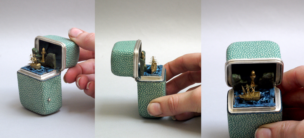
This is too cute not to show you all. I discovered this page by accident, and could not stop going oooh and ahhh! It is priceless, and I mean that literally, as this item is a one of a kind according to the experts. According to the article:

The object is an early 19th century miniature musical automaton movement that controls a nautical scene. The scene features a gilt lighthouse set on cliffs of green and brown painted wood. A gilded ship sits on a painted sea in front of the cliffs. The ship rocks to and fro as though in a storm while a (then unidentified) tune plays on a plucked comb. more ->

 More information here on the Automata / Automaton blog.

*****************************

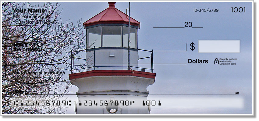
I know many people do not use checks/cheques these days, but if you do, AND you like lighthouses, here is a company that produces Lighthouse Checks!

Check out checkadvantage.com for these checks. They have four different designs which you can see on their website. I will keep them in mind for my next batch of cheques.

******************************

OK, here’s another one. A lighthouse on a USA Waterfowl Hunting Stamp. I know there are lighthouses on Postage Stamps, but never realized they did it for Hunting Stamps. Are there any more out there? This one is for 1994 and shows Oak island lighthouse. The full story is here on the Southport Times website.

The Widow’s Walk and a House Rental called ‘Lighthouse Watch’

What is a Widow’s Walk? It is definitely not a new dance!

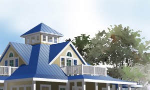
I will give you a hint – It is a fixture built onto a house. It was prevalent in the days of sailing ships, both in Italy where it originated as a style of architecture, and also in eastern American houses on the waterfront.

Here’s a legendary quote on the use of the Widow’s Walk:

The widow's walk is the fenced in balcony on the top right

The faithful and dedicated wife, performing her daily circumambulations on the cold and lonely widow’s walk: The next sail to top the horizon may well carry her husband, gone to sea these many years. But not today. The sun sets, bringing to a close her lonely vigil for this day. Perhaps, though, the much-anticipated vision will appear tomorrow and if not tomorrow, the next day. – Fishermen’s Voice

That article gives more credit to the use of the widow’s walk for fire prevention rather than for lonely widows pining for their husbands. Below in the gallery are some photos of what a Widow’s Walk looks like.

[nggallery id=59]

 Give up? OK, check out this Wikipedia article1 for a good description.

It is not necessarily a lighthouse thing, but maybe, just maybe, a lonely lighthouse widow did walk around the lantern searching for the return of her man from town with the mail and groceries in his rowboat, or late from a fishing or hunting trip. On this website there are many stories of death on the water with a lighthouse background.

By the way, The walkway around the outside of a lighthouse lantern room (for cleaning the lantern glass) is called a Gallery, and the walkway around the light inside (for lens cleaning) is called the Lantern Gallery.

************************

Lighthouse Watch – House Rental, North Carolina, USA. c/w widow’s walk!

 Caswell Beach house rental, North Carolina, USA. Interested? Contact 

Oak Island Accommodations, Inc. Telephone:+ 1-800-518-4118 ext. 7153373

 
  • Caswell Beach house rental
    Caswell Beach house rental
    Caswell Beach house rental
    Caswell Beach house rental
    Caswell Beach house rental
    Caswell Beach house rental
  • Caswell Beach house rental
    Caswell Beach house rental
    Caswell Beach house rental
    Caswell Beach house rental
     
 
Per week (USD)$1,396 – $2,496

 
  • Bedrooms 4
     
  • Sleeps 8
     
  • 3 Bathrooms

FOOTNOTES:

1 Widow’s Walk – A widow’s walk also known as a “widow’s watch” (or roofwalk) is a railed rooftop platform often with a small enclosed cupola frequently found on 19th century North American houses. A popular romantic myth holds that the platform was used to observe vessels at sea. The name is said to come from the wives of mariners, who would watch for their spouses’ return, often in vain as the ocean took the lives of the mariners, leaving the women widows.[1] In other coastal communities, the platforms were called Captain’s Walk, as they topped the homes of the more successful captains and supposedly ship owners and captains would use them to search the horizon for ships due in port.

However, there is little or no evidence that widow’s walks were intended or regularly used to observe shipping. Widow’s walks are in fact a standard decorative feature of Italianate architecture, which was very popular during the height of the Age of Sail in many North American coastal communities. The widow’s walk is a variation of the Italianate cupola.[2] The Italianate cupola, also known as a “belvedere”, was an important ornate finish to this style, although it was often high maintenance and prone to leaks.[3]

Beyond their use as viewing platforms, they are frequently built around the chimney of the residence, thus creating access to the structure. This allows the residents of the home to pour sand down burning chimneys in the event of a chimney fire in the hope of preventing the house from burning down

[private]http://www.homeaway.com/vacation-rental/p7153373h#map

http://southerncottages.blogspot.com/2010/04/legend-of-widows-walks.html

http://www.fishermensvoice.com/archives/0310widowsWalk.html[/private]


Docent Duty at a Lighthouse Plus a Book Review


This post is very interesting. It comes from a lady, Kathleen Ernst, who with her husband performs docent duty1 on an automated lighthouse in the United States. She has also written a historically-accurate non-fiction crime novel about the same lighthouse. I asked her permission to reprint the article 2 in full for you, which was given freely, so it is reprinted below for your enjoyment. What a retirement job!.

********************************

Docent Duty by Kathleen Ernst

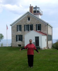
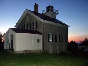
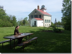
My husband Scott and I are recently back from our 4th stint as docents at Pottawatomie Lighthouse in Rock Island State Park, WI.  

Rock Island is situated off the northern tip of Door County in Lake Michigan, and Pottawatomie is the state’s oldest light station.

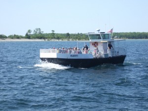
The current lighthouse, built in 1858, was magnificently restored by the Friends of Rock Island in partnership with the Wisconsin Department of Natural Resources.  It sits on top of a bluff on the northern end of Rock Island, over a mile from the boat landing and campground.  There are no roads on the island, and it takes two ferry rides to get there.

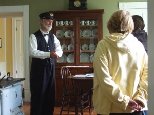
As docents, we give tours to guests from 10 AM to 4 PM each day.  Since Scott and I both love history, and telling stories, it’s a great gig.  We’re also responsible for housekeeping chores.


Otherwise, we get to live at the lighthouse.  How cool is that?

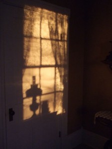
There’s no electricity or indoor plumbing.  (That’s Scott filling an Igloo at the old pump, in the rain.)  But we have a fridge and stove powered by bottled gas, and we get to sleep in the keepers’ bedroom.


We have lots of quiet evenings.  Lots of time for an impressionable writer to ponder stories of long-gone keepers, and to imagine the lighthouse as it once was.


So it was pretty much inevitable that I would write a book about the lighthouse.


In The Light Keeper’s Legacy (coming in October [2012]), my protagonist Chloe Ellefson is invited to serve as a guest curator at Pottawatomie Lighthouse.  She’s excited about the job and eager for some solitude in such a beautiful, remote place.  Needless to say, since this is a murder mystery, her time on Rock Island isn’t quite as peaceful as she’d hoped.

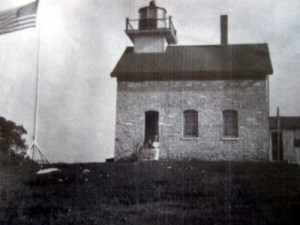
 Writing the book let me explore some new personal issues for Chloe, who is struggling to figure out what she wants from life.  And it let me write an homage to the strong individuals who lived on Rock Island in the 19th century.  The Light Keeper referenced in the title is Emily Betts, a real  and totally awesome woman who served as Assistant Keeper at Pottawatomie.  (In the National Archives photo below, that’s Emily barely visible in the doorway.)


The book also showcases the complexities of managing natural resources over the years.  And it let me share a very special place with readers—some of whom will, I hope, decide to visit Rock Island and support ongoing restoration projects.


 It doesn’t get much better than that.

http://kathleenernst.com
http://sitesandstories.wordpress.com
http://facebook.com/kathleenernst.author

1 docent: A person who acts as a guide, typically on a voluntary basis, in a museum, art gallery, or zoo.

2 The article was originally displayed on the Ink Spot blog which describes itself as a corps of crime fiction authors, so if you like crime fiction then check out their webpages.