Category Archives: Automation

Reprint – The World’s Most Incredible Lighthouses


The World’s Most Incredible Lighthouses

See the amazing towers from Cape Hatteras to Thailand

from Weather.AOL.com by VALERIE CONNERS JAN 15, 2013

  • kaddisudhi via Flickr
    1 of 21
     

    It’s hard to resist the allure of lighthouses. They stand sentry on rock-strewn, wave-battered coasts, often for for centuries, guiding mariners toward safer shores. And their very presence is a reminder of the power of nature and the fragility of life. But above all — just look at them. They’re so often breathtaking.

    From 2,000-year-old towers to ultra-modern designs, click through to see the world’s most amazing lighthouses. . . . more

[private]

The World’s Most Incredible Lighthouses

See the amazing towers from Cape Hatteras to Thailand

by VALERIE CONNERS JAN 15, 2013
  • kaddisudhi via Flickr
     

    It’s hard to resist the allure of lighthouses. They stand sentry on rock-strewn, wave-battered coasts, often for for centuries, guiding mariners toward safer shores. And their very presence is a reminder of the power of nature and the fragility of life. But above all — just look at them. They’re so often breathtaking.

    From 2,000-year-old towers to ultra-modern designs, click through to see the world’s most amazing lighthouses.

    Getty Images
     

    St. Mary’s Lighthouse, Whitley Bay, England

    St. Mary’s Lighthouse sits on an island reachable from the mainland only by a concrete causeway between tides. During high tides, the causeway is completely submerged. The 120-foot-high lighthouse lies north of Whitley Bay, and though the lighthouse is no longer active, the site remains a popular tourist attraction. Visitors can climb the 136 lighthouse steps to the lantern room, or visit a small museum, visitor’s center and cafe.   

    Joe Dsilva via Flickr
     

    Pigeon Point Lighthouse, California

    Fifty miles south of San Francisco, the 115-foot-tall Pigeon Point Lighthouse has been helping to guide sailors off the rocky Central California coast since 1872. Today it doubles as a popular hostel.

    The lighthouse itself remains closed to the public after a section of the exterior’s cornice fell off in 2001, but the grounds remain open to visitors and 30-minute guided tours are available Friday through Monday. You might even spy seals or whales. 

    brentdanley via Flickr
     

    Bass Harbor Lighthouse, Acadia National Park, Maine

    Tucked into the scenic, rocky shores of Maine’s Acadia National Park, Bass Harbor Lighthouse on Mount Desert Island is one of the park’s major attractions, thanks to its postcard-perfect setting. The lighthouse serves as home to the local Coast Guard unit’s commander. Short trails around the tower allow visitors to enjoy spectacular views.

    snowpeak via Flickr
     

    Heceta Head Lighthouse, Florence, Oregon

    One of the most visited and photographed lighthouses in the U.S., Haceta Head Lighthouse is perched along Oregon’s jagged coast more than 200 feet above the Pacific. The 56-foot-tall lighthouse was first illuminated in 1894. Its automated beacon is visible for 21 miles and is the brightest light on the Oregon coast.

    It’s located in Heceta Head State Park, where trails and viewing areas offer glimpses of puffins, cormorants, gulls and sea lions. Lighthouse lovers can spend a night at Heceta Head: The adjacent keeper’s house doubles as a bed and breakfast.

    KAIZUKA via Flickr
     

    Enoshima Lighthouse, Japan

    One of the world’s most striking lighthouses, Enoshima Lighthouse rises above tiny Yenoshima Island a few hours south of Tokyo. Renovated in 2003, the lighthouse features a massive open-air spiral staircase winding around a central steel structure and ultimately leading to a 196-foot-high observation deck.

    From the deck, visitors can take in views of Sagami Bay and Mount Fuji in the distance. Don’t have the stamina to climb the staircase? An elevator also shuttles visitors.

    Thinkstock
     

    Torre de Hercules, Spain

    The Torre de Hercules, or Tower of Hercules, was built by the Romans above La Coruña harbor in northwestern Spain in the 1st century, AD. The lighthouse is believed to be the only Greco-Roman lighthouse to retain its architectural integrity.

    Originally called the Farum Brigantium, the tower sits on a 187-foot-high rock and stands an additional 180 feet high. The tower underwent restoration in the 18th century, and today visitors can also tour a sculpture garden, see rock carvings from

    the Iron Age and explore a Muslim cemetery.

    Thinkstock
     

    Marblehead Lighthouse, Ohio

    Ohio isn’t the first place one pictures when imagining scenic lighthouse settings, yet the state is bordered by Lake Erie and the shores of the Great Lakes are home to dozens of beacons. Built along the craggy shores of the Marblehead Peninsula, Marblehead Lighthouse has been shining since 1822, making it the oldest continuously operating lighthouse on the U.S. shores of the Great Lakes.

    The 50-foot limestone tower was operated by 15 lighthouse keepers, including two

    women, until 1946. At that point, the U.S. Coast Guard took over responsibility for the light, which is now automated. 

    paul bica via Flickr
     

    Cape Byron Lighthouse, New South Wales, Australia

    Cape Byron marks the easternmost point of mainland Australia, and it’s here you’ll find the Cape Byron Headland Reserve, a state conservation area and home to the Cape Byron lighthouse. Visitors to the scenic reserve can hike the 2.3-mile loop trail and admire the coastal vegetation, sea cliffs and beaches. The lighthouse and its cottages were built in 1901 and stand on the mainland’s most easterly point. 

    Thinkstock
     

    Cap des Rosiers Lighthouse, Quebec

    At 112 feet tall, Quebec’s Cap des Rosiers lighthouse is Canada’s tallest beacon. It’s helped guide ships to safe waters since 1858. The tower sits at the mouth of the St. Lawrence River where it enters the Gulf of St. Lawrence, a rocky spot that has seen its share of shipwrecks. Among them was an Irish immigrant ship called the Carrick, which ran aground in 1847 and left 400 people dead.

    The tower’s light is set 136 feet above the sea. The tower itself is a massive structure with 7-foot-thick marble walls at its base that taper to 3 feet thick at the top.   


    Photo by Carol M. Highsmith/Buyenlarge/Getty Images
     

    Middle Bay Lighthouse, Alabama

    Rising from the center of Mobile Bay along Alabama’s Gulf Coast, Middle Bay Lighthouse is a hexagonal-shaped, screw-pile lighthouse built on seven piles screwed into the muddy sea floor. The station came into service in 1885. It gained notoriety in 1916 when the lightkeeper’s wife gave birth and the couple corralled a dairy cow to the lighthouse’s lower deck to provide milk.

    The lighthouse was deactivated in 1967, and in 2010, $200,000 worth of repair work began on the structure. Visitors can’t climb the structure, but they can see the lighthouse up close on a boat tour departing from Fairhope, Alabama

    Mkaraarslan via Wikimedia Commons
     

    Kiz Kulezi (Maiden’s Tower), Turkey

    Kiz Kulezi, or the Maiden’s Tower, sits on a small islet at the southern end of the Bosphorus Strait. It owes its name to the legend of a sultan’s daughter who was brought to the island to protect her from her anticipated demise — a snakebite on her 18th birthday — as foreseen by an oracle. The sultan ensured she was far from land and snakes, but on her 18th birthday, he brought her a basket of fruit, which unbeknownst to him, carried a poisonous asp. Needless to say, the fair maiden’s end was nigh.

    Today, the tower houses a high-end restaurant serving delicacies such as sea bass with caviar and caper sauce. Want a window view overlooking the strait? It’ll cost you. The restaurant tacks on a surcharge for window seating.

    Jim Dollar via Flickr
     

    Ocracoke Lighthouse, Ocracoke Island, North Carolina

    Built in 1823, Ocracoke Lighthouse is North Carolina’s oldest lighthouse and is still operational today. The 75-foot-tall lighthouse was automated in 1955. During the summer months, a U.S. National Park ranger is on duty and tourists can enter the lighthouse’s base. To reach the island, visitors can take a 40-minute auto and passenger ferry from Cape Hatteras.

    kahunapulej via Flickr


    Coastwatchers Memorial Lighthouse, Madang, Papua New Guinea

    One of the most famous war memorials in Papua New Guinea, Coastwatchers Memorial Lighthouse pays tribute to the soldiers and civilian volunteers who acted as coastwatchers during World War II. Built in 1959, the lighthouse sits at the entrance to Madang Harbor, stands 90 feet high and was designed to be tapered at its top with four fins at the bottom, so that it resembles a bomb. At the top of the lighthouse is a bronze beacon guard shaped like a flame.  

    “JT” Taylor via Flickr
     

    Cape Hatteras Lighthouse, North Carolina

    Just off Cape Hatteras lies one of the Atlantic coast’s most dangerous stretches of sea: the area where the Gulf Stream collides with the Virginia Drift. Hundreds, if not thousands, of ships have met their demise here, earning the region the nickname, “Graveyard of the Atlantic.”

    Cape Hatteras Lighthouse has been warning ships in the area since it was first lit in 1803. The tower’s height was increased 1853 and again in 1871. At 210 feet, it’s now the tallest lighthouse in America.

    In 2000, increasing beach erosion led to the lighthouse being moved 875 yards inland. The site now features a museum and visitor’s center. Climbing tours of the lighthouse’s 248 iron spiral stairs are held daily in spring, summer and fall.

    Seli O via Flickr
     

    Knarrarós Lighthouse, Iceland

    This lighthouse on Iceland’s south coast isn’t your run-of-the-mill round tower. Designed as a blend of functionalism and art nouveau, Knarrarós is a square, unpainted concrete structure rising 86 feet above the earth, making it southern Iceland’s tallest building. Black panels between windows grant the appearance of stripes running up the sides. Tourists can visit the site but can’t enter the unusual lighthouse. 

    bluestardrop – Andrea Mucelli via Flickr
     

    Hook Head Lighthouse, County Wexford, Ireland

    The oldest lighthouse in Ireland and one of the oldest in the world, Hook Head is over 800 years old, though local lightkeepers are said to have been setting up fires to warn ships of danger since the 5th century. The current lighthouse was built during the 12th century by the Normans, with 9- to 13-foot-thick walls and standing 80 feet high. Visitors can take guided tours to the top or visit the gift shop and cafe.

    Bruce Stokes via Flickr
     

    Burnham-on-Sea Low Lighthouse

    Called the “lighthouse on legs,” Burnham-on-Sea Low Lighthouse was erected in 1832 after an earlier lighthouse had proved to have too low of a vantage point. The Low Lighthouse is a wooden pile lighthouse that reaches 36 feet high and stands on nine wooden piers. The whitewashed structure, with its trademark red stripe, was inactive from 1969 to 1993, but it’s once again active and warning mariners.


    Alamy
     

    Promthep Cape Lighthouse, Thailand

    A veritable youngster among lighthouses, Promthep Cape Lighthouse in Phuket, Thailand, was built in 1996 to commemorate the Golden Jubilee of HM King Bhumibol Adulyadej. Perched on Laem Promthep, a popular hilltop for watching sunsets, the lighthouse houses a small museum and is free to enter. Visitors can climb the tower for a better view of the stunning shoreline below. 

    archinwater via Flickr
     

    Yokohama Marine Tower, Japan

    One of the tallest lighthouses in the world looms 348 feet over Yokohama, Japan, and features a panoramic observation deck. On clear days, visitors can see snow-capped Mount Fuji in the distance. The tower is widely recognized for its lattice structure which, after dark, is lit in colored LED lights. A four-story complex sits at the tower’s base and includes a cafe, bar, restaurant and gift shop. 

    Alamy
     
    Beachy Head Lighthouse, East Sussex, England

    One of the planet’s most striking lighthouses is Beachy Head Lighthouse, set at the base of the 530-foot-tall white cliffs in East Sussex, England. The 141-foot tower was built with over 4,000 tons of granite and was first lit in 1902. Lighthouse keepers manned the beacon for 80 years until it was automated in 1983.

    Today, the light emits two flashes every 20 seconds and can be seen eight nautical miles away. Pop culture fun facts: the Beachy Head cliffs have appeared in The Cure’s videos for “Just Like Heaven” and “Close To Me,” and the area served as the Quidditch World Cup hosting grounds in “Harry Potter and the Goblet of Fire.”

    [/private]


Taiwan – There are Lighthouses There!


New Maritime and Port Bureau starts operations

By Shelley Shan – Staff reporter – Taipei Times – January 02, 2013

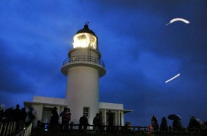
People watch the sunrise at the Sandiaojiao lighthouse on the border of New Taipei City and Yilan County yesterday, as the Maritime and Port Bureau took over management of all of the nation’s lighthouses and navigation facilities from the Customs Administration.Jan 02, 2013 FULL STORY Photo: CNA

The Maritime and Port Bureau under the Ministry of Transportation and Communications yesterday officially replaced the Customs Administration to become the agency in charge of all of the nation’s lighthouses and navigation aids.

To mark the transition of management, the two agencies yesterday jointly unveiled a new lighthouse plaque at the solar energy-powered Keelung lighthouse.

Located in Keelung Port, the 11m-tall brick lighthouse was built in 1900 and the lighting system has a nominal optical distance of 16 nautical miles (29.6km). The nation has a total of 34 lighthouses, 44 light posts and 14 radar beacons, including those in Taiwan proper as well as in the outlying islands of Penghu, Kinmen and Matsu. Continue reading Taiwan – There are Lighthouses There!

Reprint – Machias Island Subject of Dispute Between Canada and US


As I stated in my post The Lighthouse as a Sovereignty Symbol, put a lighthouse on your disputed territory and it is yours, or something to that effect. Now here is another ongoing dispute coming to light again – Canada vs USA. According to my theory above, Canada wins! – retlkpr

***************************

Machias Seal Island a seabird sanctuary

The Canadian Press

Posted: Dec 23, 2012 7:37 PM AT Last Updated: Dec 24, 2012 12:38 PM AT

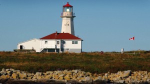
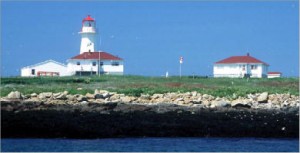
The Canadian flag flutters in the breeze by the lighthouse at Machias Seal Island. (Photograph by: Fred J. Field-The Canadian Press)

A tiny island between New Brunswick and Maine is the subject of renewed calls from both sides of the border to settle a territorial dispute once and for all.

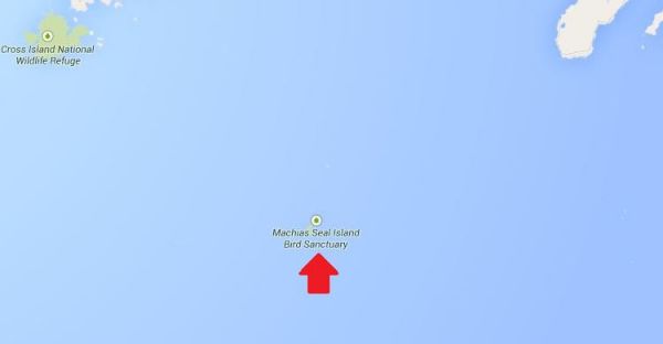
Machias Seal Island is a flat, treeless piece of rock located about 19 kilometres southwest of Grand Manan Island and east of Maine at the mouth of the Bay of Fundy.

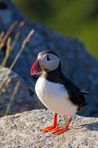
The island is a sanctuary for many kinds of seabirds including the Atlantic Puffin and draws visitors from around the world to observe them in the summer. more . . .

[private]

There are no permanent human residents on the island, just pairs of lightkeepers who spend 28 days at a time maintaining a lighthouse operated by the Canadian Coast Guard.

The original lighthouse was built by the British in 1832, and a lighthouse has been maintained there ever since.

So why would anyone even care which country gets title to Machias Seal Island?

‘Wouldn’t we feel silly?’
The answer lies in the 720 square kilometres of water around the island in what’s called a grey zone. Lobster fishermen from both Canada and the U.S. fish these waters.

“The fishing community on Grand Manan is permitted to fish there on an open-end basis and it’s our way of laying our claim to this water that is part of the Machias Seal Island dispute,” said MP John Williamson, who represents the riding of New Brunswick-Southwest.

Williamson said the island is considered to be in his riding.

‘I think our claim is sound and is legitimate.’ —MPJohn Williamson
“I think our claim is sound and is legitimate, but at the end of the day it’s going to come down to the minister in this country and the administration in Washington to settle it,” he said. “I think it is in the interests of both of our countries to do that.”

That feeling is echoed by Stephen Kelly, a professor at the Center for Canadian Studies at Duke University and a retired American diplomat who has served in Canada.

“It just strikes me if we have this opportunity to remove a potential irritant going forward, why don’t we take it?” Kelly said in an interview from his office in Durham, N.C.

Kelly put his thoughts in a commentary for The New York Times last month, which he said he was prompted to write after seeing territorial disputes that have erupted between Japan and China over uninhabited islands in the East China Sea.

He said while the situation between Canada and the United States is much different, land disputes are better settled.

Machias Seal Island

“What if some valuable resource is discovered in the grey zone around Machias Seal Island? What if some other contingency that we can’t imagine now of strategic importance comes along?” he asked.

“Wouldn’t we feel silly that we didn’t take the opportunity to resolve this when the stakes were relatively low.”

 
Irrelevant for lightkeeper

For Ralph Eldridge, a Canadian who has been a lightkeeper on the island for the last 16 years, the question of who owns Machias Seal Island is a “non-issue,” something that is never a question from the visitors who travel to the island each summer.

And Eldridge said he doesn’t have to produce his passport to go there.

“But neither does someone from the United States or China or Japan or Spain have to when they come to the island,” he said.

A spokeswoman for the Department of Foreign Affairs and International Trade said ownership of the island and surrounding waters is clear as far as Canada is concerned: they are Canadian.

“Canada’s sovereignty over Machias Seal Island and sovereign jurisdiction over the 210 square nautical mile surrounding waters is strongly founded in international law,” Barbara Harvey said in a statement.

 [/private]
***********************************

[private]

In the Media
Op-Ed: Canada and US dispute ownership of small rocky island
Digital Journal By Ken Hanly Dec 25, 2012 in World

Tourist comes to Machias Seal Island during the summer to see birds such as the Atlantic Puffin.

Machias Seal Island is a tiny rock island 16 kilometres from the coast of the US state of Maine and 19 kilometers south of Grand Manan Island just off the coast of the Canadian province of New Brunswick. The island is claimed by both Canada and the US.

Machias Seal Island has an area of just 8 hectares or about 20 acres. The island is a sanctuary for many seabirds including the Atlantic Puffin seen in the appended video. Visitors from around the world come to view the birds during the summer.
There are no permanent residents of the island although there are lighthouse keepers who come in pairs and stay four weeks at a time. The lighthouse is operated by the Canadian Coast Guard. The original lighthouse was built by the British in 1832. There has been a lighthouse maintained ever since. Many think that the presence of the lighthouse will give Canada a legitimate claim to the island. The United States has never had a presence on the island except in 1918 during the First World War when a small detachment of marines was posted to the island with Canadian agreement.

However in the past private citizens in Maine have claimed ownership of the island. There is a tour boat operator from Cutler Maine, who brings tourists to the island in the summer to view the birds. While there has been no oil or mineral resources discovered in the area, there is a large 720 square kilometres around the island called a grey zone. Lobster fishermen from both Canada and the US fish this area.

MP for New Brunswick Southwest , John Williamson said:
“The fishing community on Grand Manan is permitted to fish there on an open-end basis and it’s our way of laying our claim to this water that is part of the Machias Seal Island dispute.I think our claim is sound and is legitimate, but at the end of the day it’s going to come down to the minister in this country and the administration in Washington to settle it. I think it is in the interests of both of our countries to do that.”

Unfortunately an earlier decision of a joint commission in 1817 did not decide the ownership of Machias Sea Island even though it did decide that of other islands in the area including Moose, Dudley, and Fredericks Islands that are now owned by the US and also Grand Manan island that now belongs to Canada.

Stephen Kelly of Duke University and a retired US diplomat thinks that it would be a good idea to resolve the issue.

“It just strikes me if we have this opportunity to remove a potential irritant going forward, why don’t we take it. What if some valuable resource is discovered in the grey zone around Machias Seal Island? What if some other contingency that we can’t imagine now of strategic importance comes along?Wouldn’t we feel silly that we didn’t take the opportunity to resolve this when the stakes were relatively low.”

Ralph Edlridge, who has been a light-keeper on the island for 16 years, thought ownership was a non-issue. Neither he nor anyone else who comes to visit the island has to worry about showing a passport whether they come from Maine, Canada, China, or Spain he said. Barbara Harvey a spokesperson for Foreign Affairs and International Trade said that as far as Canada is concerned the island is Canadian: “Canada’s sovereignty over Machias Seal Island and sovereign jurisdiction over the 210 square nautical mile surrounding waters is strongly founded in international law.” Some residents of Maine may not agree.

This opinion article was written by an independent writer. The opinions and views expressed herein are those of the author and are not necessarily intended to reflect those of DigitalJournal.com

[/private]

***************************

[private]

December 28, 2012

Private Island News (P.I.N.) ISLAND ISSUES
Canada: The Little-Known Island Dispute Over Machias Seal Island

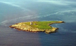
Image of Machias Seal Island from www.unb.ca

Along the border of the Canadian province of New Brunswick and the American state of Maine sits a small rocky island caught between the two countries.

An almost endless number of headlines have been made in recent months over the (at times heated) conflict between Japan and China over the ownership of a small group of islands in the East China Sea.

Due to the nature of islands, often found along inexact maritime boundaries, ownership disputes are not uncommon – but few of them tend to make headlines. A recent article has shone a spotlight on one of these lesser-known tales, involving a lighthouse isle along the Canada/USA border.

Found at the mouth of the Bay of Fundy, Machias Seal Island is an unassuming rocky outcropping of less than 20 acres, with only a lighthouse tower and outbuildings raised above its flat, barren surface. This modest appearance may be why the island was overlooked during the latter part of the 18th century, when Britain and the newly-formed United States were defining their territorial boundaries. Surprisingly, the intervening centuries have done little to resolve the question of just who owns the island.

While the dispute over Machias Seal Island has remained a friendly one, it has heated up in recent decades. Unlike in the case of Japan and China’s battle over the Diaoyu/Senkaku archipelago, there are no rich offshore oil and gas reserves at stake, however, there is a vibrant lobster fishing industry in the indeterminate “grey zone” of the surrounding waters.

Image of island’s lighthouse from www.ccg.gc.ca

“It’s very congested,” said the head of local fisherman’s association. “It’s a very hard area to fish. The Americans think it’s theirs; the Canadians think it’s theirs, and nobody gets along all that well.”

Canada has, thus far, maintained the upper hand in the conflict – despite an elimination of full-time staff from lighthouses on the East Coast to cut costs, the building on Machias Seal Island bears the distinction of being the sole remaining non-automatic lighthouse in the region, a contiguous occupation that stretches back two centuries.

The Department of Foreign Affairs has been willing to foot the Coast Guard’s bill for the live-in staff, giving only the explanation that it is for “sovereignty purposes”.

Read more about this story: Link [/private]
[private]

Island fever – December 21, 2012

The Chinese are at it. The Japanese are at it. The Brits and the Argentines are at it – all squabbling over small islands. There is even speculation that the US and Canada will revive their long-running dispute over little Machias Seal Island.

When large states are feeling small, it seems, small islands loom large. This is true not just of tiny, uninhabited outcrops. Independent and semi-independent islands are in the limelight too.

One reason for this is clear. Entitled to many of the same rights as large states, but without the same responsibilities, these islands pose an outrageous challenge to the international order and need to be brought back under control.

It is not just their tax practices, although this is the issue that currently defines the EU’s agenda. By selling passports to anyone passing, islands help criminals change identities and travel the globe undetected. And by conferring diplomatic recognition upon renegade countries, islands endanger global security.

There is a second reason too: entitled to many of the same rights as larger states, but without the same responsibilities, small islands are an outrageous challenge to the international order, and are therefore extremely useful allies to big countries.

Thanks to the competition caused by their tax regimes, small islands can be helpful to large countries wishing to impose fiscal discipline upon their partners or just hoping to excuse their own tax practices. And by handing out passports to all-comers, islands can ‘liberate’ the business elites and political opposition of repressive regimes – saving big states the need to intervene.

Small islands are even credited with a diplomatic daring which larger countries cannot afford to practice. Fearful of encouraging secessionist tendencies at home or of antagonising their international partners, large states are often too nervous to recognise breakaway countries. Small islands go where large states fear to tread.

This ambiguous status in an international system made for big players gives islands a significance quite disproportionate to their size. Take for instance Nauru (population: 9,000; size: 21 square kilometres; distinguishing features: looks from above suspiciously like a treasure island).

For years, China and Taiwan were locked in competition for Nauru’s diplomatic loyalty, with Nauru reportedly allowing itself to be bought first by one side then the other. Indeed, in 2002, when the Taiwanese president rocked the world by supporting a referendum on independence, his move was viewed as a reaction to Nauru’s sudden switch of loyalties to the People’s Republic.

The case of Nauru also shows how quickly islands can go from international pariahs to valued partners, depending on large states’ whims. In 2003, the US appears to have decided that the Nauruans’ passport-for-sale scheme was not a danger to international security after all. Just the opposite in fact: it offered a means to smuggle nuclear scientists out of North Korea. If reports are true, Nauru, the one-time bandit, suddenly found itself made deputy sheriff.

This special attitude towards islands – an attitude which does not seem to pertain to other small states – reflects the strong hold they exercise over the popular imagination. Blame that Christmas favourite, Treasure Island. For people living a routine mainland life, islands signify pirates or palm trees: they are either dangerous or alluring.

At one extreme are the harmless bores who view islands as a serious threat to international security and stability, can recite by heart the guidelines on good governance produced with a cheerful lack of irony by the EU, OECD or G20, and show an unhealthy interest in all forms of small-island deviance.

At the other are the escapists who see islands as an alluring alternative to mainland life and who secretly dream of seizing a rocky outcrop and establishing a libertarian utopia of their own.

Islands are thus either ‘unviable’ – incapable of sustaining themselves without cheating on big states, and ripe for depopulation – or an escape – ripe for repopulation by mainlanders. Acknowledging instead that islands are in fact entities in their own right, capable of responsible self-regulation – within the same context of global interdependence that affects all countries – might help avoid unfortunate situations like Nauru’s.

After all, if the reports about 2003’s ‘Operation Weasel’ are accurate, Nauru’s citizens had just succeeded in stopping their government from selling passports on grounds of good governance, only to see the US reintroduce the practice for them.

[/private]
[private]
Machias Seal Island–An Ongoing Border Dispute Between the United States and Canada


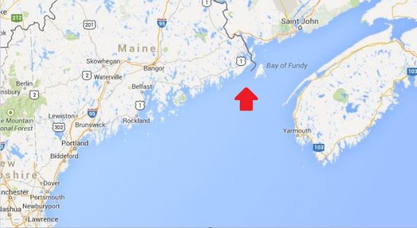
(Maps: Google Maps)

This is Machias Seal Island, a 20-acre island in the Bay of Fundy.

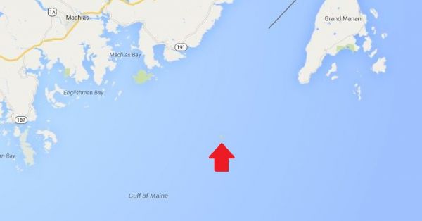
You can’t see it? Let’s zoom in.


Hmm. That doesn’t help much. Let’s zoom in some more.


There it is! It’s a speck of land that barely appears on the map.


(Photo: Albnd)

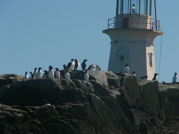
You can see the lighthouse in the photo above. The island is inhabited by 2 human lighthouse keepers, a few seals…


(Photo: Thomas O’Neil)

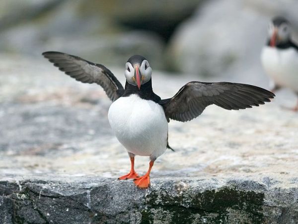
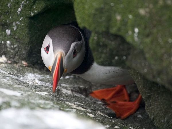
…and lots and lots of puffins.

The ownership of Machias Seal Island is disputed by the United States and Canada. Canada is in physical possession of it, but the United States has not formally dropped its claim to the island.

I’ve previously written several posts about the development of the US-Canadian border, whichincludes weird exclaves. Ambiguity about the border even led to the creation of 2 short-lived nations.


(Painting by Benjamin West of the American delegation at the Treaty of Paris)

Although the United States and Canada now maintain a long, peaceful border, the placement of that border has been in doubt since the Treaty of Paris (1783) in which Britain recognized the United States as an independent nation. That treaty attempted to draw borders over unexplored lands. The authors did the best that they could with their knowledge of geography. But, alas, one of the descriptions for the border between Maine and maritime Canada was problematic. The treaty says that US territory includes:

all Islands within twenty Leagues of any Part of the Shores of the United States, and lying between Lines to be drawn due East from the Points where the aforesaid Boundaries between Nova Scotia on the one Part and East Florida on the other shall, respectively, touch the Bay of Fundy and the Atlantic Ocean, excepting such Islands as now are or heretofore have been within the limits of the said Province of Nova Scotia.

I’ve bolded the parts of the text that are the source for the Machias Seal Island dispute.

As I’ve mentioned in a previous post, the eastern border of Maine was of great concern to the British. Some British officials coveted what Americans saw as their territory, and vice versa. Control of the Bay of Fundy was of great importance to British commissioners at the Treaty of Ghent (1814), which ended the War of 1812.


(Photo: Thomas O’Neil)

Now back to Machias Seal Island. The American argument is that it lies within 20 leagues (approximately 69 miles) of the coast of the United States.

The Canadian argument is that a land grant that pre-exists the Treaty of Paris defines the island as part of Nova Scotia. It built and has operated a lighthouse on the island since 1832.

Occasionally fishermen from the 2 nations have gotten into scraps about its ownership. Some Canadian citizens have staked mining claims to the island as a means of asserting Canadian sovereignty. The State of Maine has included the island on its maps of electoral districts.

But if possession is indeed 9/10ths of the law, then Machias Seal Island is Canadian. The United States has chosen not to press the issue.

Sources:
Clark, Edie. “Barna Norton Invades Canada.” Yankee 62.6 (1998): 48. Biography Reference Bank (H.W. Wilson). Web. 22 Apr. 2014.

Guo, Rongxing. Territorial Disputes and Resource Management: A Sourcebook. New York: Nova Science Publishers, 2007. Web. Google Books. 22 Apr. 2014.

Kelly, Stephen R. “Good Neighbors, Bad Border.” New York Times, Late Edition (East Coast) ed. Nov 27 2012. ProQuest. Web. 22 Apr. 2014 .

[/private]


Reprint – Poro Point Lighthouse, a Light for Prosperity


Philippine Information Agency (PIA)

Poro Point Lighthouse, a light for prosperity

By Jennilyne C. Role Monday 23rd of April 2012 

Poro Point, La Union, Philippines
The Poro Point Lighthouse in La Union was built in 1885 during the Spanish colonial era to serve as beacon for ships and boats plying the sea at night. Bounded on the west by the west Philippine sea and on the east by the San Fernando bay, its apex is the highest elevation of the peninsula, and allows an unobstructed view of the panoramic landscape. 

At the lighthouse, one can experience the beautiful sunrises and sunsets La Union is known for, while overlooking the undulating greens of the beautiful ‘The Cliffs Golf Course’ of Thunderbird Resorts and a coastline of pristine white sand. Atop the Poro Point Lighthouse, a tourist gets a glimpse of the best that Poto Point can offer. 

Thus, the Poro Point Lighthouse is the perfect symbolism of the Poro Point Freeport Zone (PPFZ). 

Featuring the Poro Point Lighthouse, a festival was conceptualized, in comparison with the ‘Panagbenga’ or the Flower Festival of Baguio City and the ‘Hot Air Balloon Festival’ of Clark. Dubbed as “SILLAG – The Poro Point Festival of Lights”, the festival, which will be launched on April 28, aims to boost the economic activities of the province and the whole region as a whole. 

‘Sillag’ is an Iloco word which means moonbeam or illumination from the moon, and is similarly compared to the region’s booming business climate. 

It is initiated by the Poro Point Management Corporation (PPMC), a member of the Bases Conversion and Development Authority Group which aims to promote the 6-hectare lighthouse property as a vital component of an Integrated Tourism Complex and attract domestic and tourists to create a mass market to encourage business and commerce in the PPFZ. 

The ‘Sillag’ festival components include the following: 

FLUVIAL PARADE – This is the highlight of the festival which will feature illuminated and decorated boats from participating government entities, business firms, and various stakeholders. 

HOPE LANTERNS – The lanterns will be sold to government agencies, business firms, schools, various groups and organizations as well as individuals which will be released after the fluvial parade. Proceeds of which will go the PPMCs HELPS, a Corporate Social Responsibility Program of the corporation. HELPS stands for Health, Education and Environment, Livelihood Program including employment opportunities within the zone, and Strengthening Linkages. 

MOA signing at the LIGHTHOUSE – The MOA covers the ‘Adopt-A-Lighthouse Project’ between PPMC and the Philippine Coast Guard (PCG). According to PPMC President and CEO Florante Gerdan, all lighthouses under the law is owned by the PCG. However, with the festival initiative, the PPMC requested PCG to handle and maintain the Poro Point Lighthouse. 

UNVEILING OF THE CANVASS – The canvass will show the planned transformation of the lighthouse area. It will highlight the Spanish lighthouse, the renovated modern lighthouse, and refurbished shotgun house which could possibly be a museum and a souvenir shop at the same time. 

It is also proposed in the UP Planades Development Framework Plan for the area that a multi-level observatory/viewing decks ending in circular platforms will be built that would serve as access points to water sports activities. 

The six-hectare area will be built with restaurants, specialty shops, and green and open spaces, Gerdan said. 

Other scheduled activities for the festival are concert featuring two bands; pyromusical show; children’s show featuring clown, magicians, jugglers and others to create a more festive atmosphere. 

To draw more tourists, the scheduled one-day initial festival offers free rides to the area which is expected to be more complex and more exciting the coming years. (JCR-PIA 1, La Union) 

An Island Dispute of our Own

An island dispute of our own
Posted By Joshua Keating  Wednesday, November 28, 2012 – 11:36 AM

It’s not quite the Senkakus, but Stephen Kelly highlights a long-festering territorial dispute between the United States and Canada:

Machias Seal Island is a 20-acre, treeless lump that sits nearly equidistant from Maine and New Brunswick. It, and the even smaller North Rock, lie in what local lobstermen call the gray zone, a 277-square-mile area of overlapping American and Canadian maritime claims.

The disagreement dates back to the 1783 Treaty of Paris that ended the Revolutionary War. The treaty assigned to the newly independent 13 colonies all islands within 20 leagues — about 70 miles — of the American shore. Since Machias Seal Island sits less than 10 miles from Maine, the American position has been that it is clearly United States soil.

But the treaty also excluded any island that had ever been part of Nova Scotia, and Canadians have pointed to a 17th-century British land grant they say proves the island was indeed part of that province, whose western portion became New Brunswick in the late 18th century.

Perhaps more important to the Canadian case, the British built a lighthouse on Machias Seal Island in 1832, which has been staffed ever since. Even today, two lighthouse keepers are regularly flown to the island by helicopter for 28-day shifts to operate a light — even though, like every other lighthouse in Canada, it is automated. – Opinion Pages – NY Times

[private]
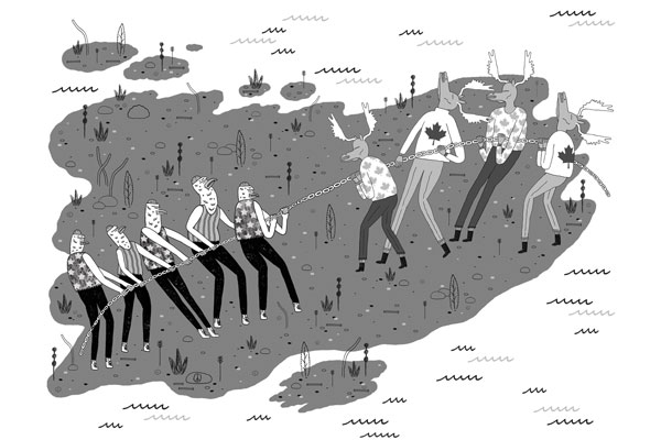
The New York Times Opinion pages Good Neighbors, Bad Border Cartoon: John Malta

By STEPHEN R. KELLY   Published: November 26, 2012

AT a time when territorial disputes over uninhabited outcrops in the East China Sea have led to smashed cars and skulls in China, a similar, if less dramatic, dispute over two remote rocks in the Gulf of Maine smolders between the United States and Canada.

Machias Seal Island and nearby North Rock are the only pieces of land that the two countries both claim after more than 230 years of vigorous and sometimes violent border-making between them.

Except for the occasional jousting of lobster boats, this boundary dispute floats far below the surface of public or official attention, no doubt reflecting the apparent lack of valuable natural resources and a reluctance to cede territory, no matter how small.

But if we are unlikely to resort to arms anytime soon, the clashes in Asia have shown how seemingly minor border disputes can suddenly stoke regional and nationalistic tensions. Our relaxed attitude toward these remote rocks may well be a mistake.

While the United States and Canada have other maritime boundary disputes along their 5,525-mile border, the world’s longest, this is the only one left that involves actual chunks of land.

Machias Seal Island is a 20-acre, treeless lump that sits nearly equidistant from Maine and New Brunswick. It, and the even smaller North Rock, lie in what local lobstermen call the gray zone, a 277-square-mile area of overlapping American and Canadian maritime claims.

The disagreement dates back to the 1783 Treaty of Paris that ended the Revolutionary War. The treaty assigned to the newly independent 13 colonies all islands within 20 leagues — about 70 miles — of the American shore. Since Machias Seal Island sits less than 10 miles from Maine, the American position has been that it is clearly United States soil.

But the treaty also excluded any island that had ever been part of Nova Scotia, and Canadians have pointed to a 17th-century British land grant they say proves the island was indeed part of that province, whose western portion became New Brunswick in the late 18th century.

Perhaps more important to the Canadian case, the British built a lighthouse on Machias Seal Island in 1832, which has been staffed ever since. Even today, two lighthouse keepers are regularly flown to the island by helicopter for 28-day shifts to operate a light — even though, like every other lighthouse in Canada, it is automated.

While abundant legal arguments surround Machias Seal Island, natural resources are far less evident. No oil or natural gas has been discovered in the area, nor has it had any strategic significance since it served as a lookout for German U-boats during World War I.

Tour boats from Maine and New Brunswick carry strictly limited numbers of bird watchers to the island to see nesting Atlantic puffins. And the surrounding waters contain lobsters that, thanks to different regulatory schemes and overlapping claims, have occasionally sparked clashes between Maine and New Brunswick lobstermen, although a bumper lobster crop this summer has slackened demand for gray zone crustaceans.

But the lack of hydrocarbons and the current lobster glut make this an ideal time to color in the gray zone.

The United States and Canada settled all their other maritime differences in the Gulf of Maine in 1984 by submitting their claims to the International Court of Justice for arbitration. They could have included the gray zone in that case, but did not. The Canadians had refused an earlier American arbitration proposal by saying their case was so strong that agreeing to arbitration would bring their title into question.

This attitude calls for re-examination. The fact that so little in the way of resources appears to be at stake, far from justifying the status quo, should be the main reason for resolving the issue. And for those concerned about blowback from “giving away” territory, letting the international court decide the case provides the most political cover.

As China and Japan can attest, border disputes do not go away; they fester. And when other factors push them back to the surface — the discovery of valuable resources, an assertion of national pride, a mishap at sea — the stakes can suddenly rise to a point where easy solutions become impossible.

Before that happens, we should put this last land dispute behind us, and earn our reputation for running the longest peaceful border in the world.

Stephen R. Kelly is the associate director of the Center for Canadian Studies at Duke University and a retired American diplomat who served twice in Canada.

A version of this op-ed appeared in print on November 27, 2012, on page A31 of the New York edition with the headline: Good Neighbors, Bad Border.

[/private]
[private] An island dispute of our ownPosted By Joshua Keating  Wednesday, November 28, 2012 – 11:36 AM  
It’s not quite the Senkakus, but Stephen Kelly highlights a long-festering territorial dispute between the United States and Canada:

Machias Seal Island is a 20-acre, treeless lump that sits nearly equidistant from Maine and New Brunswick. It, and the even smaller North Rock, lie in what local lobstermen call the gray zone, a 277-square-mile area of overlapping American and Canadian maritime claims.

The disagreement dates back to the 1783 Treaty of Paris that ended the Revolutionary War. The treaty assigned to the newly independent 13 colonies all islands within 20 leagues — about 70 miles — of the American shore. Since Machias Seal Island sits less than 10 miles from Maine, the American position has been that it is clearly United States soil.

But the treaty also excluded any island that had ever been part of Nova Scotia, and Canadians have pointed to a 17th-century British land grant they say proves the island was indeed part of that province, whose western portion became New Brunswick in the late 18th century.

Perhaps more important to the Canadian case, the British built a lighthouse on Machias Seal Island in 1832, which has been staffed ever since. Even today, two lighthouse keepers are regularly flown to the island by helicopter for 28-day shifts to operate a light — even though, like every other lighthouse in Canada, it is automated.

Kelly reasonably suspects that the lack of natural resources in the region have made both sides reluctant to rock the boat by submitting their claims to the International Court of Justice for arbitration, as they have with other disputes. There’s simply nothing there worth the risk of losing the case and having to explain to voters why you “gave away” U.S. or Canadian territory. In any case, from the photos on Flickr it looks like the Canadian government has staked a pretty permanent claim to the island, so this one may be de facto settled.

Machias is the only U.S.-Canadian border conflict that involves land, but the sea border is disputed in a few places. Here’s Wikipedia’s list:

  • Strait of Juan de Fuca 48°17?58?N 124°02?58?W (Washington /British Columbia) The middle-water line is the boundary, but the governments of both Canada and British Columbia disagree and support two differing boundary definitions that would extend the line into the Pacific Ocean to provide a more definite Exclusive Economic Zone (EEZ) boundary.
  • Dixon Entrance 54°22?N 132°20?W (Alaska / British Columbia) is wholly administered by Canada as part of its territorial waters, but the US supports a middle-water line boundary, thereby providing the US more maritime waters. Canada claims that a 1903 treaty demarcation is the international maritime boundary, while the United States holds that the maritime boundary is an equidistant line between the islands that form the Dixon Entrance, extending as far east as the middle-water line with Hecate Strait to the south and Clarence Strait to the north.[2]
  • Yukon–Alaska disputeBeaufort Sea 72°01?40?N 137°02?30?W(Alaska / Yukon) Canada supports an extension into the sea of the land boundary between Yukon and Alaska. The US does not, but instead supports an extended sea boundary into the Canadian portion of the Beaufort Sea. Such a demarcation means that a minor portion of Northwest Territories EEZ in the polar region is claimed by Alaska, because the EEZ boundary between Northwest Territories and Yukon follows a straight north-south line into the sea. US claims would create a triangular shaped EEZ for Yukon. This is mainly an Alaska-Yukon dispute.
  • Northwest Passage; Canada claims the passage as part of its “internal waters” belonging to Canada, while the United States regards it as an “international strait” (a strait accommodating open international traffic).

The last two might get a bit more controversial as resource competition in the rapidly melting Arctic heats up.

[/private]

Reprint – Restoring Canaveral Light – Brick by Brick!


Restoring Canaveral Light – Brick by Brick!


The mission statement of the Cape Canaveral Lighthouse Foundation is  “To Assist the 45th Space Wing in preserving, protecting, and interpreting the Cape Canaveral Lighthouse and its historical significance to the Florida Space Coast, State of Florida, and our Nation.” The US Air Force owns and maintains Cape Canaveral Light, but the Foundation exists to be of assistance in its restoration and to share its remarkable history.

In many ways Cape Canaveral and the Lighthouse is a bridge between the age of exploration and exploration yet to come; a bridge between the sea and the stars!

On October 13th, 2012 I attended a gathering at the Canaveral Lighthouse with my father to celebrate the progress having been made on the restoration of this special and significant beacon. Although, we had visited the light by special permission a couple of years ago in order to photograph, I did not then have the opportunity to see the interior of the tower. Saturday, October 13th, could not have been a more perfect day to gather, discuss goals, walk the newly built Keeper’s Brick Paver Walkway, and climb!! I have to say right here that I was amazed that my 88 year old father was able to navigate the stairs better than I did!  The metal lighthouse is lined with brick and the winding stairs curl upwards around a center pole with no hand railing along the brick walls. Of course, it was probably because I was lugging my heavy camera!! Probably!! Continue reading Reprint – Restoring Canaveral Light – Brick by Brick!

Reprint – Cape Canaveral Light – Warden of the Sea, Launchpad to the Stars!


The following story is the first of two parts on the Cape Canaveral lighthouse by Judy Lovell, a photographer extraordinaire, who runs a WordPress blog called Janthina Images.

Besides this article, and the one following, please view her image gallery on her website as well. In the gallery she has some lovely photos of Florida lighthouses with prints available for sale. Enjoy, and drop by her website occasionally for different articles. If you wish to view the image gallery as a slideshow, please click here.

***********************************

Cape Canaveral Light – Warden of the Sea, Launchpad to the Stars!

They fill that night with Knowledge. A thousand ships go by,
A thousand captains bless them, so bright and proud and high:
The world’s dark capes they glamour; or low on sand banks dread,
They, crouching, mark a pathway between the Quick and Dead —
Like star points in the ether
They bring the seamen ease,
These Lords of Wind and Weather
These Wardens of the Seas!

…Edwin James Brady…

Lighthouses have long stood at the edges of the world, lonely outposts maintained by devoted souls to ensure the safety of ships at sea. But, only one remarkable beacon was destined to illuminate the path for ships of space! But how did this happen? How did a lighthouse built on a hook of sand jutting out into the Atlantic to protect mariners from dangerous currents become a front row witness to the advent of the Space Age?

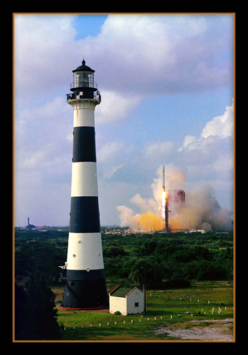
Rocket Launch with Canaveral Lighthouse is courtesy NASA Continue reading Reprint – Cape Canaveral Light – Warden of the Sea, Launchpad to the Stars!

Mise Tales Fifteen


For an update on what a Mise Tale is then please see Mise Tales One.

Some of these stories and articles are a bit late for Halloween, but better late than never, especially when lighthouses are a year-round topic!

The Fog – Best Scary Movie Starring Point Reyes Lighthouse

You may have heard of this John Carpenter film – myself, I have never seen it. I was going to write about it, but May, the author at Completely Coastal has done such a good job, I thought I would turn you over to her. Enjoy . . . [link]

A Northern California fishing town, built 100 years ago over an old leper colony, is the target for revenge by a killer fog containing zombie-like ghosts seeking revenge for their deaths. – Internet Movie Database (IMDb)

************************************

Lighthouse Switchback India Pale Ale (IPA)

The Province October 20, 2012

This is the first in a series of reviews on the new wave of British Columbia India Pale Ales (IPAs). This province already produces some Continue reading Mise Tales Fifteen

Chris Mills – Canadian Lighthouse Photographs


Canadian Lighthouse Photographs

New website is coming.
http://www3.ns.sympatico.ca/ketm/
is no longer online


Chris Mills
1121 Ketch Harbour Rd.
Ketch Harbour, Nova Scotia  B3V 1K7


British Columbia | Nova Scotia | Prince Edward Island | New Brunswick | Newfoundland

Chris Mills served as a lighthouse keeper for the Canadian Coast Guard on both the Atlantic and Pacific coasts.

He is currently co-chair of a committee which is recruiting Members of Parliament in support of a private members bill to protect lighthouses.  To see how you can help, visit this site:  Canada Needs a Lighthouse Protection Act.

Photographs and enlargements are for sale. Contact Chris Mills for price information.
All photographs and slides in the collection are identified, dated and signed.

Chris Mills is also author of the book on Nova Scotia lighthouses Lighthouse Legacies available from Amazon.ca


Sambro Island restoration project


BRITISH COLUMBIA

Some of these photos may be viewed at the Lighthouses of British Columbia site.

Green Island (1994, 1995) 250 colour photos, 70 colour slides in collection. All aspects of the station and island documented — aerial views, sea views, night views, details of light and lighthouse, lightkeepers, Coast Guard helicopters, surrounding islands and seascapes.


Langara Island (1994, 1996) 250 colour and 25 black and white photos, 180 colour slides in collection. All aspects of station documented — aerial views, night views, detailed views of 1913 First Order Fresnel Lens (manufactured by Chance Brothers), light tower and lantern, lightkeepers, dwellings, interior of engine room, old cabin on island, face carved in tree, shoreline views, lightkeeper’s goats, stormy seas.


Triple Island (1994) 24 colour photos in collection. Aerial views, third order Fresnel lens, lightkeeper, detailed views of lighthouse structure, interior of workshop and engine room.


Bonilla Island (1994) 250 colour photos in collection. Many aspects of station — aerial views, sea views, night views, shoreline views (including Japanese glass fishing floats), lightkeepers, dwellings, engine room interior, light tower. (NOTE: this collection will be expanded during Sept/Oct 1996)


Boat Bluff (1994-1996) 160 colour photos in collection. All aspects of station — aerial views, sea views, night views, details of light tower, fog horns , engine room, main light (including views of keeper inspecting light at night, inspection of light and bulbs during day), views of station and mountains from 1000 foot hill across the channel from lightstation, snow views, old hand fog horn, three modern plastic lenses, sunrise views, surrounding bays and inlets, Santa and Mrs. Claus visit 1994. (NOTE: Available as of Dec. 1996 — selection of a further 200 colour and b&w prints taken during August 1996, including Coast Guard ship and work crews supplying station.)


Ivory Island (1994-1996) 600+ colour and 36 black and white photos, 100 colour slides in collection. All aspects of the lightstation — 30 aerial views, sea views, night views, lighthouse, keepers, dwellings inside and out, engine room, main light, surrounding area, beaches, salmon fishing, snow, totem poles, artist and photographer at work at the lightstation, Coast Guard helicopters, sunsets, shoreline and forest, various tidal life (sea stars, crabs, etc.), local minor beacon lights, 25th annual Santa and Mrs. Claus visit December 1995.


McInnes Island (1994, 1995) 48 colour photos, 22 colour slides in collection. Aerial views, lighthouse structure, radio room, keeper, detail of lantern and main light, large thunder cloud formations.


Dryad Point (1995) 32 colour photos in collection. Aerial views, light tower, main light, keeper and daughter, keeper and main light, dwelling. (NOTE: This collection will be expanded during 1997)


Addenbroke Island (1994) 14 colour photos in collection. Aerial views.


Egg Island (1994) 10 colour photos in collection. Aerial views.


Pine Island (1994) 3 colour photos in collection. Aerial views.


Scarlett Point (1994) 2 colour photos. Aerial views.


Point Atkinson (1994) 14 black and white photos in collection. Light tower, keeper and main light, station dwellings and exterior of radio/engine room.


Brockton Point (1994) 5 black and white photos in collection. Light tower.


Porlier Pass (1994) 32 colour photos in collection. Two light towers (Porlier is a range light station), main lights, boat and boathouse, lightkeeper, dwelling, interior engine room and fog horn building, Coast Guard hovercraft. (NOTE: The old front range light was demolished Feb. 1996 and replaced by a fibreglass tower and the lighthouse was automated shortly after.)


Fisgard (1994) 6 colour, 2 black and white photos in collection. Light tower and detail of gothic style window in old keepers dwelling.


Sheringham Point (1994, 1995) 20 colour photos in collection. Light tower, abandoned dwelling, sunset, old Fresnel lens at local museum.


Amphitrite Point (1995) 9 colour slides in collection (prints available). Lighthouse structure, old keepers dwelling.


Lennard Island (1995) 52 colour photos, 25 colour slides in collection. Traveling to island by boat, keeper in boat, keeper in lighthouse, keeper and wife on station grounds, dwellings, radio room, engine room, details of two fog horn systems, including traditional diaphone horn taken out of service Oct. 1995, light tower, station grounds.


Cape Scott (1996) 23 colour photos in collection. Aerial views.

NOVA SCOTIA

Some of these photos may be viewed at the Nova Scotia Lighthouse Preservation Society site.

Baccaro Point
Bear River
Beaver Island
Black Rock Point
 (new lighthouse)

Black Rock Point (old lighthouse)
Boar’s Head
Brier Island
Cape Forchu
Cape George
Cape Sable
Chebucto Head
Fort Point
 (LaHave River)

Fort Point (Liverpool)
Fourchu Head
Gabarus
George’s Island
Grand Passage
Hampton
 (Chute Cove)

Horton Bluff
Jerome Pont
Louisbourg
Low Point
Maugher’s Beach
Medway Head
Peggy’s Cove
Point Aconi
Port Greville
 (old light, now at Canadian Coast Guard College, Point Edward, N.S.)

Port Medway
Prim Point
Rouse Point
Sable Island
 (east light)

Sable Island (west light)
Sambro Island
Scatarie Island
Schafner Point
Seal Island
Sydney Range
 (front light)

Sydney Range (rear light)
Western Head
Battery Point
Betty’s Island
Canso Locks
Cross Island
 (comprehensive collection including automation day)

Eddy Point
Mosher’s Island
Seal Island
 (comprehensive collection)

Seal Island Lighthouse Museum

PRINCE EDWARD ISLAND

Blockhouse Point
Borden Range
 (front light)

Borden Range (rear light)
Cape Bear
Cape Tryon
Brighton Beach Range
 (front light)

Brighton Beach Range (rear light)
East Point
Murray Harbour Range
 (front light)

New London Range (rear light)
North Rustico
Panmure Island
Point Prim
Souris East
Summerside Range
 (front light)

Summerside Range (rear light)
Woods Islands
Woods Islands Range
 (front light)

Woods Islands Range (rear light)

NEW BRUNSWICK

Cape Spencer
Cape Tormentine
Fish Fluke Point
 (Grand Harbour)

Gannet Rock (comprehensive collection: 700+ prints and slides)
Great Duck Island
East Quoddy
 (Head Harbour)

Letite
Long Eddy
Long Point
Machias Seal Island
 (comprehensive collection)

Mulholland Point
Southwest Head
Swallowtail

NEWFOUNDLAND

Cape Anguille
Cape Ray
Cape Saint Francis
 (dwelling only)

Cape Saint Mary’s
Cape Spear
Lobster Cove Head
Rose Blanche
 (old stone lighthouse)

Reprint – Photo Gallery: Sutton Bridge Lighthouse Renovation Restores View Which Inspired Sir Peter Scott

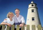
Work continues on the Peter Scott Lighthouse near Sutton Bridge - owners Sue and Doug Hilton. Picture: Matthew Usher.

Photo gallery: Sutton Bridge lighthouse renovation restores view which inspired Sir Peter Scott

By DAISY WALLAGE Monday, July 30, 2012
– with permission from EDP24 online

With an endless sky, tantalising glimpses of the The Wash and wildfowl flying overhead, this stunning, sometimes lonely view was lost for decades as time took its toll on east bank lighthouse at Sutton Bridge.

Now, after months of loving restoration, visitors can finally climb to the top and bask in the uninterrupted views that so inspired the artist and conservation pioneer Sir Peter Scott more than 70 years ago.

The view from the top. Picture: Matthew Usher.

Owners Sue and Doug Hilton bought the lighthouse, on the mouth of the River Nene, in November 2010 and are steadily achieving their goal of opening a museum and visitor centre at the site as well as restoring the landmark tower itself.

New, locally crafted steel handrails on the lighthouse stairs will allow visitors to explore beyond Sir Peter’s living room to his second floor bedroom and the lamp room during a series of open weekends next month. Continue reading Reprint – Photo Gallery: Sutton Bridge Lighthouse Renovation Restores View Which Inspired Sir Peter Scott