Tag Archives: beachcombing

Reprint – The Great Pacific Garbage Reality

May 27, 2012 – copied from the LA Times

The great Pacific garbage reality. It’s not tsunami debris we should fear; it’s the trash clogging our oceans – Usha Lee McFarling

I received permission today to reprint this article written by Usha Lee McFarling supporting the theory expressed in my story  Japanese Debris On The BC Coast – Is it from the Tsunami?

In thirty-two (32) years living on and beachcombing the British Columbia (BC) coast in many different areas, I still believe that the press is making a big, and false, hoopla over this.

Sure, every year debris comes on the western North American (NA) coasts in the wintertime – a lot of it from Asia (not only Japan!). This year seems to be an exceptionally good year for garbage with tides and currents working well together to bring it to the NA shores, and the debris is also supplemented by the Japanese tsunami of March 2011. Don’t panic! It has been happening every year, with or without the tsunami!

***************************

The Story from Ms. McFarling:

Harley-Davidson ( Peter Mark / Kyodo News, Associated Press / May 2, 2012 ) A rusting Harley-Davidson from Miyagi prefecture, Japan, was discovered on a remote beach in British Columbia in late April and photographed May 2.

For months, West Coast residents have been bracing for an onslaught of items drifting toward us since last spring’s tsunami in northeastern Japan, which swept apartment buildings, cars, even entire villages, into the sea.

Now we are seeing the first trickle of that debris. A ghost ship arrived in the Gulf of Alaska this spring. A rusting Harley Davidson from Miyagi prefecture was discovered on a remote beach in British Columbia. A soccer ball found on an Alaskan island and marked with a personal message was returned to its delighted teenage owner in the tsunami-devastated town of Rikuzentakata.

Like dreams — or nightmares — these wayward bits of other people’s lives bring us closer to the distant disaster. They make the world smaller. A number of groups have started projects to reunite recovered possessions with their former owners. And one beachside town in Oregon is hoping tsunami “treasure hunting” will result in increased tourism.

But now that the first unlikely items have reached us, we’re also beginning to worry: Will the debris be radioactive? Will human remains turn up? Will mountains of scrap cover our beaches? One blogger callously suggested the Japanese government should pay for the cleanup.

Such reactions reveal a torrent of misconception. Continue reading Reprint – The Great Pacific Garbage Reality

Adventure on the Lighthouse

Down by the seashore - photo Glenn Borgens

One of the things I miss most about the lighthouse is going down to the shore in early morning light, especially if it was a low tide, and seeing what there was to see and find. I never knew what would wash up, or go floating, flying or swimming by.

Sometimes I saw unusual birds, a whale, an otter, a different coloured starfish, or sometimes I just enjoyed the smell of the sea in the fresh air. As a lighthouse keeper we were not only on watch for problems with boats, but we were also caretakers of the sea around us.

If we happened to spot something unusual such as an oil spill, or unusual flotsam, then we  reported that to the nearest Coast Guard station. We also reported on dead birds, or other deceased wildlife such as whales. Continue reading Adventure on the Lighthouse

Groceries at Green Island c.1975

Cloo-Stung - photo Barry Duggan

The Cloo-Stung was a catamaran of the Canadian Coast Guard (CCG) used for delivery of personnel and supplies to Prince Rupert area lighthouses in protected waters. The groceries were delivered to the Coast Guard base in Prince Rupert from the local stores. These were then packed in slings (large canvas or net circles with ropes attached to allow them to be attached to a hook) and loaded onto the Cloo-Stung. Continue reading Groceries at Green Island c.1975

Not Beachcombing

No, the title does not mean I have gone a wee bit balmy. This article is about finding things but not on the beach. It is also not really about lighthouses, but does take place on, or near a lighthouse where my wife Karen and I were first stationed.

When I saw the photo below it brought back many memories of our first lighthouse at Pulteney Point, Malcolm Island.

 Pulteney Point lighthouse is located between Port McNeil and Port Hardy on Vancouver Island, British Columbia (see map below). It is still manned.

In 1901 Finnish settlers made Malcolm Island their home – see a short version of the story here.

Pulteney Point

When we arrived at the lighthouse in 1969 there were still traces of the settlements visible in the woods between the lighthouse and the town of Sointula. Old buildings, parts of wharves, chimneys, rusting appliances and farm implements. One needed a boat to explore most of them as there were no usable trails through the woods – at least none that were usable now.

But out behind the lighthouse there was a trail leading into the woods along the beach on the northwest side leading to a small creek that flowed into the ocean where the lightkeepers used to pump water to the station for drinking water. Part way along the trail were a couple of old buildings we were told housed the early settlers.

Having explored many ruins and old townsites on Vancouver Island before moving onto the lights we thought we were pretty expert at finding old souvenirs, bottles, etc.

Armed with shovel, trowel and a few sacks we headed out one day to explore the ruins. We knew we were probably not the first ones to explore the site, but hoped that our expertise would prevail and we would find what they had not.

First, we had been told many years earlier, look for a garbage dump. By now that would have been overgrown, so we looked for any hump that was off to the side of the property and away from the main house.

our find, like the bottle on the left

We did find and excavate a couple of likely spots, but found nothing that resembled what we were looking for. We searched through both buildings – one a house, and the other outbuilding, probably a sauna – hey, it was a Finnish homestead, so why not?

After hours of searching we found one small Vaseline bottle which had turned purple in the sun. Heading home proudly with our find, we showed it off to the other family at the lighthouse.


View Larger Map (Pulteney Point lighthouse at the marker)

We completely forgot about the episode until about a year later when a boat with strangers arrived at the station. The two men and two women explained that they had been exploring the old Finnish homesteads for souvenirs and asked if it would be okay to look around out back as they had been told there was a homestead there as well.

Walter Tansky, the senior keeper, said there was no problem as all the property behind the lighthouse was Crown Land. I was wondering how long they would be there before they discovered that there was nothing significant there.

After a couple of hours they had not returned. I got curious and wandered back there to see what was taking so much of their time. Upon arriving at the site I saw that the floorboards had been torn up, and there was a pile of old bottles sitting off to one side.

How? Where? What . . .? I was speechless. Where did all these bottles come from?

So after getting over my shock, I asked some questions. It turns out they had found what they thought was the kitchen by probing. Probing involves the use of a spring steel probe about 1/4″ in diameter and about 4 feet long. It usually has a metal or wood T-handle. This is pushed into the earth to locate buried objects like metal and glass.

Under the floor in the kitchen they found most of the bottles. They assumed that a wood shelf had collapsed onto the rotten floor and carried its load of bottle with it. Some were broken, but most were in very good condition because they had not been moved since the early 1900s.

So this was not beachcombing, and I could not call it landcombing, but we sure did learn a lot about bottle scavenging.

Death on Price Island


McInnes marked – view Larger map

On one of our beachcombing trips Roger Mogg and I headed up this narrow deep inlet on the East side of Price Island, just a few kilometres from McInnes Island Lighthouse. (see interactive map above – red marker is McInnes Island; Price Island is NE a bit and labelled as such) Continue reading Death on Price Island

The Great Pacific Running Shoe Search

Hansa Carrier
Hansa Carrier

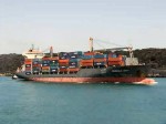
In late [27th] May of 1990, the container vessel Hansa Carrier encountered a severe storm in the north Pacific Ocean (approx. 48°N, 161°W) on its passage from Korea to the United States.

During the storm, a large wave washed twenty-one (21) forty foot (40 ft.) shipping containers overboard. See this video of damaged cargo ships and cargo being lost.

[media url=”http://www.youtube.com/watch?v=8HFARxn73dk” width=”400″ height=”300″]

Fully-loaded container ship

Five of these 20-metre containers held a shipment of approximately 80,000 Nike® shoes ranging from children’s shoes to large hiking boots. It has been estimated that four of the five containers opened into the stormy waters, releasing over 60,000 shoes into the north Pacific Ocean.


Running Shoe
This one looks a bit rough

That winter of 1990, hundreds of these shoes washed ashore on the beaches of the Queen Charlotte Islands , western Vancouver Island , Washington  and Oregon.

After hearing of the accident, oceanic scientist Curtis C. Ebbesmeyer seized the opportunity and established links with beachcombers and formed a network of people reporting the landfall of the contents of this spill.

Where the shoes were found

When Oregon newspapers began running the story, the Associated Press picked it up, and the word spread. The publicity resulted in many additional reports of the finding of Nike shoes on Pacific beaches. Dubious about some of the reported finds, Ebbesmeyer decided to confine his study to only those shoes found in groups of 100 or more. Even with this restriction, he accounted for approximately 1300 shoes from the more than 60,000 released. 

Despite a year in the ocean, much of the footwear was in fine shape and wearable after a washing. Unfortunately, the shoes were not tied to one another so that matching pairs did not always reach the beach together.

“I remember this very well as I could never find a matching pair!” – retlkpr

Each shoe, however, had an identifying serial number, and with information obtained from the manufacturer, Ebbesmeyer was able to determine that the shoes were indeed from the Hansa Carrier.

Drift bottle
Drift bottle

The accident turned into a scientific gold mine. With information on the locations where the shoes were found, Curtis Ebbesmeyer and Jim Ingraham were able to use the spill to test and calibrate their ocean current model. In the past when researchers have released a multitude of drift bottles1 to provide data for testing models, only about one or two percent of the drift bottles are typically recovered. Thus, the accidental release of approximately 61,000 shoes and the recovery of approximately 1600 shoes (2.6%) provided data as good as any pre-planned study. 

Ebbesmeyer and Ingraham used the OSCURS (Ocean Surface Currents Simulation) computer simulation model to determine where and how the shoes may have drifted after the containers were swept overboard.

The model suggested that the main landfall would have been around the northern tip of Vancouver Island and the central coast of British Columbia approximately 249 days after the spill.

The first reports of shoe landfalls came from Vancouver Island and Washington approximately 220 days after the spill. A large number of shoes were recovered in the Queen Charlotte Islands and northern Oregon suggesting that when the shoes neared the North American coast some were diverted north and others south by coastal currents. 

In the summer of 1992 (two years after the incident), shoes were reported arriving at the northern end of the Island of Hawaii. After reaching North America these shoes may have continued southward along the California coast and then been pushed off the coast by currents moving westward to Hawaii. 

The rest of the story is on the website of Keith C. Heidorn (aka the Weather Doctor).

**************************

This also happened with rubber ducks (aka friendly floatees)!

where-rubber-ducks-made-landfall-after-being-dumped-in-pacific-ocean

*********************************** 

FOOTNOTES:

1 See the story by Jeannie Nielsen about finding, and getting paid for the Drift bottles.

******************************************************

Check the Wikipedia article on the Hansa Carrier and other incidents of a similar nature. 

And if you are interested, this is where the other 57,000+ shoes probably ended up!

This is a never-ending story. as more and more stuff is dumped into the ocean every year. See the story on the Japanese Tsunami debris.

Take a look here for what you can beachcomb in the next few years – more Nike® shoes, Lego, etc.


Japanese Debris On The BC Coast – Is it from the Japanese Tsunami?


The next time you go to the beach and pick up a piece up something from the sand, think of the story of how it arrived there. Is it something lost from the local town, or something that has drifted for years to arrive here just for you?

Kuroshio Current (upper left)

 Early in the 1900’s – commercial Japanese crab fishermen began replacing wooden and cork floats on their fishing nets with free blown glass floats. When the nets broke loose or were lost, the net rotted and the glass balls floated free from their nets and drifted across the Pacific, along with much other debris, on the Kuroshio Current (also known as the Black Stream or Japanese Current). This is a north-flowing ocean current on the west side of the North Pacific Ocean and it is part of the North Pacific ocean gyre1.

1910 – PRESENT – Every year the Kuroshio Current brings material from Asia to North American shores – floats, shoes, boats, wood, bottles, cans, etc. – garbage! Continue reading Japanese Debris On The BC Coast – Is it from the Japanese Tsunami?

Glass Balls – The Dream of Every Beachcomber

Various sizes - photo BeachComberBum

In my years on the lights there was always talk of finding a glass ball. The inside lights such as my first one at Pulteney Point did not have too much chance of stopping a floating glass ball because of the strong tides.

My first outside light [not sheltered by land] was Quatsino but with only one beach at the back of the island and all the rest rocky it was nigh on impossible. Pachena  wasn’t much better and we weren’t there long enough to hit the beaches around the area. Green Island was like Pulteney but we did find one or two there sitting in the pools. 

So a real outside light was needed, and one was waiting! 

Our 14 ft. Zodiac with stowable sail - photo John Coldwell

We moved to McInnes Island  in 1977 and in the next couple of years we outfitted a fourteen (14) foot (4.27 m) Zodiac with a 25 HP Evinrude outboard with which we could go beachcombing. The children were still young then (see photo left) so a lot of the beachcombing was done alone with not much luck. Oh, I found a couple but nothing big. Then a friend came up and he found a larger one – about 12 inches (30.5 cms) in diameter along with a couple of small ones.  Continue reading Glass Balls – The Dream of Every Beachcomber

Low Tides On The BC Coast

A low tide on the British Columbia coast in Fall will reveal all sorts of treasures and provide many easy, close-to-home escapes. Even on a lighthouse, low tide was a time to explore.

Check your Tide Tables closely for tides near zero or even lower, known as minus tides. (Canadian Tide Tables for all coasts).

Wait for the high tide and then the lowering water will start revealing the riches. Here are some ways to make the most of it. Continue reading Low Tides On The BC Coast

Cape Scott Lighthouse Today

Cape Scott lighthouse today

Cape Scott lighthouse is located at the north end of Vancouver Island, British Columbia (BC) Canada. It is situated in Cape Scott Provincial Park.

To quote from the Provincial Park Website:

“Cape Scott Provincial Park is a truly magnificent area of rugged coastal wilderness that is located at the northwestern tip of Vancouver Island, 563 kilometers from Victoria.

Established in 1973 and named after the site of a lighthouse that has guided mariners since 1960, Cape Scott is characterized by more than 115 kilometers of scenic ocean frontage, including about 30 kilometers of spectacular remote beaches . . . 

. . .  The lighthouse and the Cape are outside the provincial park boundary and are private property belonging to the Department of National Defence. The old trail and foghorn were built during World War 2 by DND staff to give access to the beach, etc. but as the old structures, boardwalk and suspension bridges deteriorated, they became dangerous and were removed by the Federal Government. BC Parks is not responsible for this trail and not allowed to trespass on this private property.”

The photos were taken by the lighthouse keeper Harvey Humchitt, and his assistant Todd Malezewski. More photos are available here.