Category Archives: Travel

Dreams of Being a Lighthouse Keeper

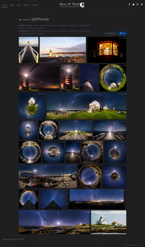
For years past, adults and children of all ages had dreams of growing up to be an adventurous lighthouse keeper. That dream is slowly dimming as the world automates its lighthouses.

The following article from The Guardian  brings to our attention the dimming of the dream in the UK

The lure of the lighthouse for our islanded souls
With the last lights set to go out, many of us will miss these concrete symbols of our humanity

by Joe Moran The Guardian, Saturday 12 April 2014.

Lighthouse, County Durham
The tower lights, the ones that rise impossibly out of the sea and carry the most romantic connotations for landlubberly ignoramuses like me, were the most dreaded by the keepers.’ Photograph: Owen Humphreys/PA

Growing up, I wanted to be a lighthouse keeper. Just like Moominpappa in Tove Jansson’s Moomin books, my ambition was to live on the loneliest lighthouse on the remotest skerry farthest from land. It didn’t end well for Moominpappa, the island he and the other Moomins settled on being barren and desolate, inhabited only by a silent fisherman who turned out to be the ex-lighthouse keeper driven mad by loneliness. It didn’t put me off.

I have since met many compatriots who have had the same dream, for there is something about lighthouses that seems to speak to our islanded souls. more . . .

[private]

Now, to celebrate the quincentenary of Trinity House, the organisation responsible for the lighthouses of England and Wales, an exhibition is opening at the National Maritime Museum. Guiding Lights will display intricate models of lighthouses and lighthouse keepers’ personal effects. It is hard to imagine a similarly pulse-quickening exhibition about air-traffic controllers or road-safety officers, although our lives are similarly in their hands.

“I meant nothing by the lighthouse,” Virginia Woolf wrote of its role in her most celebrated novel, “but I trusted that people would make it the deposit for their own emotions.” Lighthouses, Woolf realised, are endlessly suggestive signifiers of both human isolation and our ultimate connectedness to each other. Artists, from John Constable to Eric Ravilious, have made them the focus of their paintings, which can’t simply be to do with their pleasingly vertical contrast with the horizon.

I suspect that lighthouses appeal especially to introverts like me, who need to make strategic withdrawals from the social world but also want to retain some basic link with humanity. A beam sweeping the horizon for the benefit of ships passing in the night is just that kind of minimal human connection. “Nothing must be allowed to silence our voices … We must call out to one another,” wrote Janet Frame, a shy New Zealand writer also fascinated by lighthouses, “across seas and deserts flashing words instead of mirrors and lights.”

I finally cured my lighthouse fantasy by reading Tony Parker’s oral history of lighthouse keepers. Looking after a light – no keeper ever called it a lighthouse – was, I learned, a tedious job, with little to do but linger over meals and make ships in bottles. One keeper was so lonely that in the middle of the night he switched on the transmitter and listened to the ships radioing each other, just to hear some other human voices. The tower lights, the ones that rise impossibly out of the sea and carry the most romantic connotations for landlubberly ignoramuses like me, were the most dreaded by the keepers. Without even a bit of rock to walk around on and escape from your housemates, they were the lighthouse-keeping equivalent of being posted to Siberia.

In any case, I was well out of it because lighthouse keeping was not a job with prospects.

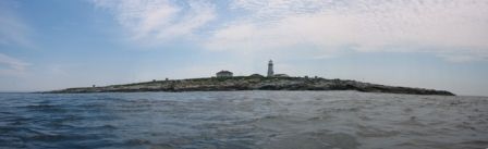
The lighthouses began to be automated in the 1970s and the last keeper left the last occupied lighthouse in 1998. Now, in an age of radar and computerised navigation systems, working lighthouses are an endangered species. Their haunting fog signals are being switched off. Their black-and-red painted stripes, meant to stand out against the land and sky, are being left to peel off. And many lighthouses are being decommissioned, turned into holiday cottages or expensively renovated homes.

No doubt satnav will now do the job just as well, but it will be a shame when the last lighthouse turns off its light. In an age when we have to justify public projects with the consumerist language of stakeholders and end users, lighthouses still feel like an uncomplicated social good that belongs to us all. They are the concrete symbol of our common humanity, of the fact that people we may never meet – at whom we may do no more than flash our lights in the dark – are also our concern.

*************************

One of my dad’s oldest friends was a lighthouse keeper for a few years. He was sometimes posted to those lights that stand alone on a rock. In a ‘big sea’ waves could be so high that water would come down the chimney and put the fire out. He also said that if your hearing went dull it meant that the level you were on was underwater because of a big swell – and a thick metal door was the only thing keeping the Atlantic out.

There are terrible stories. One was the lighthouse often had to eat the tallow candles when ships bringing supplies could not make it through the rough sea. Also the tradition of 2 keepers came into being when one single went out of his mind.
I’ve a slight problem with repeated ref to concrete. Most early lights were built with granite(or timber with plinth granite) interlocked water proof hydraulic cement. Smeaton’s Eddystone the prototype, and later Stephenson family business up north.

To be honest lighthouses are no longer necessary as the coastline is now starkly outlined by the amount of light pollution from our towns, cities and villages. You really can’t miss it when sailing down the coast. Also our new technologies are way in advance of anything we’ve had in the past and even a small yacht can now pinpoint its position to a matter of metres on the ocean. So if we do have any shipping catastrophes in the future they are likely to be down to human error.

“even a small yacht can now pinpoint its position to a matter of metres”

I too sail a small yacht in and around NW Scotland and, because I lack all but the most basic GPS, compasses and echo sounder, greatly value our lighthouses – albeit, unmanned. You will know that whenever NATO carry out exercises in the Minch, warships regularly cause GPS screens to go blank!!!  Serious accidents are not unknown.

You are referring to an exercise 2 years ago where warships blocked GPS for 20 miles. There were no accidents but due to complaints Warships in UK waters are now banned from blocking GPS. I’m not sure about other navies though.

Not every small boat has radar… not all coastlines are outlined by light pollution.

But most people now have mobile phones/iPads/Tablets with GPS.

Please, please, please do not go to sea relying on an iPad/phone etc for navigation! Road signs, and indeed ‘roads’ themselves are fairly limited at sea in my experience.

I can see one of our oldest lighthouses from here. It is on the top of St Catherine’s Down and known locally as the Pepperpot. It was built by local people as a punishment for buying smuggled wine. There was an oratory attached to it at one time to say prayers for the souls of the shipwrecked of whom there were many and the graves in the churchyard will attest. Although high up it wasn’t much use as the mist which frequently covers that part of the coast line blocked out the light when it was most needed and many ships went aground on the notorious Atherfield ledge. The new lighthouse built by the shore is a beautiful building and it would be a great shame if it were to become just another house, although coastal erosion and land slips might put off anyone but the most foolhardy from purchasing.

Foolish idea turning these off. Given potential failures of equipment these are very useful as a last backup. Oh well I’m sure it saves some middle managers budget some money somewhere.

This is a shame, lighthouses are exciting. I don’t think it’s possible to go on holidays to the coast without spending some time watching out for the distant lights and trying to identify them. I know we used to look forward to foggy days so we could hear their fog horns going off.

And at night, if you were staying in a house nearby, some of the beam would sweep around the bedroom from time to time.

Many years ago I recall reading an article in some sailing magazine. Title was The Antikythera Light. The author told of sailing through a storm in the Eastern Med. He had been at sea for days on end and the storm had bounced his small boat around quite a bit. This was long before GPS and he didn’t know exactly where he was. He knew he was approaching the Greek islands and some very dangerous and rocky shores. Then, flickering on the horizon in the far distance and through the storm…a flashing light. Lights flash in timed sequences and those are indicated on charts. He identified this one as the light on Antikythera, the island in the center of the passage through into the Aegean Sea.

Now he knew where he was. Now he was safe. He wrote of his grateful appreciation, not only for the light keeper whose job it was to help people the keeper would never see, but to the society that posted the man there and built the tower and light that led him to safety out of a storm, money spent for no special benefit to the community but only to the benefit of passing strangers in need of help.It was a wonderful essay on how humanity consists of people doing altruistic things, not only for strangers, but for strangers they would never know needed the help. Lighthouses are a symbol of what is best in all of us.

A good few years ago we did the soundtrack to this short documentary about the some of the last people to man the lighthouses, they tell their stories and explain how automation affected them, very sad some of it: http://vimeo.com/m/71760571

Bishop Rock lighthouse – the westernmost point of the Isles of Scilly – that’s the one I’d most like to go inside. And I’d pay good money to see the BBC documentary about it, by Tony Parker, first shown just over 40 years ago:  http://trinityhousehistory.wordpress.com/2014/02/06/on-this-day-in-trinity-house-history-6-february/

[/private]

Mise Tales Forty-One

For an update on what a Mise Tale is then please see Mise Tales One. As mentioned earlier on the front page of my website, any photos or cartoons, or short bits of information, when it is removed from the front page, will also be included again later in the next Misc Tales. That way you can keep track of it, search for it, or copy it.

*****************************

Aaron Priest Photography Photo Keywords  lighthouseSome beautiful night-time photos of lighthouses, some in a 360º panorama format from Aaron D. Priest on his website aaronpriestphoto.com.

************************** Continue reading Mise Tales Forty-One

Guess What!

Back in 1969 on my first lighthouse at Pulteney Point we had a third keeper on station. Wayne and Beth were a very friendly couple who lived the hippie lifestyle. One of the things Wayne used to do every morning at daybreak was wander down to the shoreline right in front of his house, bend over and look at the sunrise between his legs, and then scoop up a few handfuls of seawater and drink it. To each his own I guess!

water
A Single Drop of Seawater, Magnified 25 Times

OK, you’ve seen the title of the photo above taken from the website This is Colossal. On there they state:

You know when you’re horsing around at the beach and accidentally swallow a nasty gulp of salt water? Well I hate to break it to you but that foul taste wasn’t just salt. Photographer David Littschwager captured this amazing shot of a single drop of seawater magnified 25 times to reveal an entire ecosystem of crab larva,diatoms, bacteria, fish eggs, zooplankton, and even worms. Read more about what you probably don’t want to know at Dive Shield. We do admit the little crab larva in the lower right-hand corner is pretty darned cute. (via Lost at E Minor) Prints of this photograph are available at Art.com.

[private]

Under the microscope: Just a splash of seawater

Scoop up a bucket of seawater (or swallow a mouthful) and this is what you get: a bizarre menagerie of plants and animals, some of them known to us, others a complete mystery.

This extraordinary photograph shows a random splash of seawater, magnified 25 times. The Earth’s open seas are home to countless tiny animals and plants that are known collectively as plankton.

sealifeDM0511_1024x681

Sealife Key
Sealife Key

Sealife Text   [/private]

Navigation By Lighthouse Stars

Pulsars

Often referred to as Cosmic Lighthouses, neutron stars (also known as pulsars) are incredibly dense stars that shoot out X-rays at a predictable rate, like a lighthouse.


Read more on them here: NEW NASA MISSION TO PROBE CELESTIAL LIGHTHOUSES

A new NASA mission proposes to examine the nature of these neutron stars as well as how accurately we can use these beacons as celestial guiding points for deep space missions.


Pulsars spin at a dizzying rate of anywhere from seconds to milliseconds. As they whip around in their rotation, the hotspots flash periodically within sight of Earth. X-ray brightness from the pulsar increases when the hotspots comes within view, then dims as the hotspots turn away.


(There are a) millisecond class of pulsars that spin as rapidly as 700 times a second.These pulsars have such a consistent rotation rate that they are considered accurate celestial clocks. In space, they could be used in a similar way to global positioning satellites that provide navigation data to the military and civilians, particularly in vehicles.

COSMIC LIGHTHOUSES WILL GUIDE SPACESHIPS THROUGH THE GALAXY

On May 6, 2014 a new article on an ultra-precise pulsar was published by Janet Fang

NEW PULSAR RESOLUTION IS ONE MILLION TIMES MORE PRECISE

[private]


Artist s conception of how NICER will look when mounted on the space station. Credit: NASA

NEW NASA MISSION TO PROBE CELESTIAL LIGHTHOUSES

Sen—Spinning in space are incredibly dense stars that shoot out X-rays at a predictable rate, like a lighthouse. A new NASA mission proposes to examine the nature of these neutron stars – also known as ‘pulsars’ – as well as how accurately we can use these beacons as celestial guiding points for deep space missions.Called NICER (Neutron Star Interior Composition Explorer) the mission will use X-rays to look at emissions from these strange stars. The instrument will launch in 2017. It will be mounted on the International Space Station for observations from low Earth orbit.Neutron stars are thought to form after the collapse of a massive star that is between 8 and 30 times the size of the sun, according to the University of Maryland’s Coleman Miller, an astronomy researcher. After the supernova blows off most of its mass, what is left behind is a small core about the size of New York City, at 20 kilometres (12 miles) across.In this small space, the protons and electrons that make up matter are “literally scrunched together”, stated NASA. One sugar-cube-sized bit of neutron star has a mass of a billion tons, the equivalent of Mount Everest’s weight, the agency added.Zaven Arzoumanian of NASA’s Goddard Space Flight Center, is deputy principal investigator for NICER. He told Sen: “Everything in our world is made of atoms consisting of protons and neutrons making up the nucleus plus electrons in orbit around it. But they are mainly empty space.”If you squeezed some gold, uranium or lead so hard that you eliminated all the empty space, you’d have something just like a neutron star. We want to understand how stuff behaves at such incredibly high densities.”

NICER is one of NASA’s astrophysics explorer-class missions that aim to examine the universe at low cost. This will cap NICER’s mission costs at just US$55 million (£39.2 million). Simulataneously with NICER’s announcement, the agency also said it will fund the Transiting Exoplanet Survey Satellite for US$200 million (£130.7 million).

The NICER instrument will include 56 small X-ray telescopes packed into a mini fridge-sized package. It will probably arrive at station in a Dragon cargo spacecraft manufactured and operated by SpaceX.

Once ready, the telescope array will examine X-rays that come from “hotspots” on the star’s surface, as well as its magnetic field, NASA stated. Pulsars spin at a dizzying rate of anywhere from seconds to milliseconds. As they whip around in their rotation, the hotspots flash periodically within sight of Earth. X-ray brightness from the pulsar increases whn the hotspots comes within view, then dims as the hotspots turn away.

NICER will focus on the millisecond class of pulsars that spin as rapidly as 700 times a second. These pulsars have such a consistent rotation rate that they are considered accurate celestial clocks. In space, they could be used in a similar way to global positioning satellites that provide navigation data to the military and civilians, particularly in vehicles.

“To demonstrate the navigation technology’s viability, the NICER … payload will use its telescopes to detect X-ray photons within these powerful beams of light to estimate the arrival times of their pulses,” NASA stated.

“With these measurements, the system will use specially developed algorithms to stitch together an on-board navigation solution.”

[/private]

[private]

Future spacecraft can use cosmic lighthouses to navigate the Galaxy. Credit: RAS / starship Enterprise from the TV series Star Trek. Compilation by MPE

COSMIC LIGHTHOUSES WILL GUIDE SPACESHIPS THROUGH THE GALAXY

Sen— Scientists have proposed using pulsars – ‘cosmic lighthouses’ – as a way of navigating future space missions.Space navigation currently relies on communications with Earth which can become problematic at large distances from the planet, but the proposed star navigation based on pulsar signals would make deep space exploration more feasible.Stars have always been important for navigation, and mariners have lobang been using the night sky to find their way. Many satellites and spacecraft also have star trackers which monitor the positions of the constellations so that they can automatically adjust their orientation. However, star trackers cannot achieve sufficient accuracy for deep space missions. In addition, the constellations will not retain their familiar patterns if one were to travel far beyond the Solar System.Currently spacecraft are tracked by radio telescopes on Earth, but this has major flaws. As light can only travel at a finite speed, it takes time to send a signal to Earth and back again to determine the spacecraft’s position. For example, a signal from NASA’s Voyager 1 would take around 30 hours to do a round trip.In addition, the further one travels from Earth, the larger the errors in the measured location will be. There will be an error of four kilometres for every Astronomical Unit travelled, where an Astronomical Unit is the distance between the Sun and the Earth (150 million kilometres). Thus for the likes of Voyager 1, which is at a distance of around 120 Astronomical Units from Earth, we can only pinpoint its location to within 480 kilometres.Neither of these facts are particularly comforting to any future deep space astronauts, so how can we can get around this problem? Professor Werner Becker from the Max-Planck-Institut für extraterrestrische Physik discussed a possible solution at the National Astronomy Meeting in Manchester, England, last week.Becker has suggested using cosmic lighthouses, known as pulsars, as navigational aids. A pulsar is a “dead” star which ended its adult life in a massive explosion known as a supernova. After many of the outer layers of the star get blown away, an extremely dense, compact core known as a neutron star is left behind. Neutron stars emit beams of radiation from their poles, and if one of these beams sweeps past Earth, akin to beams from a lighthouse, then the star is known as a pulsar.Pulsars have periodic signals, and will gradually spin down over time. However, Becker’s calculations take this reduction in rotation rate into account to produce accurate measurements. “The periods can be measured with accuracy which compares with atomic clocks, and this includes all the measurements of the spin down,” Becker told Sen. “Then you can predict the pulse arrival time over quite a long time.”

There are several different types of pulsars, but the ones best suited for the job are milli-second pulsars, which have extremely rapid rotation rates. “We concentrated on the milli-second pulsars for the purpose that they have the shortest periods which allows you to probe the distance with the highest accuracy,” explained Becker.

Knowing the exact time at which to expect a beam from a pulsar to arrive at Earth, and then comparing this to the time that the beam swept past a distant spacecraft, allows the location of the craft to be determined. Becker explained how the time difference in pulses can be extrapolated to find differences in distances.

“When we compare the pulse arrival time, we know where it should have been and where we measured it, and the difference in arrival time can be used (if multiplied by the velocity [of the spacecraft] and period of the pulsar) to compute the distance from the position you assumed you were during the measurement and where you were actually during the measurement. Then you correct your position according to your measurement and you do a new measurement. So it’s a kind of iterative process.”

The pulses as measured from Earth would also need to be corrected to the Solar System barycentre, i.e. the centre of mass of the Solar System, to take into account the different locations of radio telescopes.

As well as interstellar space, pulsar navigation could also be used for space exploration in the Solar System to provide back-up to Earth based systems. “The next step is going to Mars, and then you may ask the question do you really want to rely on being tracked only from Earth,” said Becker. If communications failed between Earth and a spacecraft en route to Mars, then the astronauts would be forced to navigate using the constellations. However, using this new system they would be able to navigate independent of radio communications with Earth.

Timing the signals from pulsars can also have applications much closer to home, as it can be used to assist current GPS satellites and the upcoming Galileo satellite navigation system, and Becker explained the advantages to this.

“These satellites are also controlled from Earth, and if you don’t control and correct the orbits of the GPS satellites for longer than 72 hours the signals get completely unreliable. It needs a control from the Earth, but if you have a satellite using this pulsar method and technology, you could use this to augment the GPS satellites or the Galileo satellites and they would refer to this external satellite doing the navigation. It would mean that you would not have any requirement to control the satellites any more from Earth; it would make it really autonomous.”

Astronomers have been collecting data on pulsars for decades, so some milli-second pulsars have already been timed to high precision. The next step for the pulsar navigation method is to design the technology that will allow it to be used aboard a spacecraft, and simulations are already being implemented to discover the best way to do this.

tem will use specially developed algorithms to stitch together an on-board navigation solution.”

[/private]

[private]

New Pulsar Resolution is One Million Times More Precise

May 6, 2014 | by Janet Fang

photo credit: The densely packed matter of a pulsar spins at incredible speeds, and emits radio waves that can be observed from Earth, but how neutron stars emit these waves is still a mystery / Swinburne Astronomy Productions/CAASTRO

An international team of astronomers has made a precise measurement of a distant, spinning star that’s about a million times more precise than the previous world’s best. That resolution is like being able to see DNA’s double helix structure from the moon.
“Compared to other objects in space, neutron stars are tiny,” Jean-Pierre Macquart from Curtin University explains in a news release. They’re about tens of kilometers in diameter. “So we need extremely high resolution to observe them and understand their physics.” Neutron stars are particularly interesting for astronomers because some of them (called pulsars) gave off pulsed radio waves whose beams regularly sweep across telescopes. Nearly five decades since pulsars were discovered, astronomers still don’t understand how they emit those pulses.
To get this highest resolution yet, Macquart, Ue-Li Pen of the Canadian Institute of Theoretical Astrophysics, and colleagues used the interstellar medium — the turbulent “empty” spaces in between, where charged particles float around — as a giant magnifying glass to look at the radio waves emitted by a small, spinning neutron star called PSR 0834+06.
These pulse signals become distorted as they pass through the interstellar medium. The team was able to use the distortions to reconstruct a close-up view of the pulsar from thousands of individual images of the scattering speckle pattern.
“The best we could previously do was pointing a large number of radio telescopes across the world at the same pulsar, using the distance between the telescopes on Earth to get good resolution,” Macquart explains. By combining views from several telescopes, the previous record had a resolution of 50 microarcseconds.
The new record using this “interstellar lens,” the galaxy’s biggest telescope, is 50 picoarcseconds, or a million times more detail. And it resolves areas of less than 5 kilometers in the emission region. Because of that, the team found that the emission region of pulsar B0834+06 was much smaller than previously assumed and possibly much closer to the star’s surface — a critical piece of information for understanding the origin of the radio wave emission.
The work was published in Monthly Notices of the Royal Astronomical Society.
Image/video: Swinburne Astronomy Productions/CAASTRO

[/private]


Two of the World’s Oldest Lighthouses

Under the title Can you shed light on it? by the Grimsby Telegraph and posted: on May 01, 2014 Tim Mickleburgh said:

The world’s oldest lighthouse (the Pharos of Alexandria) was built by Sostratus of Cnidus around 270 BC.

Spurn
The oldest UK lighthouse? The lighthouse and lightkeeper’s house at Spurn.

It was a pyramid-shaped tower of white marble on the island of Pharos (in Greek the word Pharos means lighthouse) off the coast of Alexandria, Egypt.

It was estimated to be 400ft tall, and was one of the Seven Wonders of the World, a listing designated by Antipater of Sidon in the second century BC.

This formed part of Alexander’s Harbour, Alexander being of course Alexander the Great.

Alas, the lighthouse was destroyed by an earthquake in 1375 AD.

Unfortunately, the Guinness Book Of Records never provided a listing for the oldest British lighthouse. – read more

*****************************

The oldest lighthouse in my home country of Canada was built in 1713 and went into service at the French fortress of Louisbourg on Cape Breton Island in 1734.

What is the name and location of the oldest lighthouse in your country? Write me a note and let me know and I will post it here.

[private]

THE world’s oldest lighthouse was built by Sostratus of Cnidus around 270 BC, writes Tim Mickleburgh.

It was a pyramid-shaped tower of white marble on the island of Pharos (in Greek the word Pharos means lighthouse) off the coast of Alexandria, Egypt.

It was estimated to be 400ft tall, and was one of the Seven Wonders of the World, a listing designated by Antipater of Sidon in the second century BC.

This formed part of Alexander’s Harbour, Alexander being of course Alexander the Great.

Alas, the lighthouse was destroyed by an earthquake in 1375 AD.

Unfortunately, the Guinness Book Of Records never provided a listing for the oldest British lighthouse.

So when this came up as a quiz question recently, I was stumped, expressing ignorance when the answer was given as Spurn Head.

This though set me to do some private research.

Fortunately I have the book written by Kenneth E Hartley and Howard M Frost, The Spurn Head Railway (Second Edition 1988). It gives reference to a hermit named Reedbarrow being responsible for erecting a lighthouse in c1427, going on to state that “following the unrecorded disappearance of Reedbarrow’s early lighthouse a London man, Justinian Angel, erected a lighthouse at Spurn during the years 1673-4”. There is no claim however that the lighthouse was Britain’s first.

So I then turned to Lynn F Pearson’s Piers And Other Seaside Architecture (Second Edition 2011) for enlightenment. But it wasn’t to be, as lighthouses don’t feature within its pages.

The AA Book Of The Seaside (1972) is of more help, telling readers that only 11 lighthouses existed by the 17th century, all on the south coast. It adds that the Roman Pharos in Dover castle was “one of the earliest surviving examples … from this dim brazier … lighthouses have slowly developed”.

This though presumably wasn’t a standalone building, unlike that at Spurn Head.

Thus I await further information from amongst your erudite readership!

Do you know which is Britain’s oldest lighthouse? If you can help, then please write to Bygones, Grimsby Telegraph, 80 Cleethorpe Road, Grimsby, North East Lincolnshire DN31 3EH or you can e-mail bygones@grimsbytelegraph.co.uk

[/private]

Machias Seal Island – An Ongoing Border Dispute Between the United States and Canada

I have mentioned Machias Seal Island before in my articles here, here, here, and here.

Well writer John Farrier published on Neatorama on Tuesday, April 22, 2014 a great article about how MAJOR/insignificant this dispute really is!

1398212464-0

(Maps: Google Maps)

This is Machias Seal Island, a 20-acre island in the Bay of Fundy.

You can’t see it? Let’s zoom in.

And from there the story continues! Such an insignificant island for such a big debate. That is government for you. Naturally it belongs to Canada! . . . more

[private]

1398212464-1

Hmm. That doesn’t help much. Let’s zoom in some more.
1398212874-0

There it is! It’s a speck of land that barely appears on the map.

1398212874-1
(Photo: Albnd)

You can see the lighthouse in the photo above. The island is inhabited by 2 human lighthouse keepers, a few seals…

1398212874-2

(Photo: Thomas O’Neil)

…and lots and lots of puffins.

The ownership of Machias Seal Island is disputed by the United States and Canada. Canada is in physical possession of it, but the United States has not formally dropped its claim to the island.

I’ve previously written several posts about the development of the US-Canadian border, whichincludes weird exclaves. Ambiguity about the border even led to the creation of 2 short-lived nations.

1398213788-0

(Painting by Benjamin West of the American delegation at the Treaty of Paris)

Although the United States and Canada now maintain a long, peaceful border, the placement of that border has been in doubt since the Treaty of Paris (1783) in which Britain recognized the United States as an independent nation. That treaty attempted to draw borders over unexplored lands. The authors did the best that they could with their knowledge of geography. But, alas, one of the descriptions for the border between Maine and maritime Canada was problematic. The treaty says that US territory includes:

all Islands within twenty Leagues of any Part of the Shores of the United States, and lying between Lines to be drawn due East from the Points where the aforesaid Boundaries between Nova Scotia on the one Part and East Florida on the other shall, respectively, touch the Bay of Fundy and the Atlantic Ocean, excepting such Islands as now are or heretofore have been within the limits of the said Province of Nova Scotia.

I’ve bolded the parts of the text that are the source for the Machias Seal Island dispute.

As I’ve mentioned in a previous post, the eastern border of Maine was of great concern to the British. Some British officials coveted what Americans saw as their territory, and vice versa. Control of the Bay of Fundy was of great importance to British commissioners at the Treaty of Ghent (1814), which ended the War of 1812.

1398215328-0

(Photo: Thomas O’Neil)

Now back to Machias Seal Island. The American argument is that it lies within 20 leagues (approximately 69 miles) of the coast of the United States.

The Canadian argument is that a land grant that pre-exists the Treaty of Paris defines the island as part of Nova Scotia. It built and has operated a lighthouse on the island since 1832.

Occasionally fishermen from the 2 nations have gotten into scraps about its ownership. Some Canadian citizens have staked mining claims to the island as a means of asserting Canadian sovereignty. The State of Maine has included the island on its maps of electoral districts.

But if possession is indeed 9/10ths of the law, then Machias Seal Island is Canadian. The United States has chosen not to press the issue.

Sources:
Clark, Edie. “Barna Norton Invades Canada.” Yankee 62.6 (1998): 48. Biography Reference Bank (H.W. Wilson). Web. 22 Apr. 2014.

Guo, Rongxing. Territorial Disputes and Resource Management: A Sourcebook. New York: Nova Science Publishers, 2007. Web. Google Books. 22 Apr. 2014.

Kelly, Stephen R. “Good Neighbors, Bad Border.” New York Times, Late Edition (East Coast) ed. Nov 27 2012. ProQuest. Web. 22 Apr. 2014 .

RELATED NEATORAMA POSTS

[/private]


A Lighthouse For Aircraft

10256131_629917400425264_8651924895302771196_n
Photo courtesy of Bretagne Phare St-Mathieu Facebook page

What a beautiful lens! What a unique story.

On Facebook the United States Lighthouse Society page shared a photo of the Brittany (Bretagne), France St. Mathieu lighthouse lens. It was borrowed from the  Bretagne Phare St-Mathieu Facebook page.

In French the page says:

La saison démarre bien, j’ai déjà accueillit beaucoup de monde. Et qui dit nouvelle saison , dit “Nuit du Phare”. La première nuit de cette année aura lieu lundi 5 mai à partir de 21h30. Toutes les 1/2h. un groupe de 20 personnes pourra venir admirer la mer d’Iroise et ses phares à partir du chemin de ronde. Visite uniquement sur réservation au 0298890017 ou 0686310347.

which roughly translates (with the help of Google Translate) into: Continue reading A Lighthouse For Aircraft

It’s Old, But Not The Oldest!

On September 21, 2013 I wrote Message in a Bottle which described a 107 year old message-in-a-bottle find. Later on October 29, 2013 I wrote More Messges in Bottles which described more messages found in bottles. It seems that everybody loves to do it!

Today I found this story in The Local – Germany’s News in English dated March 07, 2014.

Fishermen find oldest message in a bottle

German fishermen made a surprising catch this week when they pulled the oldest recorded message in a bottle out of the sea. A man from Berlin scribbled the note 101 years ago. . . . more

[nggallery id=94]

[private]
What initially looked like a normal, discarded beer bottle, nestled among fish in the Maria I’s nets, turned out to be a record-breaking find – as it contained a postcard dated May 17th, 1913 written by a man named Richard Platz.

A modest Danish postcard with two German stamps on it and a polite message asking the finder to send it on to his address in Berlin; it appears that Platz could have been trying to save on international postage fees.

But the card never arrived, instead landing in the hands of fishermen from Heikendorf in Schleswig Holstein, on Tuesday – over 100 years later.

“I had it in my hand, but then a colleague told me there was something in it,” skipper Konrad Fischer told regional newspaper the Kieler Nachrichten, explaining he was ready to throw it back into the Baltic.

“When I saw the date I got really excited,” he said.

Until now, the oldest message in a bottle listed in the Guinness Book of Records was 97 years old when found in 2012, making Fischer’s a potential record breaker.

“If the message is really this old, maybe a museum would be interested,” said Fischer, who will be taking his bottled post to experts for them to take a closer look.

Fischer has been a fisherman for 50 years and in that time has found mines, bombs, torpedoes and a corpse in the sea.

He told news agency DPA that he was not sure yet what he would do with the bottle but would “maybe auction it to the highest bidder”. [/private] Continue reading It’s Old, But Not The Oldest!

Mise Tales Forty

For an update on what a Mise Tale is then please see Mise Tales One. As mentioned earlier on the front page of my website, any photos or cartoons, or short bits of information, when it is removed from the front page, will also be included again later in the next Misc Tales. That way you can keep track of it, search for it, or copy it.

*****************************

necklace5_1024x1024

survival necklace s1401 from Cougar Fashion in Tahsis, British Columbia

from the rainforest, for the rainforest price $12.50 this necklace is transformed to emergency fishing gear within minutes. all you need is a pocket knife.

contents: – 3.8 m. fishing line  – 3.5 cm. bait hook – interlock snap swivel  – split ring  – 6 cm. hoochie

Now this is a unique West Coast piece. It is a very beautiful necklace and would draw comments wherever it is worn. dsc_6902I am not too sure how practical it would be with only 3.8 meters (12.5 feet) of fishing line, but anything could work in an emergency.One would be better off also wearing a Survival Strap (get one in a matching colour) to add length to the necklace. Hey, two unique pieces of survival jewelry which you can wear anytime. Check out all the other items which you can find at Cougar FashionContinue reading Mise Tales Forty

What Light Is That?

What light is that? Have you ever asked yourself that question? Maybe when reading a magazine, seeing an advertisement, or watching a movie – what lighthouse is that? Where is that lighthouse?

Harbour
computer screenshot

MV5BMTQ3MDA4MDIyN15BMl5BanBnXkFtZTYwOTg0Njk4._V1_SX214_Well this happened to me while I was watching the first of the Jason Bourne movies  – The Bourne Identity (IMDb)

Eight (8) minutes into the DVD movie (see screen shot at right) the fishboat that rescued him from the ocean enters Cassis harbour (according to the book by Robert Ludlum) and we see this green light at the end of a breakwater. Unfortunately the movie does not follow the book at all (“The novel is wildly

Cassis harbour light look likes this

wildly different from the movie.”) and I have no idea where this harbour is located. It is definitely not Cassis harbour near Marseille, France. If you look at the film you will see as they enter the harbour there is a shipyard on the left side – there is definitely no shipyard in the photo on the right. Of the fifteen places listed in the IMDb website for the film locations, none of them apply to this harbour.

So, where is it? Do you know? If so please let me know so I can inform the readers as well.

Continue reading What Light Is That?