Tag Archives: BC

Visiting the BC Coast Lighthouses

Do you want to visit some of British Columbia lighthouses? A lot of them are isolated, but there are a few that tourists can easily see. Some of these are manned; some are automated.
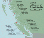
One of the best websites for finding the location of the  lighthouses is Ron Ammundsen’s Lighthouses of British Columbia website. On the opening page he has maps of manned/staffed and unmanned lighthouses and their locations. This will show you what is available, and where they are located. To find photos and information on the chosen lighthouses check out Google.
 

One of the main items you will require is a place to stay. When flying to British Columbia via International Airlines (from another country) your point of entry would be Vancouver International Airport (YVR). From there you have a variety of ways to accommodate yourself – from hotel, motel, bed and breakfast, camp site, hostel, inn, resort, etc. Select from the list on the Hello BC website. Enter your dates, town, and preference, and select a place to stay. Really easy website to find your way around.

The next thing after a room for the night, is a place to eat. Canada is well-known for its diversity in the culinary arts, and British Columbia is no exception. The easiest way is to introduce you to a special webpage called Dining, again from Hello BC. This is an interactive menu connected to a BC map. Pick what type of food you want, where you want to eat, and wait for the results. It is well organized and easy to use.

The choice is amazing! Your selection may be saved as a PDF file for reference. Pick your town, pick your food and grab a cab to good dining. The nice thing is you can look on the map to see if a location is near your place of residence for any place in BC. The map (left) shows the 538 results from just selecting West Coast. Each red flag is a city with multiple locations in each. Each result will give you location, telephone number and website if available. A very comprehensive help page.
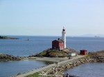
Fisgard Lighthouse

Before you come you should decide where you want to go, and what lighthouses you want to see. Most of the available lighthouses will be seen in and around the cities of Vancouver, and Victoria, BC. Others are visible from the ferries, and up and down Vancouver Island. On the Hello BC website on the Things To Do page there are no exact listings for lighthouses but if you type lighthouse in the search box (upper right) you will get a page of lighthouse listings, things lighthouse, resorts near lighthouses, etc. With the map from the website on Lighthouses of British Columbia you can then sort out where you want to go and which lighthouse you may wish to visit..
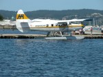
If you want to get off the beaten track, you can fly into many places or take ferries, hike in, or even rent a local water taxi or fish boat. The opportunities are unlimited depending on your time and finances. On the Hello BC webpage is also a section on Transportation and Maps listing many services available in BC.

Take your time, talk to other tourists, and if you have any questions, maybe I or other readers can help you out. They don’t call it Beautiful BC for nothing. Enjoy!

******************************

To help you enjoy the coast more, it might be helpful to read up on a few of the things you might find at the shoreline. A great website for this is Vic High Marine. Check out the information on all things you might stumble across, or see on your trip.

Any more good advice out there? Please send it on and I will post it.

West Coast Recipes – Part One


I thought this might be interesting for people in other parts of the world who read this website. There are many food recipes associated with the West Coast of Canada and USA – many from the First Nations people, and many from the residents be they mariners, lighthouse keepers, villagers, prospectors, hunters or others. I will try and see what I can find. I will try and post about five (5) recipes per post. If others have any contributions, please pass them on. Full credit will be given.


One recipe I have posted can be found here: Thomas Crosby Muffins. Also a book was written about British Columbia lighthouses called The Lighthouse Cookbook by Anita Stewart. It is an excellent book and is available from Amazon.com.


******************************** 

1. Salmon Fish Cakes

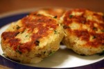
Now this is one of the simplest recipes to make, and I learned about making them from my wife Karen who’s father used to cook them while out on the West Coast fishing for salmon. His recipe was pretty simple: Use whatever is available! Take some leftover cooked salmon, mix it about half and half with some leftover cooked potatoes, throw in an egg to help hold it together and season with salt and pepper. If available, add a few chopped green onions. Make into patties and fry in one-quarter inch (1/4″) oil, flipping once until brown on both sides. Serve with whatever condiment is available – lemons and/or ketchup.  Enjoy!

Below is a more cookbook style of making the same thing:

Salmon Fish Cakes

1 1/4 lbs potatoes, peeled and cut into chunks

1 lb salmon fillets, skin on, scaled and bones removed (or in a pinch try using 2 cans of Clover Leaf’s canned boneless/skinless salmon) Continue reading West Coast Recipes – Part One

Chris Mills – Canadian Lighthouse Photographs


Canadian Lighthouse Photographs

New website is coming.
http://www3.ns.sympatico.ca/ketm/
is no longer online


Chris Mills
1121 Ketch Harbour Rd.
Ketch Harbour, Nova Scotia  B3V 1K7


British Columbia | Nova Scotia | Prince Edward Island | New Brunswick | Newfoundland

Chris Mills served as a lighthouse keeper for the Canadian Coast Guard on both the Atlantic and Pacific coasts.

He is currently co-chair of a committee which is recruiting Members of Parliament in support of a private members bill to protect lighthouses.  To see how you can help, visit this site:  Canada Needs a Lighthouse Protection Act.

Photographs and enlargements are for sale. Contact Chris Mills for price information.
All photographs and slides in the collection are identified, dated and signed.

Chris Mills is also author of the book on Nova Scotia lighthouses Lighthouse Legacies available from Amazon.ca


Sambro Island restoration project


BRITISH COLUMBIA

Some of these photos may be viewed at the Lighthouses of British Columbia site.

Green Island (1994, 1995) 250 colour photos, 70 colour slides in collection. All aspects of the station and island documented — aerial views, sea views, night views, details of light and lighthouse, lightkeepers, Coast Guard helicopters, surrounding islands and seascapes.


Langara Island (1994, 1996) 250 colour and 25 black and white photos, 180 colour slides in collection. All aspects of station documented — aerial views, night views, detailed views of 1913 First Order Fresnel Lens (manufactured by Chance Brothers), light tower and lantern, lightkeepers, dwellings, interior of engine room, old cabin on island, face carved in tree, shoreline views, lightkeeper’s goats, stormy seas.


Triple Island (1994) 24 colour photos in collection. Aerial views, third order Fresnel lens, lightkeeper, detailed views of lighthouse structure, interior of workshop and engine room.


Bonilla Island (1994) 250 colour photos in collection. Many aspects of station — aerial views, sea views, night views, shoreline views (including Japanese glass fishing floats), lightkeepers, dwellings, engine room interior, light tower. (NOTE: this collection will be expanded during Sept/Oct 1996)


Boat Bluff (1994-1996) 160 colour photos in collection. All aspects of station — aerial views, sea views, night views, details of light tower, fog horns , engine room, main light (including views of keeper inspecting light at night, inspection of light and bulbs during day), views of station and mountains from 1000 foot hill across the channel from lightstation, snow views, old hand fog horn, three modern plastic lenses, sunrise views, surrounding bays and inlets, Santa and Mrs. Claus visit 1994. (NOTE: Available as of Dec. 1996 — selection of a further 200 colour and b&w prints taken during August 1996, including Coast Guard ship and work crews supplying station.)


Ivory Island (1994-1996) 600+ colour and 36 black and white photos, 100 colour slides in collection. All aspects of the lightstation — 30 aerial views, sea views, night views, lighthouse, keepers, dwellings inside and out, engine room, main light, surrounding area, beaches, salmon fishing, snow, totem poles, artist and photographer at work at the lightstation, Coast Guard helicopters, sunsets, shoreline and forest, various tidal life (sea stars, crabs, etc.), local minor beacon lights, 25th annual Santa and Mrs. Claus visit December 1995.


McInnes Island (1994, 1995) 48 colour photos, 22 colour slides in collection. Aerial views, lighthouse structure, radio room, keeper, detail of lantern and main light, large thunder cloud formations.


Dryad Point (1995) 32 colour photos in collection. Aerial views, light tower, main light, keeper and daughter, keeper and main light, dwelling. (NOTE: This collection will be expanded during 1997)


Addenbroke Island (1994) 14 colour photos in collection. Aerial views.


Egg Island (1994) 10 colour photos in collection. Aerial views.


Pine Island (1994) 3 colour photos in collection. Aerial views.


Scarlett Point (1994) 2 colour photos. Aerial views.


Point Atkinson (1994) 14 black and white photos in collection. Light tower, keeper and main light, station dwellings and exterior of radio/engine room.


Brockton Point (1994) 5 black and white photos in collection. Light tower.


Porlier Pass (1994) 32 colour photos in collection. Two light towers (Porlier is a range light station), main lights, boat and boathouse, lightkeeper, dwelling, interior engine room and fog horn building, Coast Guard hovercraft. (NOTE: The old front range light was demolished Feb. 1996 and replaced by a fibreglass tower and the lighthouse was automated shortly after.)


Fisgard (1994) 6 colour, 2 black and white photos in collection. Light tower and detail of gothic style window in old keepers dwelling.


Sheringham Point (1994, 1995) 20 colour photos in collection. Light tower, abandoned dwelling, sunset, old Fresnel lens at local museum.


Amphitrite Point (1995) 9 colour slides in collection (prints available). Lighthouse structure, old keepers dwelling.


Lennard Island (1995) 52 colour photos, 25 colour slides in collection. Traveling to island by boat, keeper in boat, keeper in lighthouse, keeper and wife on station grounds, dwellings, radio room, engine room, details of two fog horn systems, including traditional diaphone horn taken out of service Oct. 1995, light tower, station grounds.


Cape Scott (1996) 23 colour photos in collection. Aerial views.

NOVA SCOTIA

Some of these photos may be viewed at the Nova Scotia Lighthouse Preservation Society site.

Baccaro Point
Bear River
Beaver Island
Black Rock Point
 (new lighthouse)

Black Rock Point (old lighthouse)
Boar’s Head
Brier Island
Cape Forchu
Cape George
Cape Sable
Chebucto Head
Fort Point
 (LaHave River)

Fort Point (Liverpool)
Fourchu Head
Gabarus
George’s Island
Grand Passage
Hampton
 (Chute Cove)

Horton Bluff
Jerome Pont
Louisbourg
Low Point
Maugher’s Beach
Medway Head
Peggy’s Cove
Point Aconi
Port Greville
 (old light, now at Canadian Coast Guard College, Point Edward, N.S.)

Port Medway
Prim Point
Rouse Point
Sable Island
 (east light)

Sable Island (west light)
Sambro Island
Scatarie Island
Schafner Point
Seal Island
Sydney Range
 (front light)

Sydney Range (rear light)
Western Head
Battery Point
Betty’s Island
Canso Locks
Cross Island
 (comprehensive collection including automation day)

Eddy Point
Mosher’s Island
Seal Island
 (comprehensive collection)

Seal Island Lighthouse Museum

PRINCE EDWARD ISLAND

Blockhouse Point
Borden Range
 (front light)

Borden Range (rear light)
Cape Bear
Cape Tryon
Brighton Beach Range
 (front light)

Brighton Beach Range (rear light)
East Point
Murray Harbour Range
 (front light)

New London Range (rear light)
North Rustico
Panmure Island
Point Prim
Souris East
Summerside Range
 (front light)

Summerside Range (rear light)
Woods Islands
Woods Islands Range
 (front light)

Woods Islands Range (rear light)

NEW BRUNSWICK

Cape Spencer
Cape Tormentine
Fish Fluke Point
 (Grand Harbour)

Gannet Rock (comprehensive collection: 700+ prints and slides)
Great Duck Island
East Quoddy
 (Head Harbour)

Letite
Long Eddy
Long Point
Machias Seal Island
 (comprehensive collection)

Mulholland Point
Southwest Head
Swallowtail

NEWFOUNDLAND

Cape Anguille
Cape Ray
Cape Saint Francis
 (dwelling only)

Cape Saint Mary’s
Cape Spear
Lobster Cove Head
Rose Blanche
 (old stone lighthouse)

Tides

photo Paul Kurbis

One of the reasons for the establishment of a lighthouse is to mark the dangers from the effect of extreme tides (low and high) on surrounding lands, islands, waterways, and beaches. 

Look at the photo on the left of my old lighthouse at McInnes Island at low tide (click for a larger version). We can tell it is low tide because the kelp is exposed on the rocks, and the high tide mark on the rocks is marked by a dirty black line. Here on the Pacific Coast of Canada, the tides come in and go out twice a day, and the range is between seventeen (17) and twenty-one (21) feet (6 to 7 meters)!

Note the small rock at dead center, bottom of the photo. At high tide that would be covered and become a menace to navigation. In this case this is not a marked shipping channel so no marker is necessary. The reason for the lighthouse (visible on the left of the large island) is that it was listed as a landfall light. A marker for ships coming in from the Pacific Ocean to the British Columbia coastline, and also a marker for the entrance to Milbanke Sound. It really doesn’t mark the island as dangerous; just an indicator of a mariner’s location on the ocean.

Example of a floating dock

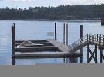
To return to a docked boat on the BC coast after a few hours of sightseeing or shopping is sometimes a surprise for many tourists. The docks for the boats are built to float up and down on fixed pilings to accommodate the 21 foot tides (see photo left). To get onto the dock you walk up or down a ramp. A roller on the lower end rolls along the dock as the tide rises or falls. The top part of the ramp is hinged.

The tides change approximately every six hours, so if you left your boat and walked up the steep ramp to the topside dock at 10 AM (low tide) and came back at 2 PM (4 hours difference), the ramp would be almost horizontal (high tide). If you had lots of heavy groceries to move it was always a good idea to plan at what time of day you wanted to move them! Continue reading Tides

Reprint – Presentation of a Lifetime Membership from Lightkeepers UCTE Local 20232 To Jim Abram

B.C. lightkeepers honour their champion

By Kristen DouglasCampbell River Mirror
Published: September 25, 2012 2:00 PM 
Updated: September 25, 2012 2:13 PM

[media url=”http://www.youtube.com/watch?v=JN7SZCsEERY” width=”400″ height=”350″]
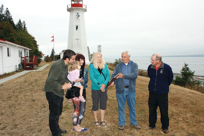
Strathcona Regional District director and former lightkeeper Jim Abram was honoured with a lifetime membership to the B.C. Lightkeepers Union Friday morning at the Cape Mudge Lighthouse on Quadra Island. Pictured from left, Abram’s son Jesse, daughter Melissa Abram, granddaughter Cleo Abram-Veloso, Abram’s wife Wendy, and Jim Abram, gather around to look at the commemorative plaque presented to Abram on behalf of the union.
 

Under cloudy skies, with the imposing Cape Mudge lighthouse looming in the background, former lightkeeper Jim Abram vowed to keep fighting for lightkeepers – the eyes and ears on the ocean. Continue reading Reprint – Presentation of a Lifetime Membership from Lightkeepers UCTE Local 20232 To Jim Abram

Reprint – A Light on the Past

A light on the past

with permission from Rosalind Duane, North Shore News, August 05, 2012

Elaine Graham remains the only resident among the historical buildings at Point Atkinson Lighthouse. Photograph by: NEWS photo, Lisa King

ELAINE Graham was raised in the slums of London, far from the multi-hued green of nature.

“There was nothing on my street when I was growing up,” she recalls. “I had lots of play-friends, loads of kids to play with, but there wasn’t even a geranium on a windowsill.”

Many years later, Graham is now surrounded by 75 hectares of the largest first-growth stand of coastal-elevation trees in the Lower Mainland. Her home is nestled among the remaining structures at the base of Point Atkinson Lighthouse, which stands on a craggy promontory at the edge of Lighthouse Park in West Vancouver.

She has spent half her life here, and is eager to tell the story of her neck of the woods.

Graham moved to the Point Atkinson Lighthouse station with her husband Donald and two young sons in 1980. Donald became the last of the lighthouse keepers at the site (along with senior keeper Gerry Watson) when the lighthouse was automated in 1996.

The Grahams stayed on in one of the two keeper’s houses, she as a park attendant and he as a groundskeeper. Continue reading Reprint – A Light on the Past

Mission Boat “William H. Pierce”

– as told to me by Mike Gallagher – deckhand and acting skipper “W. H. Pierce” and mate on the “Thomas Crosby IV”.

The following guestbook entry was received by Ron Ammundsen, webmaster of the BC Lighthouse web pages and forwarded to me. It was signed by Michael Gallagher.

Between 1952-56 in the summers, I was aboard the “William H. Pierce” with Dr. George Darby out of Bella Bella (now Waglisla). We went ashore at most lighthouses from Boat Bluff south to Egg Island , sometimes for medical reasons, sometimes to take magazines, have tea and talk . . . mainly listen.

WH Pierce at pointer island c. 1953 - photo Mike Gallagher

After Ron forwarded the entry to me I contacted Mike and asked if he had any stories for my Lighthouse Memories webpage. He said:

I probably have too many stories of my four summers with Dr. Darby, so I’ll mention a couple as they relate to lighthouses. Continue reading Mission Boat “William H. Pierce”

For Sale – James Island, Sidney, British Columbia, Canada


January 19, 2013 – As of today’s date the property has not sold!

OK, it’s NOT a lighthouse, but it is a light, and it is on your own private island. Well, it could be yours if you have $75, 000, 000 to spare! We can always dream!

If you wanted you could build your own lighthouse in the middle, but why worry, it comes with a white (W) flashing (Fl) navigational light (see LL #227 above)1 off the NW point of the island. All yours with the purchase of the island.

Take a look at the photo below!

 That is James Island off Sidney, British Columbia, Canada, and it is being listed by Sotheby’s International Realty Canada for the above-mentioned price.  To quote the website:

Situated only a few miles off of Sidney, James Island is in close proximity to Victoria, British Columbia’s capital city, and is easily accessed by private plane or boat. A retreat like no other, James Island compares to only a handful of international properties. Improved with a magnificent 18-hole Jack Nicklaus Signature golf course, the island has been thoughtfully developed to seamlessly blend in with not only its surrounding environment, but also its history. A wide range of improvements complement the island including a masterpiece

owner’s residence of 5,000 square feet, 6 beautifully appointed guest cottages, private docks and airstrip, pool house, managers residence, a ‘western village’, and much more.

The place used to be a munitions factory for years, up until 1994, when it was sold for $19,000,000. In the end Canadian Industries Limited (CIL) used to make gunpowders and dynamite. I remember as a child seeing the signs on Vancouver Island that trespassing was forbidden. 

Sotheby's Website


More photos on Sotheby’s website

More on the story from the Times Colonist newspaper


FOOTNOTES: 

1DESCRIPTION OF COLUMNS (in List of Lights Notations)

Column 1 -Indicates light list number of each aid

Column 2 -Name of aid

Column 3 -Location

Column 4 -Characteristic of light

Column 5 -Focal height in metres above water

Column 6 -Nominal range

Column 7 -Description, height in metres

Column 8 -General remarks, fog signals and CHS No. of the largest scale paper chart of the area


Reprint – DFO Shutting Down Coast Guard Radio Stations, but Prince Rupert’s Will Be Expanded


I wrote an article on January 04, 2012 entitled MCTS To Lose Staff To Save Money. After that date, the department of Fisheries and Oceans (DFO or F&O) have changed their plans. They are now closing whole stations instead of a removing a few men! The news article below is well written and explains what is planned for the BC coast. If all goes through we will have only two (2) MCTS stations on the whole BC coast, relying on mountaintop repeaters to reply to ships at sea.

I can also see soon that their plans will include again trying to de-staff the lighthouses. Pretty soon the whole BC coast will be bare of any support for boaters!

***********************************

By Alan S. Hale – The Northern View
Published: May 18, 2012 4:00 PM
Updated: May 18, 2012 4:59 PM

The Coast Guard communication monitoring station in Prince Rupert will be even more important to ensuring the safety of seafarers. The Prince Rupert station will be one of only two “modernized” coast guard stations in the entire province – the other one being in Sydney. Continue reading Reprint – DFO Shutting Down Coast Guard Radio Stations, but Prince Rupert’s Will Be Expanded

A Trip by Helicopter up the West Coast to Carmanah Point 2006

 A trip by helicopter up the west coast of Vancouver island to Carmanah Point 
October 25, 2006
 

Bell 212 at Carmanah Point - photo Mike Shepherd

To see what part of the west coast of Vancouver island is like from the air, check out Mike Shepherd’s article Coast Guard Bell 212 Helicopter Trip

There are some really nice shots of the Pacific Ocean and familiar lighthouses.

– Mike Shepherd is a Marine Communications and Traffic Services (MCTS) bofficer at Tofino MCTS, which is located on Amphitrite Point, near Ucluelet, British Columbia, Canada.