Category Archives: British Columbia

Re-inventing the Wheel, er, The Paddleboard


This not a lighthouse story, but it shows what interests a lighthouse keeper. If you live near the sea, you are always interested in ways and means of travelling, fishing , and exploring on the ocean. It is only natural. Here is my newest find – a SUP!

****************************

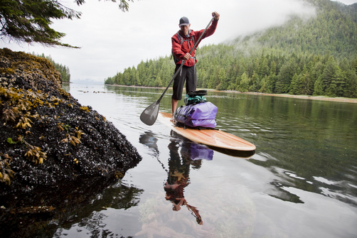
After posting the story “Stand” – An Adventure Documentary on November 14, 2012, I was really intrigued by the surfboards the people were using in the film.  They were not really surfboards as they appeared to be too heavy even though made of native British Columbia (BC) cedar wood.

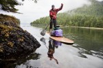
A Cedar Strip Stand Up Paddleboard (SUP)

As you can see from the photo above, they are called a Stand Up Paddleboard (SUP). I had never heard of them before, and thought they would be ideal for adventurers on the BC coast, or anywhere! Continue reading Re-inventing the Wheel, er, The Paddleboard

Reprint – “Stand” – An Adventure Documentary


Stand – Power Teaser

 [media url=”http://vimeo.com/52119128″ width=”400″ height=”350″]

[private]https://ccanadaht3.com/wp-content/uploads/2012/11/Vimeo-.mp4[/private]

 from  PLUS


STAND, presented by Quiksilver Waterman, will take viewers on a journey through the waters of B.C.’s west coast. Through the stories of an aboriginal high school class building their own stand-up paddleboards as a form of protest, the efforts of expedition stand-up paddler Norm Hann, and the powerful surfing of iconic west coast native Raph Bruhwiler, the diversity of people, landscape and wildlife that would be affected by an oil spill
will be articulated. STAND will take you to the core of the issue and unfurl the soul of B.C.’s west coast one paddle stroke at a time.

Cedar Standup Paddleboard

The crew is currently raising funds through the popular crowd-sourcing platform IndieGoGo, in order to complete post-production and bring this story into the mainstream consciousness. You can become a champion of the Great Bear and help protect our precious coastlines by donating to the project and in return receive some great rewards.

IndieGoGo Fundraiser: indiegogo.com/standfilm

Created by Anthony Bonello and Nicolas Teichrob

Music:
Original Score by Alan Poettcker (myspace.com/thesekidswearcrowns)

Sound Design:
Gregor Phillips (cinescopesound.com/)

Cinematography: Anthony Bonello and Nicolas Teichrob
Editing: Nicolas Teichrob

Additional footage courtesy of:
Adam DeWolfe (adamdewolfe.com)
Pacific Wild (pacificwild.org)
Peter Yonemori

***************************

STAND – a SUP adventure through the Great Bear Rainforest

 [media url=”http://vimeo.com/38708656″ width=”400″ height=”350″]

[private]https://ccanadaht3.com/wp-content/uploads/2012/11/stand_-_a_sup_adventure_through_the_great_bear_rainforest_1280x720.mp4[/private]

October 23, 2012 –  “STAND” the new film from b4apres Media in association with Dendrite Studios will take you into the heart of the largest temperate rainforest on the planet—the Great Bear in British Columbia, Canada. Hung on the skeleton of a good ol’ fashioned adventure undertaken by a group of surfers, the potential effects of introducing super tankers to these pristine waters will be articulated. As the crew moves through this remote region under their own power, the landscape will be unfurled one paddle stroke at a time and punctuated by the faces and fears of the First Nation people who call this garden of Eden their home. Not just an efficient mode of transport, a stand up paddleboard expedition will be symbolic of “standing up” to preserve this last bastion of rainforest. Captured in cinematic High Definition, the film will bring the Enbridge Pipeline debate into the collective consciousness in a way that will have you fishing in your basement for that old fluorescent wetsuit.

Quiksilver Waterman has signed on as the presenting sponsor for STAND. Since the crew had the concept for the film last year, they have been searching for a partner to support the project. That partner, however, needed to be the right fit and believe in the cause, in protecting British Columbia’s West Coast. Thankfully Quiksilver Waterman along with the Quiksilver Foundation 1 share a strong commitment to the environment.

Norm Hann and Raph Bruhwhiler are both Quiksilver ambassadors and agreed to join the project from the beginning. Both are true waterman and dedicated to the protection of the waters that they derive so much enjoyment from as well as the occasional seafood platter. Having Quiksilver Waterman involved makes the perfect trilogy and will allows the filmmakers to illuminate the stories, adventures and landscapes that abound in this truly magic part of the world.

Long protected by the 1972 Trudeau government moratorium on crude oil tankers plying British Columbia’s north coast, these waters are now facing the risk of oil spill. Potentially, 225 Very Large Crude Carriers (VLCC) per year would each transport approximately 2 million barrells of oil through the Great Bear Rainforest. In context, today’s supertankers carry ten times the volume of the Exxon Valdez oil spill. Put simply, the pristine marine and terrestrial ecosystems as well as the people of the Great Bear would likely not recover from such an incident.

This issue is perhaps the most important environmental issue in B.C. history. Whats more, a catastrophic oil spill could reach beyond borders and impact much of the Pacific North West coastline.

Visit the official Dogwood Initiative Website to learn more and find out how to get involved.

August 21, 2013Go see the film in Toronto.

****************************

FOOTNOTE:

1 For years, Quiksilver and Roxy have been actively engaged in charitable activities, both locally and globally. Quiksilver recognises the concept of corporate social responsibility and benevolence. We want our philanthropic work to have impact beyond what we do as one company and believe that we can do this by coordinating the support of other organizations and individuals. The Quiksilver Foundation was formed to bring all of Quiksilver’s charitable giving under one umbrella. The Foundation commenced its activities as a private foundation in October of 2004.

With offices in Europe, Australia and America, Quiksilver has the capability of reaching people worldwide. Quiksilver has the vision of making a difference to community and environment through the Quiksilver Foundation.

The Quiksilver Foundation is a non-profit organization committed to benefiting and enhancing the quality of life for communities of boardriders across the world by supporting environmental, educational, health and youth-related projects.
The Quiksilver Foundation has a commitment to improve the quality of all our lives.
We desire to benefit:

Local Communities, including schools, local charities through support and outreach programs;

Major special projects and organizations sharing our focus on children, education, science, oceans and the environment.

Reprint – New Tsunami Warning Protocol Rolled Out in B.C.

New tsunami warning protocol rolled out in B.C.

New system tested by magnitude 6.4 quake off Alaska coast on Monday

CBC News 

Posted: Nov 12, 2012 2:43 PM PT 

Last Updated: Nov 12, 2012 7:05 PM PT 

[media url=”https://ccanadaht3.com/wp-content/uploads/2012/11/bc-tsunami-warning-williams-11_32291146.flv” width=”400″ height=”350″]

The B.C. government is upgrading its tsunami warning plans following delays broadcasting emergency information after a magnitude 7.7 earthquake last month.

After the quake struck off the west coast of Haida Gwaii on Oct. 27 at 8:04 p.m. PT, emergency officials in B.C. did not issue any sort of tsunami alert or advisory for 51 minutes, leaving many civic leaders in B.C. wondering what they were supposed to do. . . . more

[private]

But many communities did start evacuations based on notifications issued by U.S. officials just minutes after the quake was detected.


B.C. has rolled out a new system to issue tsunami alerts and advisories faster to the public using twitter, email and SMS. (Emergency Info B.C./Twitter)

After questions about B.C.’s response, Justice Minister Shirley Bond ordered a review of the notification protocol, and on Monday she rolled out the changes.

Under the new protocol, when emergency officials in B.C. receive an alert or advisory from the West Coast and Alaska Tsunami Warning Centre, they will immediately email it to a list of prioritized local authorities, emergency responders and media outlets.

The alert will also be immediately broadcast on Twitter thru the @EmergencyInfoBC account and posted on the Emergency Info B.C. website.

Provincial emergency officials will then follow up with direct phone calls to local authorities starting with those in areas of highest risk.

Alaska earthquake tests new protocol

The system appeared to be in operation when a magnitude 6.4 earthquake struck about 248 km off the coast of Alaska on Monday afternoon at 12:42 p.m. PT.

At 12:46 p.m., the @NWS_WCATWC twitter account broadcast a message saying there was no tsunami danger for the West Coast from Alaska to California.

A modified version of the tweet was retweeted on the Emergency Info B.C. account at 12:50 p.m.

Other improvements to the Emergency Info B.C. website will include:

  • A mobile version for use on smartphones.
  • An RSS feed for updates
  • Development of an interactive map for tsunami warning zones.
  • Digital audio recordings of tsunami warnings posted online.

Justice Minister Shirley Bond said the changes are the direct result of a review that was conducted following the Oct. 27 earthquake.

“We made a commitment to review our earthquake and tsunami response and we are now taking action to implement some of the early recommendations identified,” said Bond.

“We have also been in direct contact with those mayors who expressed concern about B.C.’s emergency response reaction time and have communicated with regional district board chairs, local authorities and first responders, gathering their feedback.”

How to sign up for tsunami warnings:


[/private]

I Could Not Have Said It Better!

UN-CRUISE Blog

Five Finger Lighthouse

October 23, 2012 at 11:48 AM by Alyson

By Alison, Expedition Guide, Wilderness Discoverer

 Throughout the season, our boat passed the Five Finger Lighthouse in Frederick Sound. The story about the great fire of 1933 and the lighthouse refit was shared by guides, but upon reflection, we never covered what this lighthouse symbolized for those that used the structure.


Five Finger Lighthouse in Frederick Sound

This particular lighthouse was a home to the keepers, a guiding light for passing boats, a place to find companionship whilst reuniting with friends or visiting neighbors, and a trading post to deliver and purchase supplies, and now is a whale research station. The only dwelling that stayed constant for those on the seas, living on fox farms, or prospecting for gold was the familiar beacons on treacherous cliffs, which could be why, when we think of lighthouses, the first word that comes to mind is hope.

As the Wilderness Discoverer traveled down the waterways of SE Alaska, British Columbia, and the islands of the Pacific Northwest, the sighting of lighthouses spurred heartfelt conversations. The structure, the light, sea stories and shipwrecks, and those histories similar to Five Finger Lighthouse may have conjured up emotions of moving toward home. Observing lighthouses along the shore gives a feeling of solace and may have acted as a symbol of hope for warmth, love, safety, security, direction, and a lifeline to the outside world.

Read more about the Five Finger Lighthouse: 5fingerlighthouse.com

Chris Mills – Canadian Lighthouse Photographs


Canadian Lighthouse Photographs

New website is coming.
http://www3.ns.sympatico.ca/ketm/
is no longer online


Chris Mills
1121 Ketch Harbour Rd.
Ketch Harbour, Nova Scotia  B3V 1K7


British Columbia | Nova Scotia | Prince Edward Island | New Brunswick | Newfoundland

Chris Mills served as a lighthouse keeper for the Canadian Coast Guard on both the Atlantic and Pacific coasts.

He is currently co-chair of a committee which is recruiting Members of Parliament in support of a private members bill to protect lighthouses.  To see how you can help, visit this site:  Canada Needs a Lighthouse Protection Act.

Photographs and enlargements are for sale. Contact Chris Mills for price information.
All photographs and slides in the collection are identified, dated and signed.

Chris Mills is also author of the book on Nova Scotia lighthouses Lighthouse Legacies available from Amazon.ca


Sambro Island restoration project


BRITISH COLUMBIA

Some of these photos may be viewed at the Lighthouses of British Columbia site.

Green Island (1994, 1995) 250 colour photos, 70 colour slides in collection. All aspects of the station and island documented — aerial views, sea views, night views, details of light and lighthouse, lightkeepers, Coast Guard helicopters, surrounding islands and seascapes.


Langara Island (1994, 1996) 250 colour and 25 black and white photos, 180 colour slides in collection. All aspects of station documented — aerial views, night views, detailed views of 1913 First Order Fresnel Lens (manufactured by Chance Brothers), light tower and lantern, lightkeepers, dwellings, interior of engine room, old cabin on island, face carved in tree, shoreline views, lightkeeper’s goats, stormy seas.


Triple Island (1994) 24 colour photos in collection. Aerial views, third order Fresnel lens, lightkeeper, detailed views of lighthouse structure, interior of workshop and engine room.


Bonilla Island (1994) 250 colour photos in collection. Many aspects of station — aerial views, sea views, night views, shoreline views (including Japanese glass fishing floats), lightkeepers, dwellings, engine room interior, light tower. (NOTE: this collection will be expanded during Sept/Oct 1996)


Boat Bluff (1994-1996) 160 colour photos in collection. All aspects of station — aerial views, sea views, night views, details of light tower, fog horns , engine room, main light (including views of keeper inspecting light at night, inspection of light and bulbs during day), views of station and mountains from 1000 foot hill across the channel from lightstation, snow views, old hand fog horn, three modern plastic lenses, sunrise views, surrounding bays and inlets, Santa and Mrs. Claus visit 1994. (NOTE: Available as of Dec. 1996 — selection of a further 200 colour and b&w prints taken during August 1996, including Coast Guard ship and work crews supplying station.)


Ivory Island (1994-1996) 600+ colour and 36 black and white photos, 100 colour slides in collection. All aspects of the lightstation — 30 aerial views, sea views, night views, lighthouse, keepers, dwellings inside and out, engine room, main light, surrounding area, beaches, salmon fishing, snow, totem poles, artist and photographer at work at the lightstation, Coast Guard helicopters, sunsets, shoreline and forest, various tidal life (sea stars, crabs, etc.), local minor beacon lights, 25th annual Santa and Mrs. Claus visit December 1995.


McInnes Island (1994, 1995) 48 colour photos, 22 colour slides in collection. Aerial views, lighthouse structure, radio room, keeper, detail of lantern and main light, large thunder cloud formations.


Dryad Point (1995) 32 colour photos in collection. Aerial views, light tower, main light, keeper and daughter, keeper and main light, dwelling. (NOTE: This collection will be expanded during 1997)


Addenbroke Island (1994) 14 colour photos in collection. Aerial views.


Egg Island (1994) 10 colour photos in collection. Aerial views.


Pine Island (1994) 3 colour photos in collection. Aerial views.


Scarlett Point (1994) 2 colour photos. Aerial views.


Point Atkinson (1994) 14 black and white photos in collection. Light tower, keeper and main light, station dwellings and exterior of radio/engine room.


Brockton Point (1994) 5 black and white photos in collection. Light tower.


Porlier Pass (1994) 32 colour photos in collection. Two light towers (Porlier is a range light station), main lights, boat and boathouse, lightkeeper, dwelling, interior engine room and fog horn building, Coast Guard hovercraft. (NOTE: The old front range light was demolished Feb. 1996 and replaced by a fibreglass tower and the lighthouse was automated shortly after.)


Fisgard (1994) 6 colour, 2 black and white photos in collection. Light tower and detail of gothic style window in old keepers dwelling.


Sheringham Point (1994, 1995) 20 colour photos in collection. Light tower, abandoned dwelling, sunset, old Fresnel lens at local museum.


Amphitrite Point (1995) 9 colour slides in collection (prints available). Lighthouse structure, old keepers dwelling.


Lennard Island (1995) 52 colour photos, 25 colour slides in collection. Traveling to island by boat, keeper in boat, keeper in lighthouse, keeper and wife on station grounds, dwellings, radio room, engine room, details of two fog horn systems, including traditional diaphone horn taken out of service Oct. 1995, light tower, station grounds.


Cape Scott (1996) 23 colour photos in collection. Aerial views.
NOVA SCOTIA

Some of these photos may be viewed at the Nova Scotia Lighthouse Preservation Society site.

Baccaro Point
Bear River
Beaver Island
Black Rock Point
 (new lighthouse)

Black Rock Point (old lighthouse)
Boar’s Head
Brier Island
Cape Forchu
Cape George
Cape Sable
Chebucto Head
Fort Point
 (LaHave River)

Fort Point (Liverpool)
Fourchu Head
Gabarus
George’s Island
Grand Passage
Hampton
 (Chute Cove)

Horton Bluff
Jerome Pont
Louisbourg
Low Point
Maugher’s Beach
Medway Head
Peggy’s Cove
Point Aconi
Port Greville
 (old light, now at Canadian Coast Guard College, Point Edward, N.S.)

Port Medway
Prim Point
Rouse Point
Sable Island
 (east light)

Sable Island (west light)
Sambro Island
Scatarie Island
Schafner Point
Seal Island
Sydney Range
 (front light)

Sydney Range (rear light)
Western Head
Battery Point
Betty’s Island
Canso Locks
Cross Island
 (comprehensive collection including automation day)

Eddy Point
Mosher’s Island
Seal Island
 (comprehensive collection)

Seal Island Lighthouse Museum

PRINCE EDWARD ISLAND

Blockhouse Point
Borden Range
 (front light)

Borden Range (rear light)
Cape Bear
Cape Tryon
Brighton Beach Range
 (front light)

Brighton Beach Range (rear light)
East Point
Murray Harbour Range
 (front light)

New London Range (rear light)
North Rustico
Panmure Island
Point Prim
Souris East
Summerside Range
 (front light)

Summerside Range (rear light)
Woods Islands
Woods Islands Range
 (front light)

Woods Islands Range (rear light)

NEW BRUNSWICK

Cape Spencer
Cape Tormentine
Fish Fluke Point
 (Grand Harbour)

Gannet Rock (comprehensive collection: 700+ prints and slides)
Great Duck Island
East Quoddy
 (Head Harbour)

Letite
Long Eddy
Long Point
Machias Seal Island
 (comprehensive collection)

Mulholland Point
Southwest Head
Swallowtail

NEWFOUNDLAND

Cape Anguille
Cape Ray
Cape Saint Francis
 (dwelling only)

Cape Saint Mary’s
Cape Spear
Lobster Cove Head
Rose Blanche
 (old stone lighthouse)

Tides

photo Paul Kurbis

One of the reasons for the establishment of a lighthouse is to mark the dangers from the effect of extreme tides (low and high) on surrounding lands, islands, waterways, and beaches. 

Look at the photo on the left of my old lighthouse at McInnes Island at low tide (click for a larger version). We can tell it is low tide because the kelp is exposed on the rocks, and the high tide mark on the rocks is marked by a dirty black line. Here on the Pacific Coast of Canada, the tides come in and go out twice a day, and the range is between seventeen (17) and twenty-one (21) feet (6 to 7 meters)!

Note the small rock at dead center, bottom of the photo. At high tide that would be covered and become a menace to navigation. In this case this is not a marked shipping channel so no marker is necessary. The reason for the lighthouse (visible on the left of the large island) is that it was listed as a landfall light. A marker for ships coming in from the Pacific Ocean to the British Columbia coastline, and also a marker for the entrance to Milbanke Sound. It really doesn’t mark the island as dangerous; just an indicator of a mariner’s location on the ocean.

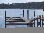
Example of a floating dock

To return to a docked boat on the BC coast after a few hours of sightseeing or shopping is sometimes a surprise for many tourists. The docks for the boats are built to float up and down on fixed pilings to accommodate the 21 foot tides (see photo left). To get onto the dock you walk up or down a ramp. A roller on the lower end rolls along the dock as the tide rises or falls. The top part of the ramp is hinged.

The tides change approximately every six hours, so if you left your boat and walked up the steep ramp to the topside dock at 10 AM (low tide) and came back at 2 PM (4 hours difference), the ramp would be almost horizontal (high tide). If you had lots of heavy groceries to move it was always a good idea to plan at what time of day you wanted to move them! Continue reading Tides

Reprint – Presentation of a Lifetime Membership from Lightkeepers UCTE Local 20232 To Jim Abram

B.C. lightkeepers honour their champion

By Kristen DouglasCampbell River Mirror
Published: September 25, 2012 2:00 PM 
Updated: September 25, 2012 2:13 PM

[media url=”http://www.youtube.com/watch?v=JN7SZCsEERY” width=”400″ height=”350″]
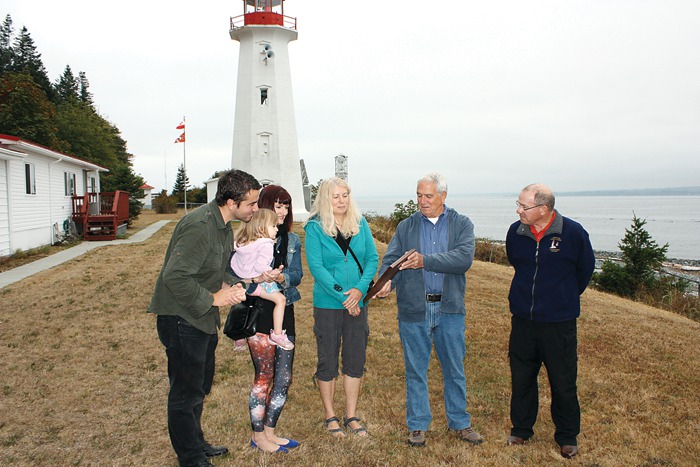
Strathcona Regional District director and former lightkeeper Jim Abram was honoured with a lifetime membership to the B.C. Lightkeepers Union Friday morning at the Cape Mudge Lighthouse on Quadra Island. Pictured from left, Abram’s son Jesse, daughter Melissa Abram, granddaughter Cleo Abram-Veloso, Abram’s wife Wendy, and Jim Abram, gather around to look at the commemorative plaque presented to Abram on behalf of the union.
 

Under cloudy skies, with the imposing Cape Mudge lighthouse looming in the background, former lightkeeper Jim Abram vowed to keep fighting for lightkeepers – the eyes and ears on the ocean. Continue reading Reprint – Presentation of a Lifetime Membership from Lightkeepers UCTE Local 20232 To Jim Abram

Because John Coldwell Has An Inquiring Mind . . .

I just recently married a lovely Filipino lady here in the Philippines. The marriage was held on the beach at the Drill Shack Resort just outside Dumaguete, Negros Oriental, Philippines – actually closer to Dauin.

While in the Dumaguete area I met a Canadian friend, Brian Waddington, who used to live on a lighthouse near to mine at McInnes Island, BC. Brian wrote on August 27, 2012 on his Blogpost:

Because John Coldwell Has An Inquiring Mind I Will Publicly Embarrass Myself And Give Him And His Bride To Be This Story As A Wedding Present

John was the senior keeper at McInnes when I became the junior keeper at Ivory. He retired after 32 years as a keeper. He now runs a truly informative website about the life of a lighthouse keeper on the west coast of Canada. If you have ever wondered about the life of a keeper click on his name.

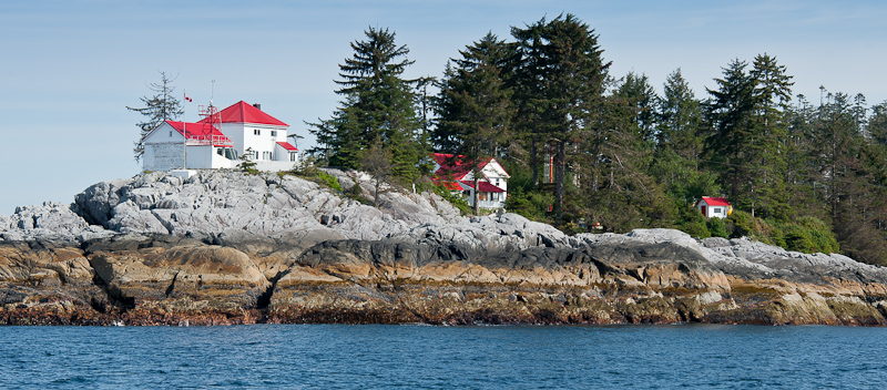
From left to right; workshop and senior keepers house, junior keeper house and garage, landing platform (red pole) control shed for hiline.

Ivory Island is a lighthouse on the north-west coast of Canada. Thirty plus years later I still dream of Ivory. To say it was a seminal time in my life is simply an understatement. Ivory was where I found the start of my spiritual path. Ivory is where the only child I have helped to conceive and father was created. I met my first two spiritual mentors while I was there. Ivory Island introduced me to the Thomas Crosby V which led me to Haisla village which allowed for the occasion where I met my future wife which is why I now live in the Philippines.

Some of my memories are sublime, some are joyous, some are mysterious but this one is just plain embarrassing. First you need a little background information. There are basically two ways to deliver anything to Ivory – helicopter or ship. Helicopter is quick and easy but not so good for heavy or bulky goods.

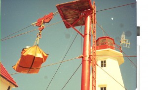
When goods are brought in by boat the cargo ship anchors, lowers the work boat and they bring the goods to where the ‘hook’ is lowered via the hi line. (look very closely at the first picture, just above the control shed you will see the hi-line running from the tall red pole down towards the water). Once the work boat crew secures the cargo to the hook it is picked up, wound in, lowered, unhooked and the hook is lowered again for the next load. Simple if everything works right not so simple when it doesn’t. This day it didn’t.

Perhaps I allowed the hook to pick up too much speed as gravity pulled it back to the water. Perhaps the stopper and the hook did not mate properly because a gust of wind moved the mechanism at a crucial point. In any case instead of doing what it was supposed to do the hook plunged into the water. Luckily this occurs with some frequency so the work boat was well clear of the rapidly descending hook. The other times this had happened I simply wound the hook in the way a fisherman reels in his line. The hook comes up sets itself properly and then I would again lower it so the work boat could hook up another load.

This time the hook snagged on something. With no way of knowing if it was snagged on a sunken log, a small easily moved rock or something worse I decided to apply a little more power and see what would happen. Bad decision! All of a sudden guy wires are snapping and the tower is starting to bend. No more cargo came ashore that day. What did come ashore a few days later was a five man work crew from Prince Rupert via helicopter with most of what was needed to fix the hi-line.

I say most… what they did not have was the bit for drilling the holes needed to do to put in the new anchoring pins. The drill bit was flown up from Victoria via helicopter. My bad choice was starting to get expensive. It got even more expensive after they had drilled four (if memory serves) five foot long 2 inch wide holes for the pins and then spent a day or two trying to hammer the 2 inch steel pins into the 2 inch holes.

For the next few days the work crew enjoyed a mini vacation while they waited for the proper sized drill bit. It is just possible that this had become such an embarrassment of errors to one and all concerned that they could not fire me without firing some bosses too. In any case I was and am ever so thankful I wasn’t fired.

There you are John my wedding gift to you, your future wife and your web site. Hope you can use it and it brings a smile to your face.

*******************************

Thanks Brian. We could not have had a better wedding gift!

A Lighthouse at Night


One of the nicest things about night shift on McInnes Island lighthouse was observing the sky on a clear night. It was always the same, and always different.

The same stars were always there, but the moon waxed and waned, comets streaked across at intervals, sometimes an airplane’s navigation lights blinked in the south, or sometimes the Northern Lights flashed in the north. Below are some more shots.

[nggallery id=66]

One of the problems with seeing such sights in the city is the city lights, often called light pollution. The graphic below ill show you what is seen and not seen as light pollution decreases.

I must confess, that is what the night sky looks like at night from a lighthouse, but not having a photo from my experiences on McInnes lighthouse as my camera was too amateurish for such detail, I added the lighthouse silhouette to the photos from the gallery below. Are the photos below fantastic or not?

[nggallery id=67]


But, when looking at the full-sized photo at the top, turn off your lights and imagine what it was like. Sometimes we would take a foam mat and lay down on the helicopter pad and just watch the night sky. It was fascinating. For meteor showers and comets it was unbeatable. Continue reading A Lighthouse at Night

Reprint – A Light on the Past

A light on the past

with permission from Rosalind Duane, North Shore News, August 05, 2012

Elaine Graham remains the only resident among the historical buildings at Point Atkinson Lighthouse. Photograph by: NEWS photo, Lisa King

ELAINE Graham was raised in the slums of London, far from the multi-hued green of nature.

“There was nothing on my street when I was growing up,” she recalls. “I had lots of play-friends, loads of kids to play with, but there wasn’t even a geranium on a windowsill.”

Many years later, Graham is now surrounded by 75 hectares of the largest first-growth stand of coastal-elevation trees in the Lower Mainland. Her home is nestled among the remaining structures at the base of Point Atkinson Lighthouse, which stands on a craggy promontory at the edge of Lighthouse Park in West Vancouver.

She has spent half her life here, and is eager to tell the story of her neck of the woods.

Graham moved to the Point Atkinson Lighthouse station with her husband Donald and two young sons in 1980. Donald became the last of the lighthouse keepers at the site (along with senior keeper Gerry Watson) when the lighthouse was automated in 1996.

The Grahams stayed on in one of the two keeper’s houses, she as a park attendant and he as a groundskeeper. Continue reading Reprint – A Light on the Past