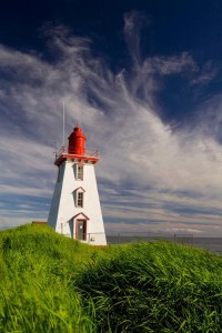
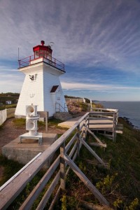
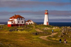
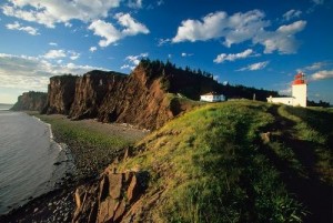
Category Archives: Heritage Lighthouse Protection Act

Some Canadian Lighthouses Granted Heritage Status

Parks Canada has released a list of 74 lighthouses that have been granted heritage status.Here’s the list of lighthouses:
British Columbia (21)
Active Pass on Mayne Island.
Boat Bluff on Sarah Island in the Kitimat-Stikine area.
Cape Beale in the Alberni-Clayoquot Regional District.
Cape Mudge on Quadra Island.
Carmanah Point in the Cowichan Valley Regional District.
Dryad Point on B.C.’s Central Coast.
East Point on Saturna Island
Egg Island at Port Hardy.
Entrance Island at Nanaimo.
Estevan Point on Vancouver Island.
Fisgard at Colwood.
Green Island at Prince Rupert.
Langara Point at Masset.
McInnes Island on Milbanke Sound near Kitimat.
Merry Island along the Sunshine Coast.
Nootka at Yuquot, Vancouver Island.
Pachena Point in the Alberni-Clayoquot Regional District.
Pulteney Point at Port McNeill.
Sheringham Point at Shirley on Vancouver Island.
Trial Islands at Oak Bay.
Triple Islands in the Skeena-Queen Charlotte area.

More info:

http://www.theglobeandmail.com/…/a-beacon-…/article25235100/

http://metronews.ca/news/canada/1415217/list-of-74-heritage-lighthouses-released/#

Shine Bright Like A Lighthouse. A Love Affair With Maritime History.

Shine Bright Like A Lighthouse. A Love Affair With Maritime History.

John Sylvester, Country Magazine May 15, 2014

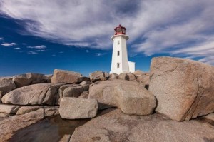
Peggy's Cove
Peggy’s Point Lighthouse (Photo: John Sylvester)

Having grown up in Nova Scotia, I have fond memories of scrambling over the curved granite whaleback rocks below my aunt’s cottage near the community of Peggy’s Cove.

Even though that’s the home of Nova Scotia’s most famous landmark, Peggy’s Point Lighthouse, I didn’t pay much attention to the lighthouse in those days. The tide pools and shallow caves of the whalebacks were more enticing. As an adult, however, I’ve grown to appreciate and cherish these beautiful beacons and the maritime tradition they represent. . . . more

See more photos and information under his story in Country Magazine called Lighthouse Preservation in Atlantic Coast Canada

Editor’s Note: Find additional information on Quebec, Newfoundland and Prince Edward Island lighthouses, along with ideas for exploring the surrounding towns, right here on our blog!

And be sure to read John Sylvester’s new eBook: A Photographer’s Guide to Prince Edward Island, a downloadable PDF for mobile devices, available at: www.photographersguidetopei.com.

[private]

As long as humans have sailed the oceans, we’ve needed navigational aids to warn of hidden shoals and dangerous headlands. The earliest warning lights were coastal bonfires. The first known lighthouse was built at Alexandria, Egypt, around 280 B.C. The British built North America’s first one at the entrance to Boston Harbor in 1716. The French ­followed 15 years later with Canada’s first lighthouse near their fortress at ­Louisbourg on what is now Nova Scotia’s Cape Breton Island.

John Sylvester_01
Peggy’s Point Lighthouse (Photo: John Sylvester)

In sailing’s golden age, from the 1700s to the mid-19th century, lighthouses proliferated along the Atlantic coast. In Atlantic Canada alone, nearly 500 still stand along 33,000 miles of mainland and island coastline. A few miles up the coast from Peggy’s Cove, North America’s oldest continuously operating light, Sambro Island Lighthouse, stands on a tiny granite outcrop at the entrance to Halifax Harbor. Built in 1758, its eye-catching 80-foot red-and-white tower has been the first sign of land seen by countless sailors, immigrants and ocean liner passengers—including the Titanic survivors—as they approached the safety of landfall.

During the heyday of maritime activity, lighthouse keepers and their families lived in homes either attached to or close by the lighthouse. They often had to fend for themselves in isolated circumstances, growing a garden and raising livestock in addition to their full-time duties tending the light. Every evening, in fair weather or foul, the light keeper climbed a narrow, winding staircase to the top of the tower to light the lamp, located behind a powerful Fresnel lens that magnified and ­transmitted the beam far out to sea.

Light keepers eventually lost their jobs to automation, and in recent years sophisticated GPS navigation systems have rendered lighthouses redundant. Some have fallen into disrepair, but many have been rescued by local preservation or historical societies and converted into museums or tourist attractions.

Thanks to broad grassroots support, the federal government passed an act encouraging lighthouse preservation. But Natalie Bull, executive director of Heritage Canada The National Trust, notes that the legislation ultimately says it’s up to communities to protect their lighthouses.

John Sylvester_02
Bay of Fundy Lighthouse (Photo: John Sylvester)

“It’s very challenging, but residents of the Maritime Provinces are resourceful,” she adds. “Community groups have long been willing to take on these preservation projects, even before the act passed. New Brunswick’s Cape Enrage Lighthouse is a great example.”

The Cape Enrage keepers house was slated to be torn down when, in 1993, a group of local high school kids and their physics teacher started renovating it. Two years later the Coast Guard transfered ownership to the province, and the site is now the hub of a thriving adventure tourism destination that includes kayaking, rock climbing and horseback riding.

The wonderful thing about lighthouses, of course, is that they’re invariably built on beautiful coastal stretches. Some have been converted into inns where you can rent a room overlooking the ocean, listen to the waves lapping the shore and imagine life in a bygone era. You can now find lighthouse inns in all five of the provinces on Canada’s Atlantic Coast.

John Sylvester_03
Quirpon Island Lighthouse (Photo: John Sylvester)

A few years ago I clambered into a small fishing boat that transported me to remote Quirpon Island off the north coast of Newfoundland, where I stayed in a cozy inn that was a former light keeper’s cottage. I spent two glorious days exploring the island, watching whales and sculpted icebergs drift by, and being pampered with Newfoundland’s renowned hospitality.

But even when I can’t spend the night, I rarely pass up a chance to visit one of these inviting beacons. On a recent trip to Nova Scotia, my wife and I drove out to Peggy’s Point Lighthouse on a beautiful autumn day. We joined tourists from all over the world wandering among the same whaleback rocks that fascinated me as a child.

We lingered through the afternoon, enjoying the timeless wonder of waves breaking on the rocks and sunlight sparkling off the ocean while one of Canada’s most beloved symbols of a proud seafaring tradition stood watch. And this time, I knew enough to appreciate it.

John Sylvester is an author and photographer based in Prince Edward Island, Canada. He specializes in photographing the people and places of Canada, and has published extensively on the Atlantic region, including the great lighthouses.

John Sylvester_04
Cape d’Or Lighthouse (Photo: John Sylvester)


John Sylvester_05
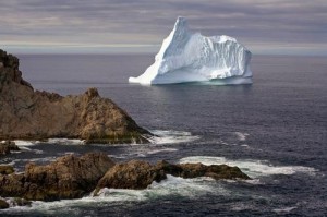
An ice flow off Newfoundland (Photo: John Sylvester)


John Sylvester_06
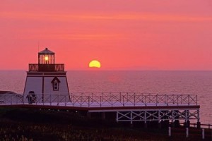
Sunset at Fortune Head Lighthouse (Photo: John Sylvester)

[nggallery id=96]

[/private]

Machias Seal Island – An Ongoing Border Dispute Between the United States and Canada

I have mentioned Machias Seal Island before in my articles here, here, here, and here.

Well writer John Farrier published on Neatorama on Tuesday, April 22, 2014 a great article about how MAJOR/insignificant this dispute really is!

1398212464-0

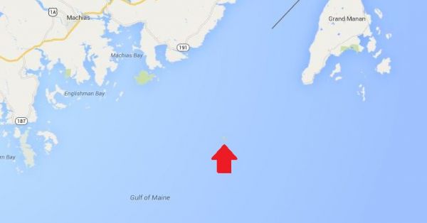
(Maps: Google Maps)

This is Machias Seal Island, a 20-acre island in the Bay of Fundy.

You can’t see it? Let’s zoom in.

And from there the story continues! Such an insignificant island for such a big debate. That is government for you. Naturally it belongs to Canada! . . . more

[private]

1398212464-1

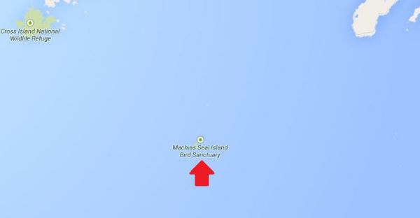
Hmm. That doesn’t help much. Let’s zoom in some more.
1398212874-0

There it is! It’s a speck of land that barely appears on the map.

1398212874-1
(Photo: Albnd)

You can see the lighthouse in the photo above. The island is inhabited by 2 human lighthouse keepers, a few seals…

1398212874-2

(Photo: Thomas O’Neil)

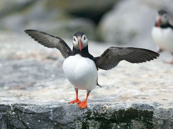
…and lots and lots of puffins.

The ownership of Machias Seal Island is disputed by the United States and Canada. Canada is in physical possession of it, but the United States has not formally dropped its claim to the island.

I’ve previously written several posts about the development of the US-Canadian border, whichincludes weird exclaves. Ambiguity about the border even led to the creation of 2 short-lived nations.

1398213788-0

(Painting by Benjamin West of the American delegation at the Treaty of Paris)

Although the United States and Canada now maintain a long, peaceful border, the placement of that border has been in doubt since the Treaty of Paris (1783) in which Britain recognized the United States as an independent nation. That treaty attempted to draw borders over unexplored lands. The authors did the best that they could with their knowledge of geography. But, alas, one of the descriptions for the border between Maine and maritime Canada was problematic. The treaty says that US territory includes:

all Islands within twenty Leagues of any Part of the Shores of the United States, and lying between Lines to be drawn due East from the Points where the aforesaid Boundaries between Nova Scotia on the one Part and East Florida on the other shall, respectively, touch the Bay of Fundy and the Atlantic Ocean, excepting such Islands as now are or heretofore have been within the limits of the said Province of Nova Scotia.

I’ve bolded the parts of the text that are the source for the Machias Seal Island dispute.

As I’ve mentioned in a previous post, the eastern border of Maine was of great concern to the British. Some British officials coveted what Americans saw as their territory, and vice versa. Control of the Bay of Fundy was of great importance to British commissioners at the Treaty of Ghent (1814), which ended the War of 1812.

1398215328-0

(Photo: Thomas O’Neil)

Now back to Machias Seal Island. The American argument is that it lies within 20 leagues (approximately 69 miles) of the coast of the United States.

The Canadian argument is that a land grant that pre-exists the Treaty of Paris defines the island as part of Nova Scotia. It built and has operated a lighthouse on the island since 1832.

Occasionally fishermen from the 2 nations have gotten into scraps about its ownership. Some Canadian citizens have staked mining claims to the island as a means of asserting Canadian sovereignty. The State of Maine has included the island on its maps of electoral districts.

But if possession is indeed 9/10ths of the law, then Machias Seal Island is Canadian. The United States has chosen not to press the issue.

Sources:
Clark, Edie. “Barna Norton Invades Canada.” Yankee 62.6 (1998): 48. Biography Reference Bank (H.W. Wilson). Web. 22 Apr. 2014.

Guo, Rongxing. Territorial Disputes and Resource Management: A Sourcebook. New York: Nova Science Publishers, 2007. Web. Google Books. 22 Apr. 2014.

Kelly, Stephen R. “Good Neighbors, Bad Border.” New York Times, Late Edition (East Coast) ed. Nov 27 2012. ProQuest. Web. 22 Apr. 2014 .

RELATED NEATORAMA POSTS

[/private]


Mise Tales Thirty-Five


For an update on what a Mise Tale is then please see Mise Tales One.

Britain StormsJanuary 07, 2014 – People watch and photograph enormous waves as they break, on Porthcawl harbour, South Wales, Monday Jan. 6, 2014. (AP Photo/PA, Ben Birchall) . . . more

[private]

LONDON — What used to be Winter Storm Hercules has moved across the Atlantic and is now hammering the United Kingdom with high winds and winter weather.. Britain’s western coast is being lashed by high winds and strong rains following a month of unusually frequent winter storms.

A steady procession of storms has battered the island nation over the past few weeks, making December the windiest since 1969. Monster waves up to 27 feet (8.3 meters) high washed across the British coast on Monday, prompting evacuations and rescues.

“This latest storm actually originated as Winter Storm Hercules in the U.S. just after the New Year’s holiday,” said weather.com Senior Meteorologist Jon Erdman.

(MORE: Dangerously Cold Temperatures Hit U.S.)

The nearly non-stop storms have crumbled long-standing sea cliffs and damaged waterfronts.

“It’s been one after the other with no break,” Nicola Maxey, a spokeswoman for Britain’s Meteorological Office, said Tuesday.

More than 100 flood warnings remain across England and Wales.

“This latest Atlantic storm will slowly wind down and weaken over the Norwegian Sea off Scandinavia through Tuesday, giving way to a well-deserve reprieve from the stormy barrage the rest of the work week,” said Erdman.

Heavy winds and rain have also battered the French coast, driving large waves into southwestern town of Biarritz on Tuesday. [/private]

************************ Continue reading Mise Tales Thirty-Five

Lighthouses of Prince Edward Island

Prince Edward Island Lighthouse Society

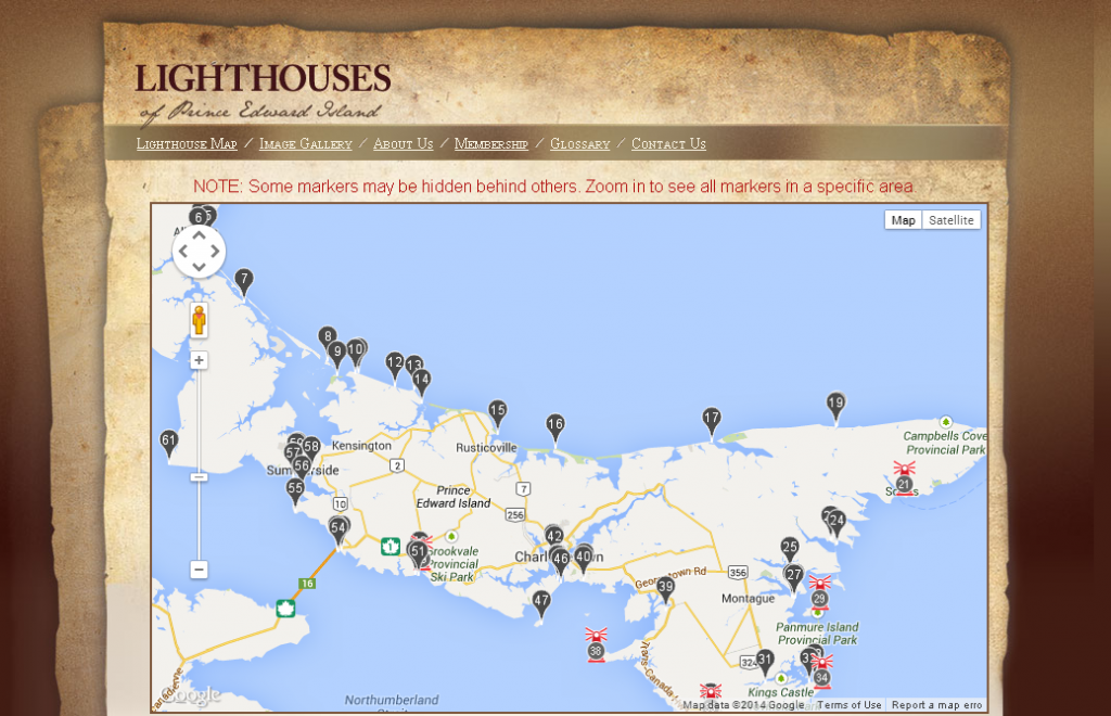
 Click on the partial map for the website.

From the Prince Edward Island Lighthouse Society comes this beautiful descriptive map of ALL the lighthouses (manned and automated) on Prince Edward Island (aka PEI), the smallest of Canada’s provinces. It consists of the main island and 231 minor islands. Altogether the entire province has a land area of 5,685.73 km2 (2,195.27 sq mi). (Wiki) Continue reading Lighthouses of Prince Edward Island

Mise Tales Twenty-Six


For an update on what a Mise Tale is then please see Mise Tales One.

August 26, 2013 Vancouver Sun

Keeping the light on at Point Atkinson

Pt.Atkinson

 When the Point Atkinson lighthouse was built 130 years ago, it was designed to protect shippers in the Strait of Georgia. Now the lighthouse itself is in need of a benefactor. . . . more


[private] Keeping the light on at Point Atkinson


 VANCOUVER SUN AUGUST 26, 2013
  
Keeping the light on at Point Atkinson
 

The Point Atkinson Lighthouse at Lighthouse Park in West Vancouver stands guard at the mouth of Burrard Inlet May 11, 2004.

Photograph by: RIC ERNST , PNG

When the Point Atkinson lighthouse was built 130 years ago, it was designed to protect shippers in the Strait of Georgia. Now the lighthouse itself is in need of a benefactor.

The Department of Fisheries and Oceans and the District of West Vancouver are discussing ways to put the lighthouse into the hands of the community after Point Atkinson — along with 18 other B.C. lighthouses — was deemed “surplus” to the federal government’s needs three years ago and offered up for sale or transfer.

“In reflection, (the federal government) realized some of the national historic sites aren’t going to go to the highest bidder,” said Brent Leigh, deputy chief administrative officer at the District of West Vancouver, which has a co-management agreement with the government to maintain the lighthouse.

“They expect to work with the district in a community-based program that would ensure that we retain community use … Point Atkinson is one of our most beloved community assets.”

Originally built on a rocky cliff in 1875, the lighthouse has been more than just a beacon of hope for shippers over the centuries. It has also recorded a series of historical firsts as time went on, as chronicled in the book Keepers of the Light, written by one of the last lightkeepers, Donald Graham:

1774: Captain Vancouver rows past the point and names it for a ”particular friend.”

1872: The Marine Department awards contract to Arthur Finney to build the lighthouse.

1875: New lighthouse exhibits fixed white light illuminated by two coal oil lamps and silver-plated copper reflectors.

1875: Edwin Woodward and his wife land at the station.

1876: James Atkinson Woodward, the first white child born in West Vancouver, is born there.

1881: 185-acre park created as a Lighthouse Reserve.

1889: Scotch siren fog signal, powered by a coal-generated steam plant installed to help shippers navigate the fog.

1912: Original tower replaced by 60-foot-high concrete tower. Light replaced by a vaporized oil lamp.

1960: Vaporized oil lamp replaced by electric light bulb.

1994: Lighthouse designated a National Historic Site.

1996: Point Atkinson refitted with an automated solar-powered light.

Donald Graham and Gerry Watson were the last lightkeepers. Graham’s wife Elaine still lives in the cottage at Lighthouse Park.

With files from Canadian Lightkeepers Association website

© Copyright (c) The Vancouver Sun [/private]
 
*************************** Continue reading Mise Tales Twenty-Six

Lightkeepers to the Rescue – AGAIN!


This is a past and very notable lifesaving rescue by two BC lightkeepers, Lynn Hauer and assistant lightkeeper Wolfgang Luebke who were at Chatham Point lighthouse at the time.

******************************

Chatham point lighthouse - photo from Margaret Lutz

We sleep with the radios always on, and ‘with one ear open’.

At 3 AM on April 30, 2012 I was awakened by the unmistakeable sound of a Mayday distress signal. Being able to copy both sides of the communication, I knew it was within our response area. I sprang out of bed. Comox Coast Guard Radio was responding to the call from a very concerned woman, “We don’t have a lifeboat; we are putting our life jackets on now. We are bailing but it isn’t helping!!”

I knew we could be there in 10 to 20 minutes; we were tasked by Rescue Coordination Center. Assistant lightkeeper Wolfgang Luebke and I responded in our 18 foot aluminum station boat. It was pitch black out, and raining. We made our way by compass bearing, across Johnstone Strait into Burgess Passage.

Arriving on scene, we found a man and woman frantically bailing water with ice cream pails! Their bilge pump was inoperative. Their efforts were futile. Their ‘kicker’ motor was under water, and the large outboard was next. Water was pouring in around the re-boarding gate and inches from flooding completely over the transom, which would have seen them go down in minutes. We began pumping the water out of their vessel, with the Honda pump that is always stored under the seat of our station boat. We were all very relieved to see the flood water level slowly subsiding.

Cape Palmerston

The Cape Palmerston (CG SAR vessel) arrived on scene approximately 40 minutes after us. We saved an $80K boat from going to the bottom, and we surely saved a man and his wife from drowning; they would have been in that frigid water with only PFDs, for more than a half hour, had two keepers from Chatham Point Light not been there…we wouldn’t have been there if not for your SEEING THE LIGHT!

Lynn Hauer

*************************************

This letter was from from Lynn Hauer, a lightkeeper at Chatham Point and it was addressed to Canadian senator Nancy Greene, hence the reference to Seeing the Light. Senator Greene and her friends were very important in fighting to keep BC lighthouses manned. If unmanned, these people would probably have died. Many instances happen daily where a BC lightkeeper helps a mariner. Many of them you will never read about as they go into station reports and are lost in the central Coast Guard office paperwork – well, not actually lost, just suppressed.

The only way for the lightkeepers to get attention is to report their rescues to the Press (forbidden) or have it written up by myself, or other people outside the arm of Coast Guard censorship.

As Lynn said in a preface to the email she passed around to the lighthouse keepers:

It is important to keep the Senators up to speed of things that are going on. They support lightkeepers (LKs), we should keep them in the loop. They and the public recognize and care about what LKs do.

***************************

The following emails show how the email  was received by Senator Greene.

Dear Lynn,

First, thank you for your quick action!  You are so right.
Thanks also for passing this on to me. I will circulate it as best I can.
All the best!
Nancy
 

Thank you so much Nancy.
Your recognition means very much to Wolfgang and I. The thank you that we received from the couple that night, we extend to you.

Lynn, Ann, and Thyr


Chris Mills – Canadian Lighthouse Photographs


Canadian Lighthouse Photographs

New website is coming.
http://www3.ns.sympatico.ca/ketm/
is no longer online


Chris Mills
1121 Ketch Harbour Rd.
Ketch Harbour, Nova Scotia  B3V 1K7


British Columbia | Nova Scotia | Prince Edward Island | New Brunswick | Newfoundland

Chris Mills served as a lighthouse keeper for the Canadian Coast Guard on both the Atlantic and Pacific coasts.

He is currently co-chair of a committee which is recruiting Members of Parliament in support of a private members bill to protect lighthouses.  To see how you can help, visit this site:  Canada Needs a Lighthouse Protection Act.

Photographs and enlargements are for sale. Contact Chris Mills for price information.
All photographs and slides in the collection are identified, dated and signed.

Chris Mills is also author of the book on Nova Scotia lighthouses Lighthouse Legacies available from Amazon.ca


Sambro Island restoration project


BRITISH COLUMBIA

Some of these photos may be viewed at the Lighthouses of British Columbia site.

Green Island (1994, 1995) 250 colour photos, 70 colour slides in collection. All aspects of the station and island documented — aerial views, sea views, night views, details of light and lighthouse, lightkeepers, Coast Guard helicopters, surrounding islands and seascapes.


Langara Island (1994, 1996) 250 colour and 25 black and white photos, 180 colour slides in collection. All aspects of station documented — aerial views, night views, detailed views of 1913 First Order Fresnel Lens (manufactured by Chance Brothers), light tower and lantern, lightkeepers, dwellings, interior of engine room, old cabin on island, face carved in tree, shoreline views, lightkeeper’s goats, stormy seas.


Triple Island (1994) 24 colour photos in collection. Aerial views, third order Fresnel lens, lightkeeper, detailed views of lighthouse structure, interior of workshop and engine room.


Bonilla Island (1994) 250 colour photos in collection. Many aspects of station — aerial views, sea views, night views, shoreline views (including Japanese glass fishing floats), lightkeepers, dwellings, engine room interior, light tower. (NOTE: this collection will be expanded during Sept/Oct 1996)


Boat Bluff (1994-1996) 160 colour photos in collection. All aspects of station — aerial views, sea views, night views, details of light tower, fog horns , engine room, main light (including views of keeper inspecting light at night, inspection of light and bulbs during day), views of station and mountains from 1000 foot hill across the channel from lightstation, snow views, old hand fog horn, three modern plastic lenses, sunrise views, surrounding bays and inlets, Santa and Mrs. Claus visit 1994. (NOTE: Available as of Dec. 1996 — selection of a further 200 colour and b&w prints taken during August 1996, including Coast Guard ship and work crews supplying station.)


Ivory Island (1994-1996) 600+ colour and 36 black and white photos, 100 colour slides in collection. All aspects of the lightstation — 30 aerial views, sea views, night views, lighthouse, keepers, dwellings inside and out, engine room, main light, surrounding area, beaches, salmon fishing, snow, totem poles, artist and photographer at work at the lightstation, Coast Guard helicopters, sunsets, shoreline and forest, various tidal life (sea stars, crabs, etc.), local minor beacon lights, 25th annual Santa and Mrs. Claus visit December 1995.


McInnes Island (1994, 1995) 48 colour photos, 22 colour slides in collection. Aerial views, lighthouse structure, radio room, keeper, detail of lantern and main light, large thunder cloud formations.


Dryad Point (1995) 32 colour photos in collection. Aerial views, light tower, main light, keeper and daughter, keeper and main light, dwelling. (NOTE: This collection will be expanded during 1997)


Addenbroke Island (1994) 14 colour photos in collection. Aerial views.


Egg Island (1994) 10 colour photos in collection. Aerial views.


Pine Island (1994) 3 colour photos in collection. Aerial views.


Scarlett Point (1994) 2 colour photos. Aerial views.


Point Atkinson (1994) 14 black and white photos in collection. Light tower, keeper and main light, station dwellings and exterior of radio/engine room.


Brockton Point (1994) 5 black and white photos in collection. Light tower.


Porlier Pass (1994) 32 colour photos in collection. Two light towers (Porlier is a range light station), main lights, boat and boathouse, lightkeeper, dwelling, interior engine room and fog horn building, Coast Guard hovercraft. (NOTE: The old front range light was demolished Feb. 1996 and replaced by a fibreglass tower and the lighthouse was automated shortly after.)


Fisgard (1994) 6 colour, 2 black and white photos in collection. Light tower and detail of gothic style window in old keepers dwelling.


Sheringham Point (1994, 1995) 20 colour photos in collection. Light tower, abandoned dwelling, sunset, old Fresnel lens at local museum.


Amphitrite Point (1995) 9 colour slides in collection (prints available). Lighthouse structure, old keepers dwelling.


Lennard Island (1995) 52 colour photos, 25 colour slides in collection. Traveling to island by boat, keeper in boat, keeper in lighthouse, keeper and wife on station grounds, dwellings, radio room, engine room, details of two fog horn systems, including traditional diaphone horn taken out of service Oct. 1995, light tower, station grounds.


Cape Scott (1996) 23 colour photos in collection. Aerial views.
NOVA SCOTIA

Some of these photos may be viewed at the Nova Scotia Lighthouse Preservation Society site.

Baccaro Point
Bear River
Beaver Island
Black Rock Point
 (new lighthouse)

Black Rock Point (old lighthouse)
Boar’s Head
Brier Island
Cape Forchu
Cape George
Cape Sable
Chebucto Head
Fort Point
 (LaHave River)

Fort Point (Liverpool)
Fourchu Head
Gabarus
George’s Island
Grand Passage
Hampton
 (Chute Cove)

Horton Bluff
Jerome Pont
Louisbourg
Low Point
Maugher’s Beach
Medway Head
Peggy’s Cove
Point Aconi
Port Greville
 (old light, now at Canadian Coast Guard College, Point Edward, N.S.)

Port Medway
Prim Point
Rouse Point
Sable Island
 (east light)

Sable Island (west light)
Sambro Island
Scatarie Island
Schafner Point
Seal Island
Sydney Range
 (front light)

Sydney Range (rear light)
Western Head
Battery Point
Betty’s Island
Canso Locks
Cross Island
 (comprehensive collection including automation day)

Eddy Point
Mosher’s Island
Seal Island
 (comprehensive collection)

Seal Island Lighthouse Museum

PRINCE EDWARD ISLAND

Blockhouse Point
Borden Range
 (front light)

Borden Range (rear light)
Cape Bear
Cape Tryon
Brighton Beach Range
 (front light)

Brighton Beach Range (rear light)
East Point
Murray Harbour Range
 (front light)

New London Range (rear light)
North Rustico
Panmure Island
Point Prim
Souris East
Summerside Range
 (front light)

Summerside Range (rear light)
Woods Islands
Woods Islands Range
 (front light)

Woods Islands Range (rear light)

NEW BRUNSWICK

Cape Spencer
Cape Tormentine
Fish Fluke Point
 (Grand Harbour)

Gannet Rock (comprehensive collection: 700+ prints and slides)
Great Duck Island
East Quoddy
 (Head Harbour)

Letite
Long Eddy
Long Point
Machias Seal Island
 (comprehensive collection)

Mulholland Point
Southwest Head
Swallowtail

NEWFOUNDLAND

Cape Anguille
Cape Ray
Cape Saint Francis
 (dwelling only)

Cape Saint Mary’s
Cape Spear
Lobster Cove Head
Rose Blanche
 (old stone lighthouse)

Three More Lighthouses Saved! Sadly not Canadian

New status shines light on landmark from UK News Guardian

Published on Thursday 10 May 2012 09:29

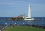
A coastal landmark on the borough coastline has been declared a listed building to help preserve it for future generations.

St Mary's lighthouse

St Mary’s Lighthouse, a popular destination for sightseers and school trips, has been given grade II-listed status by English Heritage.

The 19th century tower and adjoining cottages host more than 80,000 visitors a year.

Officials at English Heritage decided to list the lighthouse, keeper’s and fishermen’s cottages because of their historic and architectural interest.

A spokesperson for English Heritage said: “The late 19th century lighthouse and associated cottages have been designated at grade II. More ->

******************************** Continue reading Three More Lighthouses Saved! Sadly not Canadian