Category Archives: Information

Mise Tales Thirty-Six


For an update on what a Mise Tale is then please see Mise Tales One.

*****************************

[youtube url=”http://youtu.be/b3e7CDg8a3g”]

Here is a great video taken on board the Coast Guard ship CCGS Sir Wilfred Laurier as it services the mountain-top radio sites using the onboard helicopter. Great shots of the Queen Charlotte Islands (Haida Gwai) and the old lighthouse and radio station at Cape St. James.

It is titled on Youtube as the “Big Red Restaurant“!

**************************** Continue reading Mise Tales Thirty-Six

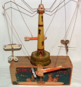
Early 1900’s Tin Lighthouse Windup Toy with Four Airplanes

$_3This item appeared on ebay recently and became an instant hit. On the ebawebsite it was described as:

DESCRIPTION: This is a very unusual and rare early aviation airplane toy called “Light-house Aero-Planes”. It is marked on the toy and box “Mfgd. By Valentine Sandberg N.Y. Pat. Appd. For”. Included is a partial original box, lighthouse tower, 4 airplanes, and all parts needed to assemble it. When wound Continue reading Early 1900’s Tin Lighthouse Windup Toy with Four Airplanes

Learning From Nature – Improving LEDs

This is NOT a religious rant so please bear with me.

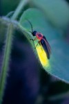
FireflyTwo Jehovah’s Witnesses dropped by the other day and left after a short time, leaving me with copies of their two publications – Awake! and The Watchtower.

As I deposited them on the kitchen table I noticed on the back page of the February 2014 issue of Awake! a story entitled The Lantern of the Photuris Firefly.

Well naturally the word lantern caught my eye plus the fact that fireflies are prevalent in the Philippines where I am living right now.

Interesting story, and very interesting how scientists adapted it to modern day Light Emitting Diode (LED) technology which is used in your el-cheapo flashlights up to modern high-intensity LEDs for beacons and marker lamps of all sorts used in lighthouses and light beacons. Continue reading Learning From Nature – Improving LEDs

Mise Tales Thirty-Five


For an update on what a Mise Tale is then please see Mise Tales One.

Britain StormsJanuary 07, 2014 – People watch and photograph enormous waves as they break, on Porthcawl harbour, South Wales, Monday Jan. 6, 2014. (AP Photo/PA, Ben Birchall) . . . more

[private]

LONDON — What used to be Winter Storm Hercules has moved across the Atlantic and is now hammering the United Kingdom with high winds and winter weather.. Britain’s western coast is being lashed by high winds and strong rains following a month of unusually frequent winter storms.

A steady procession of storms has battered the island nation over the past few weeks, making December the windiest since 1969. Monster waves up to 27 feet (8.3 meters) high washed across the British coast on Monday, prompting evacuations and rescues.

“This latest storm actually originated as Winter Storm Hercules in the U.S. just after the New Year’s holiday,” said weather.com Senior Meteorologist Jon Erdman.

(MORE: Dangerously Cold Temperatures Hit U.S.)

The nearly non-stop storms have crumbled long-standing sea cliffs and damaged waterfronts.

“It’s been one after the other with no break,” Nicola Maxey, a spokeswoman for Britain’s Meteorological Office, said Tuesday.

More than 100 flood warnings remain across England and Wales.

“This latest Atlantic storm will slowly wind down and weaken over the Norwegian Sea off Scandinavia through Tuesday, giving way to a well-deserve reprieve from the stormy barrage the rest of the work week,” said Erdman.

Heavy winds and rain have also battered the French coast, driving large waves into southwestern town of Biarritz on Tuesday. [/private]

************************ Continue reading Mise Tales Thirty-Five

Animated Map of Global Wind Conditions

One of the duties of a lighthouse keeper is the reporting of the weather for the boats, aircraft and also for forecasting. One of the things reported is the wind speed. From all around the world the wind speed is recorded and reported from countless weather stations.

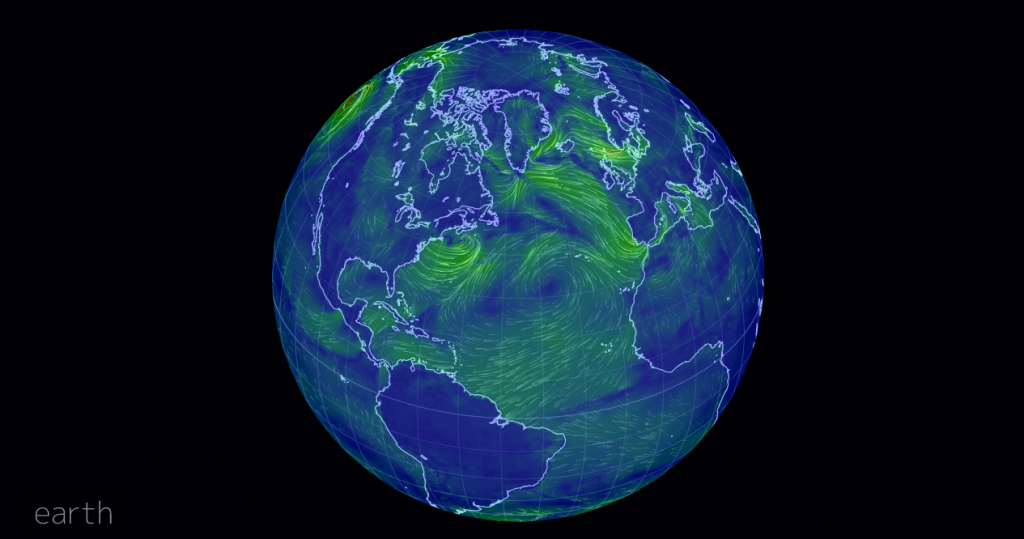
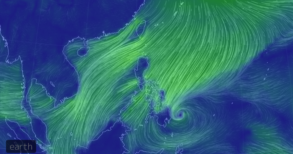
Below are two screenshots of a new webpage showing a:

Visualization of global weather conditions as forecast by supercomputers. Weather data, generated from numerical models at Earth.NullSchool.net,…

earth wind map_01
Earth wind map showing winds over the Atlantic Ocean


earth wind map_02
Earth wind map showing winds around the Philippines, with special consideration for the Tropical Depression in the lower right (the tight swirl)

The photos above are static screen shots – the website is live! Navigate around just like in Google Earth using your mouse and the scroll wheel. Zoom in, zoom out. Enjoy!


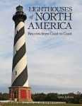
Book – Lighthouses of North America – Beacons from Coast to Coast

Lighthouses of North America – Beacons from Coast to Coast

The majority of lighthouses shown in this book are American, but as a friend of mine wrote:

I received a lighthouse book for Christmas – from an ex -lighthouse keeper and I groaned when I opened the parcel. “Oh yes, forty photos of Portland bloody Head I suppose.”  No, well yes, a couple, but Canadian lights and British Columbia lights –  4 pages on West Vancouver’s Pt. Atkinson, plus photo of Cape Mudge, and for comic relief Brockton Point (Stanley Park). – thanks JDR

So, not all bad news. The book is not coffee table format so it will fit easily on your bookshelf.

9781770852495Lighthouses of North America – Beacons from Coast to Coast

by Sylke Jackson and published by Firefly Books

320 pages, 8 1/2″ X 11″ X 1″
300 color photos, resources, index
EAN: 9781770852495
ISBN: [ 1770852492 ]
plastic-laminated hardcover
$35.00 CDN / $35.00 US Continue reading Book – Lighthouses of North America – Beacons from Coast to Coast

Mise Tales Thirty-Four


For an update on what a Mise Tale is then please see Mise Tales One.

Jaw-dropping animated video on overfishing… It’s time for change!

 ****************************

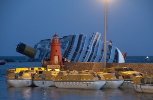
The Costa Concordia rests on its side on the morning of January 14, 2012.

 The Costa Concordia rests on its side on the morning of January 14, 2012 (click for larger photo)

 Yes, it is a photo of the Costa Concordia, aground on the rocks, but did anyone else notice the lighthouse in the photo under which the lifeboats are all clustered? See my article Lighthouses Visible in the Costa Concordia Disaster.

*************************

Aniva RockAniva rock [private]Sakhalinskaya Oblast, Russia[/private]- A formal penal island used by the Russians, Aniva was once sought after by both the Russia and Japan. This now Russian controlled territory sits uninhabited in the seas between Japan and the eastern coast of Russia.

This photo story appeared on Distractify and was entitled The 38 Most Haunting Abandoned Places On Earth. For Some Reason, I Can’t Look Away… Continue reading Mise Tales Thirty-Four

Lighthouses of Prince Edward Island

Prince Edward Island Lighthouse Society

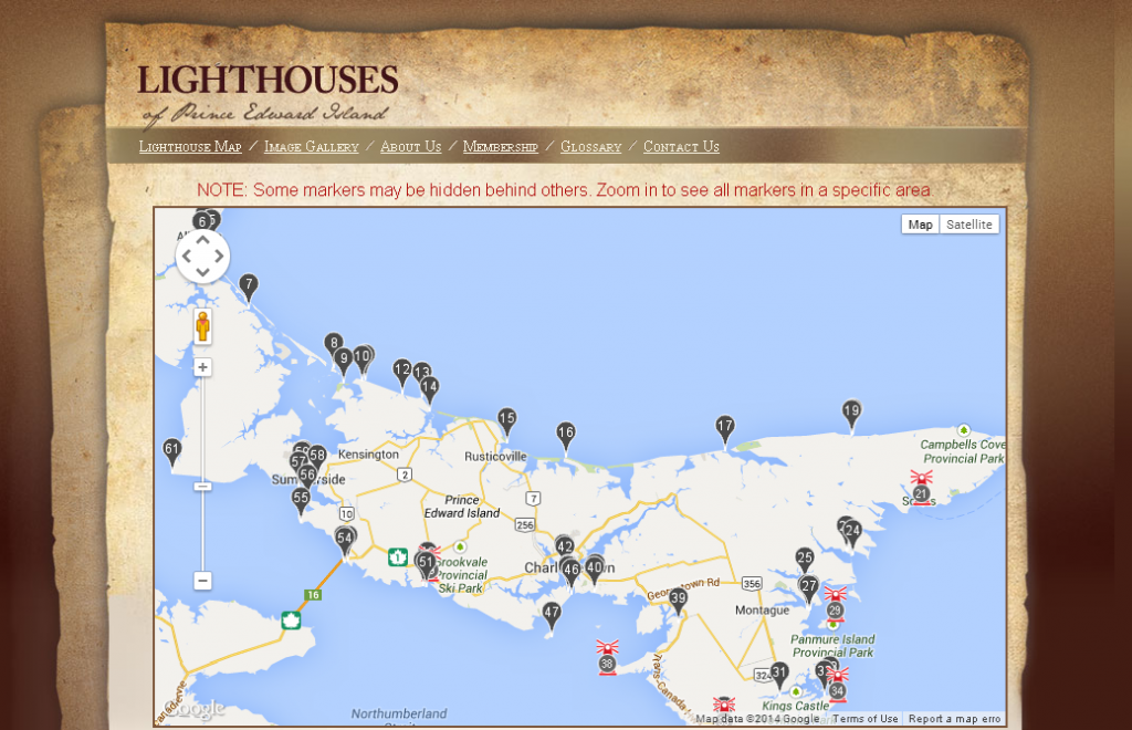
 Click on the partial map for the website.

From the Prince Edward Island Lighthouse Society comes this beautiful descriptive map of ALL the lighthouses (manned and automated) on Prince Edward Island (aka PEI), the smallest of Canada’s provinces. It consists of the main island and 231 minor islands. Altogether the entire province has a land area of 5,685.73 km2 (2,195.27 sq mi). (Wiki) Continue reading Lighthouses of Prince Edward Island

Oh No! Not Another Accident!

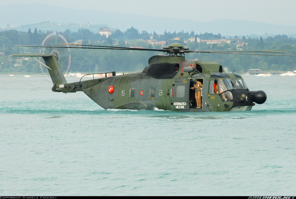
 This story could be titled Oh no, not another accident or to be more truthful How to give a helicopter a bath!

1066636

If you keep up with aviation news you may have heard about a Canadian Coast Guard (CCG) helicopter that crashed in the Arctic. Continue reading Oh No! Not Another Accident!

Fuels for Pharos

Florida Lighthouses_narrowWhat fuels did/does a lighthouse (pharos – the Greek word for lighthouse) use? I became curious about this when I discovered in an Internet  article the name Colza oil. What the heck is Colza oil? Somebody’s mispelling of Coal oil? I had to find out.

Well that led to this article on lighthouse illumination (more). I enjoyed researching it – I hope you enjoy reading it. Any additions or corrections are welcome. Please contact me.

The principal methods and types of illuminating a lighthouse are below in order of usage. The dates and equipment used are from the photo and webpage on the left. Two other excellent pages on illuminants for lamps are Illumination Sources and the lighthouse page called Pharology.

1. Open fires of wood, charcoal, tar, or coal

2. Candles of wax or tallow dips

3. Fish oil 

4. Whale oil (1720-1864) – also know as Sperm oil or Train oil

5. Vegetable oils – Colza oil used in the Argand lamp; Lard Oil (1864-1884), Olive oil, Rape oil, and Coconut oil. Rice Bran oil is also used in some lands for illumination. today

(vegetable oil vs mineral oil)

6. Mineral oil – non-vegetable oils (hydrocarbon, petroleum or paraffin oils) including white oil, liquid paraffin, and liquid petroleum used as lighting oils.

7. Manufactured fuel gas, Manufactured gas or more commonly known as just Gas – gases with such names as Coal gas, City gas, Oil gas, Illumination gas (1904-1980) derived mostly from coal, but also wood, and oil. Acetylene was another manufactured gas.

8. Kerosene (1884-1955) used as a lighting oil in the vapourized oil burners

9. Electricity (1898-now) carbon-arc lamps up to present day light-emitting diode (LED) lamps

10. Solar Continue reading Fuels for Pharos