Tag Archives: lighthouse

Mise Tales Twenty-Six


For an update on what a Mise Tale is then please see Mise Tales One.

August 26, 2013 Vancouver Sun

Keeping the light on at Point Atkinson

Pt.Atkinson

 When the Point Atkinson lighthouse was built 130 years ago, it was designed to protect shippers in the Strait of Georgia. Now the lighthouse itself is in need of a benefactor. . . . more


[private] Keeping the light on at Point Atkinson


 VANCOUVER SUN AUGUST 26, 2013
  
Keeping the light on at Point Atkinson
 

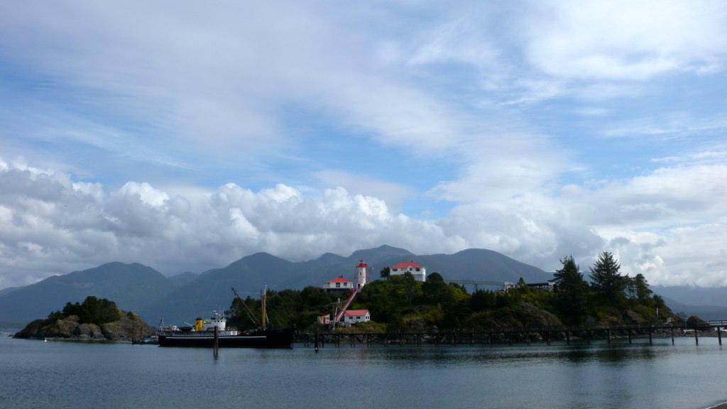
The Point Atkinson Lighthouse at Lighthouse Park in West Vancouver stands guard at the mouth of Burrard Inlet May 11, 2004.

Photograph by: RIC ERNST , PNG

When the Point Atkinson lighthouse was built 130 years ago, it was designed to protect shippers in the Strait of Georgia. Now the lighthouse itself is in need of a benefactor.

The Department of Fisheries and Oceans and the District of West Vancouver are discussing ways to put the lighthouse into the hands of the community after Point Atkinson — along with 18 other B.C. lighthouses — was deemed “surplus” to the federal government’s needs three years ago and offered up for sale or transfer.

“In reflection, (the federal government) realized some of the national historic sites aren’t going to go to the highest bidder,” said Brent Leigh, deputy chief administrative officer at the District of West Vancouver, which has a co-management agreement with the government to maintain the lighthouse.

“They expect to work with the district in a community-based program that would ensure that we retain community use … Point Atkinson is one of our most beloved community assets.”

Originally built on a rocky cliff in 1875, the lighthouse has been more than just a beacon of hope for shippers over the centuries. It has also recorded a series of historical firsts as time went on, as chronicled in the book Keepers of the Light, written by one of the last lightkeepers, Donald Graham:

1774: Captain Vancouver rows past the point and names it for a ”particular friend.”

1872: The Marine Department awards contract to Arthur Finney to build the lighthouse.

1875: New lighthouse exhibits fixed white light illuminated by two coal oil lamps and silver-plated copper reflectors.

1875: Edwin Woodward and his wife land at the station.

1876: James Atkinson Woodward, the first white child born in West Vancouver, is born there.

1881: 185-acre park created as a Lighthouse Reserve.

1889: Scotch siren fog signal, powered by a coal-generated steam plant installed to help shippers navigate the fog.

1912: Original tower replaced by 60-foot-high concrete tower. Light replaced by a vaporized oil lamp.

1960: Vaporized oil lamp replaced by electric light bulb.

1994: Lighthouse designated a National Historic Site.

1996: Point Atkinson refitted with an automated solar-powered light.

Donald Graham and Gerry Watson were the last lightkeepers. Graham’s wife Elaine still lives in the cottage at Lighthouse Park.

With files from Canadian Lightkeepers Association website

© Copyright (c) The Vancouver Sun [/private]
 
*************************** Continue reading Mise Tales Twenty-Six

Something Even Better?

alberta-fire-lookout
photo – Stuart Gradon Calgary Herald

Something Even Better than working on a lighthouse?

In an email with an ex British Columbia (BC) lighthouse keeper he mentioned that he was going to work in Alberta, Canada as a Fire Tower Lookout!

What does that have to do with lighthouses?

A lot from many people’s perspective! Both jobs have the isolation and romance that a lot of people seek in a job. When I was younger I know it was always in the back of my mind.

Again the same questions pop up – Wouldn’t it be lonely? What about wild animals? What happens if you hurt yourself? These and many more questions are asked, but to the adventurous, it is part of the adventure. Anyways, take a look at the photo at the top – that is an Alberta lookout tower but not as you or I probably imagined it – sitting on the ground!

The photo is taken from a 2011 story by Calgary Herald reporterJamie Komarnicki Mystery and mountains: A look at Alberta forest fire spottersContinue reading Something Even Better?

By-the-Wind-Sailor

VelelleOne of the things a lightkeeper notices on the shoreline are the different changes, be they strange fishing floats, bloated dead fish, defeathered seabirds, massed clumps of seaweed or the profligate carcasses of the By-the-wind-sailor.

 I had seen many beaches littered with the pale blue bodies of the By-the-wind-sailor and thinking they were the nefarious Portuguese Man o’ War I hesitated to examine them, fearful of the imagined sting I would receive. It was not until I read the article yesterday on the By-the-wind-sailor from the Monterey Bay Aquarium that I realized that I was in error in my knowledge. Continue reading By-the-Wind-Sailor

Doug Clement Photography

All photos copyright by Doug Clement Photography, and used with permission.

Doug is a professional artist, videographer and photographer. He is a lifetime resident of Victoria and has been capturing its beauty on film for over 30 years. – from the Facebook page

Lightning at Trial Island
Lightning at Trial Island © Doug Clement Photography

In my teenage years while attending High School and University, and before I moved onto the lighthouses, I lived in Victoria, British Columbia (BC), Canada (on southern Vancouver Island off the West Coast of BC). It was a delightful town to grow up in and had access to numerous beaches, parks and believe it or not, a few lighthouses, of which I was not interested at that time.

Just recently on Facebook I have seen some wonderful photography of the lighthouses in and around Victoria, BC by Doug Clement. He has given me permission to publish them here, I hope that in your first or next trip to Victoria, you get a chance to see these places. If not, please admire them in the photos by Doug Clement. 

The first photo above shows Trial Island Lighthouse at night with a blast of lightning. The actual light of the lighthouse is the greenish glow on the right side while the red lights are  warning  lights for aircraft mounted on the radio towers on the island (see the last photo in this story).

Here is a link to a Google Map showing the Trial Island Lighthouse, above photo (yellow point on map) and Ogden Point Breakwater light, photo below (red point on the map). Continue reading Doug Clement Photography

Haida Gwaii

Queen_Charlotte_Islands_Map
Haida Gwaii Map

Haida Gwaii (High-Da Gwi my pronunciation) literally means “Islands of the Haida People”, informally but formerly known as the Queen Charlotte Islands (QCI) and the Charlottes, is an archipelago on the North Coast of British Columbia, Canada, populated mostly by first nations Haida people.

Langara Point Lighthouse

Langara Point Lighthouse courtesy of Langara Fishing Adventures on Flickr Continue reading Haida Gwaii

Nootka Sea Glass

Nootka Lighthouse

When I wrote Recycling Glass as Sea Glass aka Mermaids Tears I never realized that keepers on one of the BC lighthouses, Nootka Island Lighthouse (photo above) were utilizing this free resource for jewelry.

They have a Facebook page showing some of the items for sale, some of which I am showing below. Very beautiful. My uses for the sea glass were a bit more mundane, but it is amazing what you can make with beach glass, sea glass, aka mermaid’s tears.

I also see that the keepers are also advertising their wares on Etsy – a very famous site for anything coastal.

[nggallery id=73]

There are lots more items than shown in the album above, so take a look at their Facebook page or the Etsy pages – very beautiful art work, and each is unique.

The designers can be contacted here:

Nootka Lightstation, 25 Huron Street, Victoria, British Columbia, Canada V8V 4V9

Phone: +1 250-726-1222
Email:  jtiglmann@hotmail.com

Nootka Lighthouse

Would you like to travel to Nootka Island to visit the keepers or pick out your own jewelry? Join the MV Uchuck III on a day tour to Nootka Sound. More information here.

The West Coast Trail

 90527barr18

The West Coast Trail is a 75 km (47 mi) long backpacking trail following the southwestern edge of Vancouver Island in British Columbia, Canada. It was built in 1907 to facilitate the rescue of survivors of shipwrecks along the coast, part of the treacherous Graveyard of the Pacific. It is now part of Pacific Rim National Park (Parks Canada and Wikipedia) and is often rated by hiking guides as one of the world’s top hiking trails.

The West Coast Trail is open from May 1 until September 30. It is accessible to hikers outside of this period but Parks Canada does not guarantee the accessibility of services (such as search and rescue) in the off season. It was originally known as the Dominion Lifesaving Trail (sometimes misidentified as the West Coast Lifesaving Trail).-Wikipedia

*************************

Video courtesy of Parks Canada website

*************************

1044857_10151761979494553_1816265077_n

My daughter and her friend just finished hiking the West Coast Trail this Summer 2013 and thoroughly enjoyed it. (photos on Facebook) It is rough, it is challenging, but it is an adventure, and it is fun! The trail passes by two manned lighthouses (Pachena -photo above, and Carmanah – photo below) which date back to the time when the trail was Continue reading The West Coast Trail

Where Does Beach Sand Come From?

My wife asked me the other day “Why is there more sand here after the river floods?”. I explained that because it was a mountain river, the flooding caused more rocks to grind together and tumble down from the hills grinding themselves eventually into fine sand.

In my article Reprint – A Grain of Beach Sand – Photography Book by Gary Greenberg I showed photos of grains of sand, some formed  from stones, shells, etc.

A more detailed explanation of the source of sand and why it is different colours I found in this article from the Live Science website called:

By Adam Hadhazy, Contributor   |   July 16, 2013 06:00am ET
beach-sea-130716 (1) 
Why does sand look and feel the way it does?
Credit: Beach photo via Shutterstock

Summer wouldn’t be complete without a trip to the sandy shores of an ocean, bay, lake or river. As the gritty stuff gets in between your toes, you may wonder why beaches are distinctive sandy stretches and why sand looks and feels the way it does.

And then again, you might not — you didn’t come to the beach to think, did you? But for those in an asking mood, a sandy beach is essentially where pulverized, weathered rock along with some fragments of shelled creatures and other biota have collected, tossed up by the waves and as sediment from inland areas. More . . .

[private]

“Sand is basically the material you get when you get a breakdown in rocks, when the rocks weather and decompose over hundreds of thousands and millions of years,” said Jeff Williams, senior scientist emeritus for the U.S. Geological Survey Woods Hole Science Center. [Stunning Sands Gallery: A Rainbow of Beaches]

 Sand grits it out

Not every rocky mineral is equally built to last. So, over time, the weathering process yields certain common compositions for sand as the stronger materials persist. 

“Some of the minerals are very unstable and decompose, while others such as feldspar, quartz and hornblende are more stable,” said Williams. “They’re harder, more resistant minerals, and so they tend to stay behind.”

These minerals — abundant in Earth’s crust — in ground-up form constitute a lot of the sandy particles comprising beaches. “Probably the most common composition would be quartz sand with some feldspar,” said Williams.

This mineral formula gives beaches that sort of typically, well, “beachy” complexion of a light brown found in many places in the continental United States and elsewhere. “The iron staining on the quartz and iron oxide on the feldspar gives the sand that tan or brownish color, but this varies greatly,” Williams told LiveScience.

Indeed, every beach is essentially a product of its regional and local environment, and is accordingly one-of-a-kind. [In Photos: The Top 10 Beaches of 2013]

“The sand on each beach is like a fingerprint — it’s unique to the particular beach where you find it,” said Williams. “The sand’s unique composition, color and grain size are a result of the source rocks it came from, but also a result of coastal processes that modify the sand over long periods of time.”

Examples of these processes include the types of waves and currents in an area, as well as the sea level history for that particular coast.

A sandy rainbow

All of these variables intermix to create wildly different-looking beaches, depending on location. For example, in the Florida panhandle, Williams noted, the sand is often very white because of its high quartz content over feldspar and hornblende.

purple beach sand
This beautiful photo of Pfeiffer Beach in Big Sur, Calif., was taken on June 12, 2010. The sand gets its plum color from manganese garnet particles that wash down from the hillside that overlooks the beach.
Credit: Mariusz Jurgielewicz | Dreamstime

Farther south around Miami, the sand also trends fairly white, but for a completely different reason: A significant amount of the sand particles there are made of calcium carbonate, or the tiny bits of fragmented shells from sea life.

Tropical regions have more of this shell-derived sand than temperate regions, where the sand is mostly silica-based in the form of quartz.

Williams pointed to some other neat examples. “Many of the beaches in Bermuda have not only white sand but have pink or reddish sand particles as well,” he said. The origin of this famous coloration is the remains of tiny, single-celled creatures called Foraminifera that have pink or reddish shells.

Hawaii, meanwhile, is well-known for its black sand beaches, the result of ground-up, dark volcanic rocks. Some beaches on Hawaii’s Big Island even have a greenish tint, thanks to the presence of the mineral olivine.

Old beach, new beach

As a final sandy thought, consider the fact that the sand on most of our beaches, especially on the East and Gulf Coasts, is rather old: some 5,000 years or so, Williams said. Very little new sand reaches the coast nowadays from the continental interior as it once did.

malibu-beach-erosion
Beach erosion is threatening some of Malibu’s most exclusive oceanfront property..
Credit: Cedric Weber / Shutterstock.com

The construction of roads, dams, and so on, is one reason. “Development along the coastline sort of impedes the transport of sand from the interior to the coast,” said Williams.

The other major reason is a general rise in sea levels over the past approximately 12,000 years, which has flooded river valleys and created large estuaries such as Charleston Harbor, the Chesapeake Bay, Delaware Bay and the Hudson River. These estuaries trap would-be sand before it reaches the coast, Williams explained.

As a tie-in, the erosion of beaches especially after major storms often requires beach nourishment, or replenishment projects. Sand is dredged up from offshore and deposited on the shoreline to rebuild lost real estate.

Williams noted that these projects, while often successful, must contend with the different characteristics of sand one can get even in very close vicinities. “You have to pay careful attention to the aesthetics,” said Williams. “People like to have the same sort of material on the beach as the native beach.”

[/private]

Night Photos and the Lighthouse

In August 2012 I published an article Lighthouse Under the Stars. Since then I have been very lucky to find night-time photos with  the stars and a lighthouse – not necessarily a Canadian lighthouse, but a lighthouse nonetheless. 

The first two are from Mike Salway who has given me permission to reprint them here. Please drop by and bookmark his page – some wonderful nighttime photography there.

lighthouse-milkyway5-3865

The Milky Way over Cape Leveque Lighthouse, Australia. Image credit: Mike Salway.

Continue reading Night Photos and the Lighthouse

In Memorium – Elmer Cordoni (1923 – 2013)

CORDONI, Elmer Frank “Bunk” October 18, 1923 – August 31, 2013 Elmer was born in Port Arthur, Ontario and passed away in Burnaby, BC, after a lengthy stay in hospital. He was predeceased by his wife, Olga, brothers Harold (Peggy), Peter (Shirley), Tony (Doris), and sisters Elvira (Ted) and Lydia (Alvin). He is survived by his loving family, children Corinne (Richard), Steve, Raymond (Deirdre) and Catherine, grandchildren Kristi (Barron), Stacey, Ryan (Ling), Allison (Mike) and Harley, great- grandchildren Else and Grace, and brothers Dante (Margaret) and Alfred (Vi), sisters, Doris (Judd) and Josephine, as well as many nephews and nieces.

When he was 3 years old, Elmer moved with his family to Fort Langley, BC. The large family survived the Great Depression by farming and fishing. In young adulthood, he was conscripted by the army, where he was stationed in Europe. He loved to tell stories, and was christened Bunk by his army buddies when he told them the story of the Battle of Bunker Hill. Another story: he was slated to go out to the front at Dunkirk, on the next boat, and fortunately, was rescued by the declaration of armistice. By 1951 he and Catherine Marie Hinsche got married, and started their family. Elmer was a fisherman, a gillnetter, and always handy with a hammer and saw, he built his own fishing boat, the Castanet. With Marie, he built the family home in Haney. Then came the lighthouse days, from 1958 to 1967. Elmer took a posting to the isolated lightstation, Scarlett Point. In 1963, the family moved to Active Pass Lightstation on Mayne Island.

In 1967, Elmer and Marie divorced and Elmer became a single father. With his children, he moved to East Vancouver. Later, he met and married Olga, and they spent many happy years buying handyman special real estate bargains, fixing them up and making a bit of money. He took early retirement from his job of maintaining the navigational lights on the Fraser River, up to Indian Arm. Elmer and Olga built a new house in Fleetwood, Surrey, and had a summer place in Bowser, BC. Later, they sold both places and moved to Parksville, where they lived until Olga’s death.

In the later years of his retirement, Elmer moved back to Fleetwood, where he spent time with family and travelled to exotic locations with his daughter, Catherine. He came more alive when around his family, always ready with a smile and sometimes, a funny ditty or jingle. He will be sorely missed.

Thanks go to the staff at Surrey Memorial Hospital, who took care of Elmer for 9 months, and to the staff at Fellburn Care Centre, who helped him in the last days of his life. Reception to be held at Langley Golf Centre, 21550 – 44th Ave Langley, Sunday, October 27, 1:30 to 4:30.

To send condolences please visit, http://wordpress-rcordoni.rhcloud.com/dad/

Published in Vancouver Sun and/or The Province on Oct. 5, 2013

To include your memories in Elmer’s memorial please click this link.