Category Archives: Recreation

Mise Tales Twenty-Eight


For an update on what a Mise Tale is then please see Mise Tales One.

The Lovely Bones   IMDb

The Lovely Bones   IMDb2

Has anyone seen the movie released in 2009 entitled The Lovely Bones? It features a fictitious lighthouse marking the entrance way to heaven in a thoroughly entertaining film.

“Centers on a young girl who has been murdered and watches over her family – and her killer – from purgatory. She must weigh her desire for vengeance against her desire for her family to heal.” – IMDb

There is one strange thing about this lighthouse – the light in the lantern revolves counter-clockwise (CCW)! This is most unusual and there are only a few lighthouses in the world that revolve CCW, the majority revolving clockwise (CW).

A couple I found were in Australia. Does anyone know the whys and wherefores of CW vs CCW rotation of the lamp? I think this deserves further investigation and maybe a future article. Thanks for any help you can contribute. Continue reading Mise Tales Twenty-Eight

Wildlife and Spirit Bear Adventures

When I wrote the story A Wolf At McInnes I never really explained how the wolf got on to McInnes Island, so today I am going to combine two stories into one. Firstly, the wolf swam from nearby Price Island over two (2) kilometers away, probably island hopping to catch its breath. Pictured below and in the album are photos of wolves swimming taken by photographer Leanne Reandy, a staff member of Spirit Bear Adventures, on a trip back to Klemtu from Bella Bella, BC. 

wolf swimming - by Leanne Reandy

[nggallery id=78] Continue reading Wildlife and Spirit Bear Adventures

Inside Passage Ferry Trip to Visit Some of the Lighthouses

The idea for this story came from an article in the Vancouver Sun newspaper. I asked for permission to reprint it here for all to see, and they said I would have to pay them. This was an article about the Inside Passage ferry trip with mention of a couple of lighthouses – very few actually. I am not even going to mention the title of the story – how can they turn down free advertising.  😉

manned lighthouses
manned lighthouses

 When you visit Canada do you plan on seeing some lighthouses? We have twenty-seven (27) manned lighthouses on the west coast of British Columbia (BC); Canada. There are other unmanned lighthouses that are available for viewing also. You can see some of them if you wish with the BC Ferries, plus enjoy wonderful trips through BC waters.


The Inside Passage

Let us start with the longest trip first. How about fifteen (15) hours on a luxurious ferry in daylight so that you can make many photos. Fifteen hours may seem like a long time, but there is so much to see that time flies by, especially if the weather is fine.

Northern Expedition
Northern Expedition – BC Ferries photo


Northern Adventure
Northern Adventure – BC Ferries photo

There are two ferries on the route (2013) – the Northern Expedition and the Northern Adventure. You can actually follow them live on this website.

Continue reading Inside Passage Ferry Trip to Visit Some of the Lighthouses

Tidelines and Ocean Currents

Tidelines – it is spelled both ways but I prefer the one-word form.

A tideline, according to Wikipedia

refers to where two currents in the ocean converge (or meet). Driftwood, floating seaweed, foam, and other floating debris may accumulate, forming sinuous lines called tidelines.

Two-rivers-that-meets-but-do-not-mixThe topic of this article came about after I saw the photo above.The photo actually shows two oceans meeting, but is similar to what happens with the tides on the ocean further south, especially with reference to the Pacific Ocean on the Canadian British Columbia (BC) coast where the tides change (from high to low and back again) twice a day – sometimes rising and falling by as much as seven (7) meters (22 feet)! Continue reading Tidelines and Ocean Currents

Mise Tales Twenty-Six


For an update on what a Mise Tale is then please see Mise Tales One.

August 26, 2013 Vancouver Sun

Keeping the light on at Point Atkinson

Pt.Atkinson

 When the Point Atkinson lighthouse was built 130 years ago, it was designed to protect shippers in the Strait of Georgia. Now the lighthouse itself is in need of a benefactor. . . . more


[private] Keeping the light on at Point Atkinson


 VANCOUVER SUN AUGUST 26, 2013
  
Keeping the light on at Point Atkinson
 

The Point Atkinson Lighthouse at Lighthouse Park in West Vancouver stands guard at the mouth of Burrard Inlet May 11, 2004.

Photograph by: RIC ERNST , PNG

When the Point Atkinson lighthouse was built 130 years ago, it was designed to protect shippers in the Strait of Georgia. Now the lighthouse itself is in need of a benefactor.

The Department of Fisheries and Oceans and the District of West Vancouver are discussing ways to put the lighthouse into the hands of the community after Point Atkinson — along with 18 other B.C. lighthouses — was deemed “surplus” to the federal government’s needs three years ago and offered up for sale or transfer.

“In reflection, (the federal government) realized some of the national historic sites aren’t going to go to the highest bidder,” said Brent Leigh, deputy chief administrative officer at the District of West Vancouver, which has a co-management agreement with the government to maintain the lighthouse.

“They expect to work with the district in a community-based program that would ensure that we retain community use … Point Atkinson is one of our most beloved community assets.”

Originally built on a rocky cliff in 1875, the lighthouse has been more than just a beacon of hope for shippers over the centuries. It has also recorded a series of historical firsts as time went on, as chronicled in the book Keepers of the Light, written by one of the last lightkeepers, Donald Graham:

1774: Captain Vancouver rows past the point and names it for a ”particular friend.”

1872: The Marine Department awards contract to Arthur Finney to build the lighthouse.

1875: New lighthouse exhibits fixed white light illuminated by two coal oil lamps and silver-plated copper reflectors.

1875: Edwin Woodward and his wife land at the station.

1876: James Atkinson Woodward, the first white child born in West Vancouver, is born there.

1881: 185-acre park created as a Lighthouse Reserve.

1889: Scotch siren fog signal, powered by a coal-generated steam plant installed to help shippers navigate the fog.

1912: Original tower replaced by 60-foot-high concrete tower. Light replaced by a vaporized oil lamp.

1960: Vaporized oil lamp replaced by electric light bulb.

1994: Lighthouse designated a National Historic Site.

1996: Point Atkinson refitted with an automated solar-powered light.

Donald Graham and Gerry Watson were the last lightkeepers. Graham’s wife Elaine still lives in the cottage at Lighthouse Park.

With files from Canadian Lightkeepers Association website

© Copyright (c) The Vancouver Sun [/private]
 
*************************** Continue reading Mise Tales Twenty-Six

Haida Gwaii

Queen_Charlotte_Islands_Map
Haida Gwaii Map

Haida Gwaii (High-Da Gwi my pronunciation) literally means “Islands of the Haida People”, informally but formerly known as the Queen Charlotte Islands (QCI) and the Charlottes, is an archipelago on the North Coast of British Columbia, Canada, populated mostly by first nations Haida people.

Langara Point Lighthouse

Langara Point Lighthouse courtesy of Langara Fishing Adventures on Flickr Continue reading Haida Gwaii

The West Coast Trail

 90527barr18

The West Coast Trail is a 75 km (47 mi) long backpacking trail following the southwestern edge of Vancouver Island in British Columbia, Canada. It was built in 1907 to facilitate the rescue of survivors of shipwrecks along the coast, part of the treacherous Graveyard of the Pacific. It is now part of Pacific Rim National Park (Parks Canada and Wikipedia) and is often rated by hiking guides as one of the world’s top hiking trails.

The West Coast Trail is open from May 1 until September 30. It is accessible to hikers outside of this period but Parks Canada does not guarantee the accessibility of services (such as search and rescue) in the off season. It was originally known as the Dominion Lifesaving Trail (sometimes misidentified as the West Coast Lifesaving Trail).-Wikipedia

*************************

Video courtesy of Parks Canada website

*************************

1044857_10151761979494553_1816265077_n

My daughter and her friend just finished hiking the West Coast Trail this Summer 2013 and thoroughly enjoyed it. (photos on Facebook) It is rough, it is challenging, but it is an adventure, and it is fun! The trail passes by two manned lighthouses (Pachena -photo above, and Carmanah – photo below) which date back to the time when the trail was Continue reading The West Coast Trail

Where Does Beach Sand Come From?

My wife asked me the other day “Why is there more sand here after the river floods?”. I explained that because it was a mountain river, the flooding caused more rocks to grind together and tumble down from the hills grinding themselves eventually into fine sand.

In my article Reprint – A Grain of Beach Sand – Photography Book by Gary Greenberg I showed photos of grains of sand, some formed  from stones, shells, etc.

A more detailed explanation of the source of sand and why it is different colours I found in this article from the Live Science website called:

By Adam Hadhazy, Contributor   |   July 16, 2013 06:00am ET
beach-sea-130716 (1) 
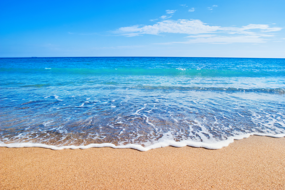
Why does sand look and feel the way it does?
Credit: Beach photo via Shutterstock

Summer wouldn’t be complete without a trip to the sandy shores of an ocean, bay, lake or river. As the gritty stuff gets in between your toes, you may wonder why beaches are distinctive sandy stretches and why sand looks and feels the way it does.

And then again, you might not — you didn’t come to the beach to think, did you? But for those in an asking mood, a sandy beach is essentially where pulverized, weathered rock along with some fragments of shelled creatures and other biota have collected, tossed up by the waves and as sediment from inland areas. More . . .

[private]

“Sand is basically the material you get when you get a breakdown in rocks, when the rocks weather and decompose over hundreds of thousands and millions of years,” said Jeff Williams, senior scientist emeritus for the U.S. Geological Survey Woods Hole Science Center. [Stunning Sands Gallery: A Rainbow of Beaches]

 Sand grits it out

Not every rocky mineral is equally built to last. So, over time, the weathering process yields certain common compositions for sand as the stronger materials persist. 

“Some of the minerals are very unstable and decompose, while others such as feldspar, quartz and hornblende are more stable,” said Williams. “They’re harder, more resistant minerals, and so they tend to stay behind.”

These minerals — abundant in Earth’s crust — in ground-up form constitute a lot of the sandy particles comprising beaches. “Probably the most common composition would be quartz sand with some feldspar,” said Williams.

This mineral formula gives beaches that sort of typically, well, “beachy” complexion of a light brown found in many places in the continental United States and elsewhere. “The iron staining on the quartz and iron oxide on the feldspar gives the sand that tan or brownish color, but this varies greatly,” Williams told LiveScience.

Indeed, every beach is essentially a product of its regional and local environment, and is accordingly one-of-a-kind. [In Photos: The Top 10 Beaches of 2013]

“The sand on each beach is like a fingerprint — it’s unique to the particular beach where you find it,” said Williams. “The sand’s unique composition, color and grain size are a result of the source rocks it came from, but also a result of coastal processes that modify the sand over long periods of time.”

Examples of these processes include the types of waves and currents in an area, as well as the sea level history for that particular coast.

A sandy rainbow

All of these variables intermix to create wildly different-looking beaches, depending on location. For example, in the Florida panhandle, Williams noted, the sand is often very white because of its high quartz content over feldspar and hornblende.

purple beach sand
This beautiful photo of Pfeiffer Beach in Big Sur, Calif., was taken on June 12, 2010. The sand gets its plum color from manganese garnet particles that wash down from the hillside that overlooks the beach.
Credit: Mariusz Jurgielewicz | Dreamstime

Farther south around Miami, the sand also trends fairly white, but for a completely different reason: A significant amount of the sand particles there are made of calcium carbonate, or the tiny bits of fragmented shells from sea life.

Tropical regions have more of this shell-derived sand than temperate regions, where the sand is mostly silica-based in the form of quartz.

Williams pointed to some other neat examples. “Many of the beaches in Bermuda have not only white sand but have pink or reddish sand particles as well,” he said. The origin of this famous coloration is the remains of tiny, single-celled creatures called Foraminifera that have pink or reddish shells.

Hawaii, meanwhile, is well-known for its black sand beaches, the result of ground-up, dark volcanic rocks. Some beaches on Hawaii’s Big Island even have a greenish tint, thanks to the presence of the mineral olivine.

Old beach, new beach

As a final sandy thought, consider the fact that the sand on most of our beaches, especially on the East and Gulf Coasts, is rather old: some 5,000 years or so, Williams said. Very little new sand reaches the coast nowadays from the continental interior as it once did.

malibu-beach-erosion
Beach erosion is threatening some of Malibu’s most exclusive oceanfront property..
Credit: Cedric Weber / Shutterstock.com

The construction of roads, dams, and so on, is one reason. “Development along the coastline sort of impedes the transport of sand from the interior to the coast,” said Williams.

The other major reason is a general rise in sea levels over the past approximately 12,000 years, which has flooded river valleys and created large estuaries such as Charleston Harbor, the Chesapeake Bay, Delaware Bay and the Hudson River. These estuaries trap would-be sand before it reaches the coast, Williams explained.

As a tie-in, the erosion of beaches especially after major storms often requires beach nourishment, or replenishment projects. Sand is dredged up from offshore and deposited on the shoreline to rebuild lost real estate.

Williams noted that these projects, while often successful, must contend with the different characteristics of sand one can get even in very close vicinities. “You have to pay careful attention to the aesthetics,” said Williams. “People like to have the same sort of material on the beach as the native beach.”

[/private]