refers to where two currents in the ocean converge (or meet). Driftwood, floating seaweed, foam, and other floating debris may accumulate, forming sinuous lines called tidelines.
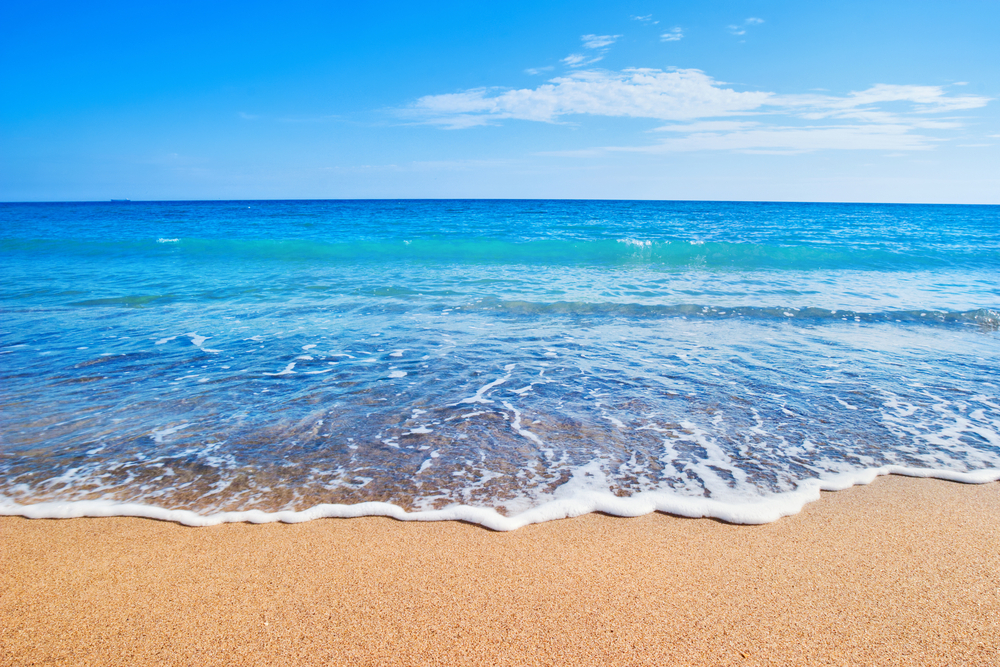
The topic of this article came about after I saw the photo above.The photo actually shows two oceans meeting, but is similar to what happens with the tides on the ocean further south, especially with reference to the Pacific Ocean on the Canadian British Columbia (BC) coast where the tides change (from high to low and back again) twice a day – sometimes rising and falling by as much as seven (7) meters (22 feet)! Continue reading Tidelines and Ocean Currents→
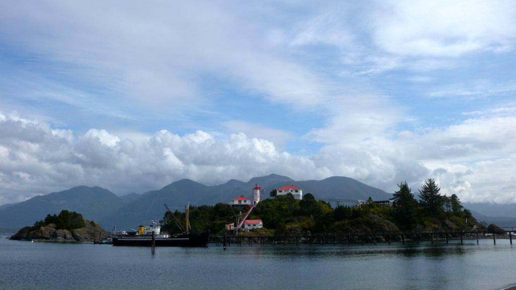
When the Point Atkinson lighthouse was built 130 years ago, it was designed to protect shippers in the Strait of Georgia. Now the lighthouse itself is in need of a benefactor. . . . more
[private] Keeping the light on at Point Atkinson
VANCOUVER SUN AUGUST 26, 2013
The Point Atkinson Lighthouse at Lighthouse Park in West Vancouver stands guard at the mouth of Burrard Inlet May 11, 2004.
Photograph by: RIC ERNST , PNG
When the Point Atkinson lighthouse was built 130 years ago, it was designed to protect shippers in the Strait of Georgia. Now the lighthouse itself is in need of a benefactor.
The Department of Fisheries and Oceans and the District of West Vancouver are discussing ways to put the lighthouse into the hands of the community after Point Atkinson — along with 18 other B.C. lighthouses — was deemed “surplus” to the federal government’s needs three years ago and offered up for sale or transfer.
“In reflection, (the federal government) realized some of the national historic sites aren’t going to go to the highest bidder,” said Brent Leigh, deputy chief administrative officer at the District of West Vancouver, which has a co-management agreement with the government to maintain the lighthouse.
“They expect to work with the district in a community-based program that would ensure that we retain community use … Point Atkinson is one of our most beloved community assets.”
Originally built on a rocky cliff in 1875, the lighthouse has been more than just a beacon of hope for shippers over the centuries. It has also recorded a series of historical firsts as time went on, as chronicled in the book Keepers of the Light, written by one of the last lightkeepers, Donald Graham:
1774: Captain Vancouver rows past the point and names it for a ”particular friend.”
1872: The Marine Department awards contract to Arthur Finney to build the lighthouse.
1875: New lighthouse exhibits fixed white light illuminated by two coal oil lamps and silver-plated copper reflectors.
1875: Edwin Woodward and his wife land at the station.
1876: James Atkinson Woodward, the first white child born in West Vancouver, is born there.
1881: 185-acre park created as a Lighthouse Reserve.
1889: Scotch siren fog signal, powered by a coal-generated steam plant installed to help shippers navigate the fog.
1912: Original tower replaced by 60-foot-high concrete tower. Light replaced by a vaporized oil lamp.
1960: Vaporized oil lamp replaced by electric light bulb.
1994: Lighthouse designated a National Historic Site.
1996: Point Atkinson refitted with an automated solar-powered light.
Donald Graham and Gerry Watson were the last lightkeepers. Graham’s wife Elaine still lives in the cottage at Lighthouse Park.
With files from Canadian Lightkeepers Association website
One of the things a lightkeeper notices on the shoreline are the different changes, be they strange fishing floats, bloated dead fish, defeathered seabirds, massed clumps of seaweed or the profligate carcasses of the By-the-wind-sailor.
I had seen many beaches littered with the pale blue bodies of the By-the-wind-sailor and thinking they were the nefarious Portuguese Man o’ War I hesitated to examine them, fearful of the imagined sting I would receive. It was not until I read the article yesterday on the By-the-wind-sailor from the Monterey Bay Aquarium that I realized that I was in error in my knowledge. Continue reading By-the-Wind-Sailor→
Haida Gwaii (High-Da Gwi my pronunciation) literally means “Islands of the Haida People”, informally but formerly known as the Queen Charlotte Islands (QCI) and the Charlottes, is an archipelago on the North Coast of British Columbia, Canada, populated mostly by first nations Haida people.
When I wrote Recycling Glass as Sea Glass aka Mermaids TearsI never realized that keepers on one of the BC lighthouses, Nootka Island Lighthouse (photo above) were utilizing this free resource for jewelry.
They have a Facebook page showing some of the items for sale, some of which I am showing below. Very beautiful. My uses for the sea glass were a bit more mundane, but it is amazing what you can make with beach glass, sea glass, aka mermaid’s tears.
I also see that the keepers are also advertising their wares on Etsy – a very famous site for anything coastal.
[nggallery id=73]
There are lots more items than shown in the album above, so take a look at their Facebook page or the Etsy pages – very beautiful art work, and each is unique.
Would you like to travel to Nootka Island to visit the keepers or pick out your own jewelry? Join the MV Uchuck III on a day tour to Nootka Sound. More information here.
The West Coast Trail is a 75 km (47 mi) long backpacking trail following the southwestern edge of Vancouver Island in British Columbia, Canada. It was built in 1907 to facilitate the rescue of survivors of shipwrecks along the coast, part of the treacherous Graveyard of the Pacific. It is now part of Pacific Rim National Park (Parks Canada and Wikipedia) and is often rated by hiking guides as one of the world’s top hiking trails.
The West Coast Trail is open from May 1 until September 30. It is accessible to hikers outside of this period but Parks Canada does not guarantee the accessibility of services (such as search and rescue) in the off season. It was originally known as the Dominion Lifesaving Trail (sometimes misidentified as the West Coast Lifesaving Trail).-Wikipedia
My daughter and her friend just finished hiking the West Coast Trail this Summer 2013 and thoroughly enjoyed it. (photos on Facebook) It is rough, it is challenging, but it is an adventure, and it is fun! The trail passes by two manned lighthouses (Pachena -photo above, and Carmanah – photo below) which date back to the time when the trail was Continue reading The West Coast Trail→
My wife asked me the other day “Why is there more sand here after the river floods?”. I explained that because it was a mountain river, the flooding caused more rocks to grind together and tumble down from the hills grinding themselves eventually into fine sand.
By Adam Hadhazy, Contributor | July 16, 2013 06:00am ET
Why does sand look and feel the way it does? Credit: Beach photo via Shutterstock
Summer wouldn’t be complete without a trip to the sandy shores of an ocean, bay, lake or river. As the gritty stuff gets in between your toes, you may wonder why beaches are distinctive sandy stretches and why sand looks and feels the way it does.
And then again, you might not — you didn’t come to the beach to think, did you? But for those in an asking mood, a sandy beach is essentially where pulverized, weathered rock along with some fragments of shelled creatures and other biota have collected, tossed up by the waves and as sediment from inland areas. More . . .
[private]
“Sand is basically the material you get when you get a breakdown in rocks, when the rocks weather and decompose over hundreds of thousands and millions of years,” said Jeff Williams, senior scientist emeritus for the U.S. Geological Survey Woods Hole Science Center. [Stunning Sands Gallery: A Rainbow of Beaches]
Sand grits it out
Not every rocky mineral is equally built to last. So, over time, the weathering process yields certain common compositions for sand as the stronger materials persist.
“Some of the minerals are very unstable and decompose, while others such as feldspar, quartz and hornblende are more stable,” said Williams. “They’re harder, more resistant minerals, and so they tend to stay behind.”
These minerals — abundant in Earth’s crust — in ground-up form constitute a lot of the sandy particles comprising beaches. “Probably the most common composition would be quartz sand with some feldspar,” said Williams.
This mineral formula gives beaches that sort of typically, well, “beachy” complexion of a light brown found in many places in the continental United States and elsewhere. “The iron staining on the quartz and iron oxide on the feldspar gives the sand that tan or brownish color, but this varies greatly,” Williams told LiveScience.
Indeed, every beach is essentially a product of its regional and local environment, and is accordingly one-of-a-kind. [In Photos: The Top 10 Beaches of 2013]
“The sand on each beach is like a fingerprint — it’s unique to the particular beach where you find it,” said Williams. “The sand’s unique composition, color and grain size are a result of the source rocks it came from, but also a result of coastal processes that modify the sand over long periods of time.”
Examples of these processes include the types of waves and currents in an area, as well as the sea level history for that particular coast.
A sandy rainbow
All of these variables intermix to create wildly different-looking beaches, depending on location. For example, in the Florida panhandle, Williams noted, the sand is often very white because of its high quartz content over feldspar and hornblende.
This beautiful photo of Pfeiffer Beach in Big Sur, Calif., was taken on June 12, 2010. The sand gets its plum color from manganese garnet particles that wash down from the hillside that overlooks the beach. Credit: Mariusz Jurgielewicz | Dreamstime
Farther south around Miami, the sand also trends fairly white, but for a completely different reason: A significant amount of the sand particles there are made of calcium carbonate, or the tiny bits of fragmented shells from sea life.
Tropical regions have more of this shell-derived sand than temperate regions, where the sand is mostly silica-based in the form of quartz.
Williams pointed to some other neat examples. “Many of the beaches in Bermuda have not only white sand but have pink or reddish sand particles as well,” he said. The origin of this famous coloration is the remains of tiny, single-celled creatures called Foraminifera that have pink or reddish shells.
Hawaii, meanwhile, is well-known for its black sand beaches, the result of ground-up, dark volcanic rocks. Some beaches on Hawaii’s Big Island even have a greenish tint, thanks to the presence of the mineral olivine.
Old beach, new beach
As a final sandy thought, consider the fact that the sand on most of our beaches, especially on the East and Gulf Coasts, is rather old: some 5,000 years or so, Williams said. Very little new sand reaches the coast nowadays from the continental interior as it once did.
Beach erosion is threatening some of Malibu’s most exclusive oceanfront property.. Credit: Cedric Weber / Shutterstock.com
The construction of roads, dams, and so on, is one reason. “Development along the coastline sort of impedes the transport of sand from the interior to the coast,” said Williams.
The other major reason is a general rise in sea levels over the past approximately 12,000 years, which has flooded river valleys and created large estuaries such as Charleston Harbor, the Chesapeake Bay, Delaware Bay and the Hudson River. These estuaries trap would-be sand before it reaches the coast, Williams explained.
As a tie-in, the erosion of beaches especially after major storms often requires beach nourishment, or replenishment projects. Sand is dredged up from offshore and deposited on the shoreline to rebuild lost real estate.
Williams noted that these projects, while often successful, must contend with the different characteristics of sand one can get even in very close vicinities. “You have to pay careful attention to the aesthetics,” said Williams. “People like to have the same sort of material on the beach as the native beach.”
Do you see the lighthouse? Is that not an impressive view!
The photo above was in a website for a Canadian west coast (Vancouver Island, British Columbia) resort. This is the actual view from one of the rooms. I could just imagine being there myself and seeing the waves beat up against the lighthouse island as I relaxed in comfort within the resort.
My website here is about British Columbia (BC) lighthouses and the environment surrounding them.
Just recently a good friend sent me an email to a website called Picture BC, a delightful photo and video tour of the province of British Columbia, Canada – as beautiful now as when it was created in 2008.
Picture BC photo
According to the site:
Picture BC is an initiative of the Union of British Columbia Municipalities (UBCM), an organization representing the communities participating in this website. The idea and support for Picture BC came from the Province of British Columbia.
The site contains a five (5) minute video tour of the whole of BC (above) which is very well done. If you have never been to BC, you will want to come and visit after seeing this video. If you plan on coming, this is where the lighthouses are. The video shows two or three lighthouses near the end of the clip but there are many more on the BC coast.
There are interactive maps of the regions of BC with links to most cities in the province.
There are also some beautiful photos of major tourist destinations in BC, as well as scenes which cannot be seen unless you take a helicopter or plane ride.
The website is done with Adobe Flash player so it is a bit tricky to manouever around, but have patience – it is worth it!
A long time ago back in 1969 on my first lighthouse at Pulteney Point, we used to recycle glass bottles by taking them out in the boat or canoe, and breaking the washed glass bottle over the side of the boat and letting the fragments settle onto the ocean floor. It was not pollution as such as most glass is 90% sand.
Have you ever seen frosted glass pieces in the beach sand? Usually many varieties of colours from the sea green pieces of broken glass from Asian fishing net floats (glass balls) to the browns and whites of everyday bottles. Usually the bottle is thrown in the sea from land, thrown overboard from a boat, or dumped from a garbage scow off a big city. Glass is the most recyclable of modern user items, even if it is just dumped in the ocean.
The whole bottle can be returned for refilling, the broken ones can be melted down and remade into new bottles. But the sea does it differently. With the pounding of the waves on a beach, each piece of a broken glass is ground down, rounded off, and frosted by the action of sand moved by the waves. Another name for these polished glass shards is mermaid’s tears.
If you are lucky you can find every colour, with red and blue harder to find. At the end of this article I will give you a way to make your own sea glass. It is very beautiful as a floor in an aquarium, used to support candles, make sun catchers – uses are endless.
What brought this story to mind was this news article:
glass-beach-mackerricher-park-fort-bragg-california – Photograph by Jef Poskanzer
In MacKerricher State Park, near the city of Fort Bragg in northern California, you will find a beach littered with glass. Over decades of crashing waves the glass has been smoothed and rounded, transforming the shoreline into a colourful palette of pebble-like glass and sand. . . . more
*********************************
Now, as promised, if you do not live near a beach with sea glass, you can make your own easily. My last lighthouse was on a rocky island with no beaches – hence no sea glass.
Go to your nearest rockhound shop and purchase their cheapest rock tumbler. The one I had was two rubber barrels on two rollers run by a small electric motor (similar to photo on the left). The next item you need from the rockhound shop is their coarsest grit to rough up the glass.
beach Glass from a Tumbler
Carefully break any bottles you want to tumble, fill a tumbler barrel with the broken glass, add water and grit, close the lid securely and drop the barrel on the rails and let it run all night. Check in the morning if your glass is what you desire. If not, then tumble some more.
It is hard to tell real sea glass from the tumbled variety, and you have an infinite variety of coloured glass to choose from – just go to your nearest liquor store – especially in the wine section! Check out this website for more information.
glass-beach-mackerricher-park-fort-bragg-california – Photograph by Jef Poskanzer
In MacKerricher State Park, near the city of Fort Bragg in northern California, you will find a beach littered with glass. Over decades of crashing waves the glass has been smoothed and rounded, transforming the shoreline into a colourful palette of pebble-like glass and sand.
From 1906-1967 (the start date is up for debate), seaside towns were known to use the coastline as dumps, Fort Bragg was no different. After the devastation of the San Francisco earthquake the streets were filled with rubble and trash was dumped on the coast for the ocean to wash away. This of course, included plenty of glass.
glass-beach-mackerricher-park-fort-bragg-california – Photograph by John ‘K’ on Flickr
It wasn’t until 1967 when city leaders and the North Coast Water Quality Board realized what a mistake it was and sought to relocate the dump away from the ocean and clean up the shoreline. After the clean-up and more decades of crashing ocean waves; only smoothed and rounded glass mostly remained.
glass-beach-mackerricher-park-fort-bragg-california – Photograph by Jef Poskanzer
Glass Beach was purchased by California State Parks in October 2002. The Coastal Conservancy, with the City of Fort Bragg and the Mendocino Land Trust worked for over four years to assemble funding for the purchase of the 38-acre property. The Land Trust managed waste removal and clean-up, and completed botanical, archaeological and erosion control work that was required prior to purchase by State Parks. Since the Pudding Creek Trestle was completed in 2007, visitors may now walk from MacKerricher State Park to the headlands at Glass Beach connecting this highly visited “city” park to several miles of beach trails.
glass-beach-mackerricher-park-fort-bragg-california – Photograph by mamojo on Flickr
As word of this unique beach spread, more and more visitors descended onto Glass Beach. Drawn to the beautifully smoothed and rounded glass, visitors began pocketing the glass with each visit. This has greatly diminished the amount of glass on the beach. And since it is now State Park property it is a misdemeanor to remove any artifacts. While there is still glass to be found the area has been greatly depleted.
In addition to searching for glass, the beach has an interesting array of tide pools to explore. Crabs, mollusks, and many aquatic plants make their homes in these ever-changing environments.
 The topic of this article came about after I saw the photo above.The photo actually shows two oceans meeting, but is similar to what happens with the tides on the ocean further south, especially with reference to the Pacific Ocean on the Canadian British Columbia (BC) coast where the tides change (from high to low and back again) twice a day – sometimes rising and falling by as much as seven (7) meters (22 feet)! Continue reading Tidelines and Ocean Currents